Though I’ve never had the system fail me, when I began to delve into all the things that can completely screw up the ability of a GPS to give a good fix, I grew a little nervous about trusting it much farther than I can throw one. Because of the very low power of the signal, GPS systems are vulnerable to interference from such natural causes as solar flares and a whole range of human-generated broadcasts, including intentional jamming. Add the fact that on a boat, anything can-and will-break, often at the worst moment, and you’ll see why it’s important always to have a backup plan.
To illustrate the frailty of your GPS, consider the story about the United States, Britain, and France trying to sell Greece some tanks in 2000. According to press accounts that cited the U.S. Department of Defense, the Americans and the British had continual problems with the guidance systems on their tanks failing. It turned out that the French had a little portable GPS jammer with a foot-high antenna that they hid behind their vehicle and used whenever another country’s vehicles were being demonstrated. The Greeks were reportedly amused, but had it been you trying to navigate along an inhospitable shore, you might not have been.
I’m not going to fall into a Luddite rant about the evils of electronics; it’s so easy to simply plug in a GPS waypoint and steer to it that even I occasionally leave my sextant and tables at home when I go on deliveries. But I also always keep an updated “estimated position” that tells me where I am and what course I should be steering to make my next waypoint. Practicing some of the more traditional forms of coastal navigation is a good mental exercise, and personally, it makes me feel like quite the old salt when I haul out the hand-bearing compass.
Besides a good compass, a depth sounder is also useful; if it reads much higher or lower than the soundings near your estimated position on the chart, you’re probably not where you think you are. Look out for landmarks and try to identify them, then compare rough bearings on the chart with your observations; check any buoys to see if current is sweeping you off course or if waves and wind are setting you to leeward. A quick and easy way to figure your position when you’re within sight of a known landmark is to calculate a running fix.
To do this, take a bearing on a known object. Then, a certain time later, take another bearing on the same object. Here’s how it’s done in practice.
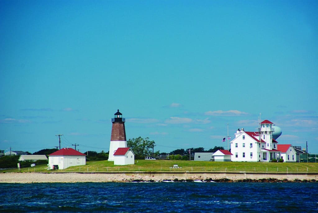
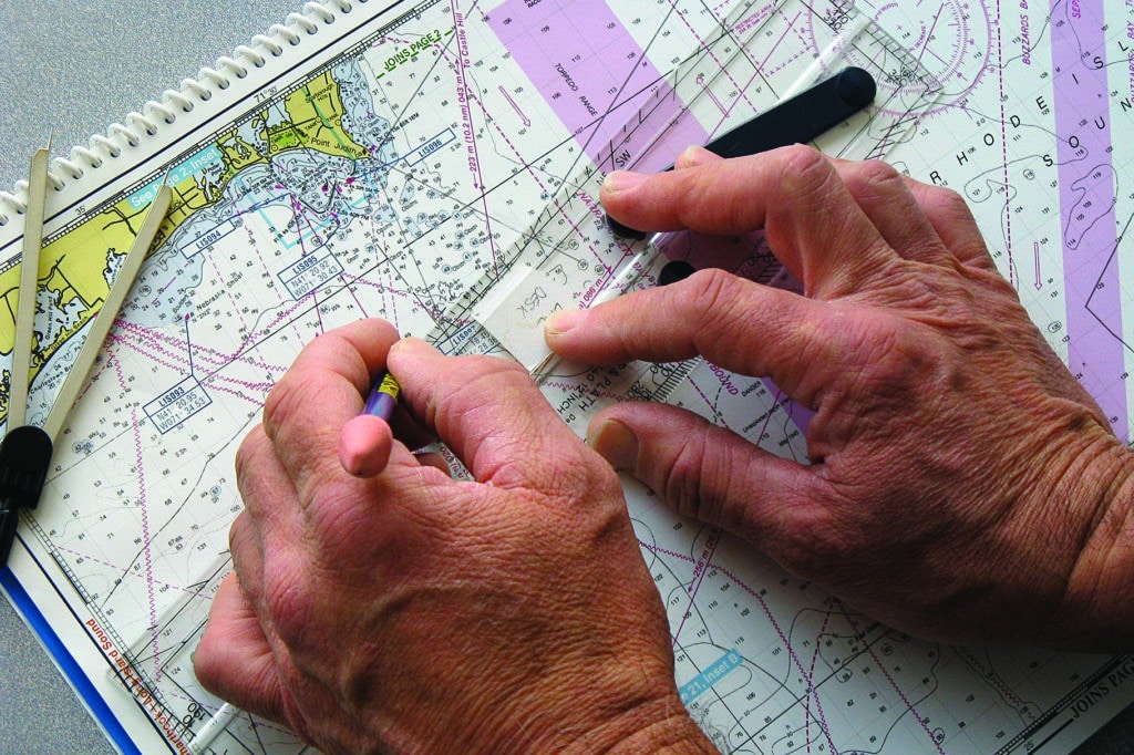
On a recent sail out of Newport, Rhode Island, I took a bearing on Point Judith light at 1233 and drew a line on the chart. That bearing line is called a “line of position.” I knew that we were somewhere on that LOP, but I didn’t know how far we were from the lighthouse.
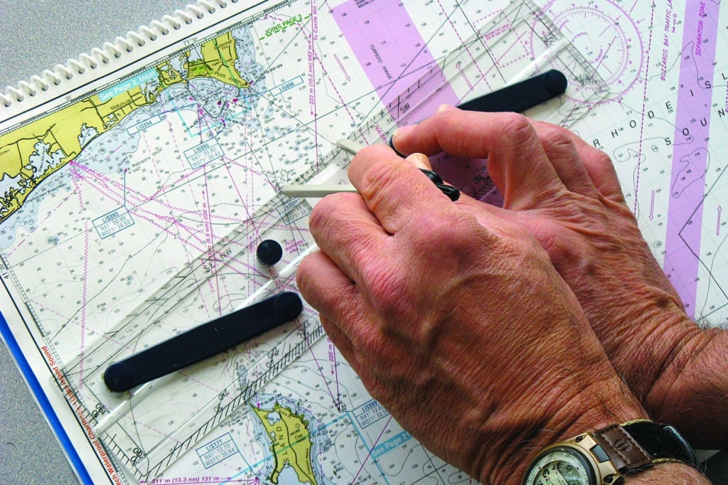
Twenty minutes later, I took another bearing on the Point Judith light and labeled it 1253.
In those 20 minutes, we steered a course of 270 degrees magnetic and were traveling at 6 knots, making 1 nautical mile every 10 minutes. I then lined up the parallel rules on 270 degrees magnetic (using the inner circle of the compass rose on the chart) and moved them over to our lines of position. At 6 knots, we covered 2 miles, so I adjusted the dividers to 2 miles and moved the parallel rules along the bearings until the distance between the lines of position measured 2 miles; I drew another line there. Where the line intersected the 1253 LOP, I drew a circle and labeled that as our position at 1253.
There was a chance of error here: We could’ve been set one way or another by current or made leeway, our speed could also have been affected by current, or we could’ve had an inaccurate knotmeter. But if my bearings were good, we now had a reliable starting point: I knew for sure that we were somewhere on that second LOP at 1253 and somewhere on the first LOP at 1233. By adjusting the distance on the dividers and course on the parallel rules to correspond with the variables I’d observed, I could see what my margin of error is and take that into account in my subsequent course.
Taking a Running Fix
Tips and Tricks
• When your GPS is working, keep an eye on your speed and see how it compares with the speed indicated by your knotmeter. This will help you to better estimate your speed should the GPS go down. To assist you in making your estimate, look over the side and notice how the water appears at the speed you’re going.
• When measuring speed and distance, remember that 1 minute of latitude equals 1 nautical mile. Remember, too, that the latitude scale is the one on either side of the chart, not the one that’s above or below. That’s the longitude scale.
• To determine how far you’ve sailed or your speed, remember this formula: Distance = Speed x Time, with time measured in hours and tenths of hours.
Andrew Burton, a former CW associate editor, learned coastal navigation from his father on cruises in the Pacific Northwest.