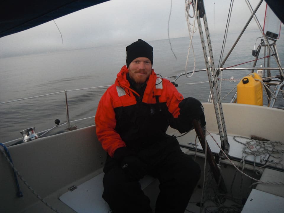
amundson-gulf.jpg
It’s crazy to think that I’ve been alone at sea and sailing nonstop for nearly 100 days. Yet I still have 200 days to go before I’ll be able to tie off to a dock and finally get some rest. Circumnavigating the Americas on a 27-foot boat takes time. My plan is to sail through the Northwest Passage, then round Cape Horn.
The journey really started in the spring of 2010. I was delivering a boat to Antigua with my friends Simon Edwards and Al “Tag” Hunt. I was telling Tag about an idea I’d had during my second singlehanded transatlantic passage. During that trip, I was thinking about trying to start a nonprofit group in Annapolis, Maryland, to make sailing opportunities available to the disabled.
“Have you ever heard of CRAB?” Tag asked me.
“What’s CRAB?” I replied.
And that’s how everything began. CRAB, which stands for Chesapeake Region Accessible Boating, is an Annapolis-based nonprofit that’s helped people with developmental, physical, and financial challenges to go sailing for 20 years.
After that delivery, Simon and I flew from Antigua to Puerto Rico, jumped on another boat, and delivered it to Annapolis. While in Annapolis, I called Don Backe, CRAB’s executive director, and found out more about the organization.
The next few months were busy. I did another delivery, then brought my own boat, a Pearson 323, home to Annapolis from St. Thomas, in the U.S. Virgin Islands. I had a little money saved up, so when I got back, instead of getting a normal job, I did volunteer work for CRAB. CRAB’s program director, Karl Guerra, would pick me up at 8 a.m. We’d get bagels and coffee, then off we’d go to do a bottom job or try to get some old funky Atomic 4 engine started. One day after looking at a 25-foot Folkboat that CRAB had for sale, I told Don that he should let me take the boat up to the Northwest Passage to raise money for CRAB.
I thought he’d laugh at me, but he liked the idea. Then two CRAB volunteers happened to read a story about me and my sailing plans in a local magazine and suggested that instead of taking the Folkboat, I take their 27-foot Albin Vega.
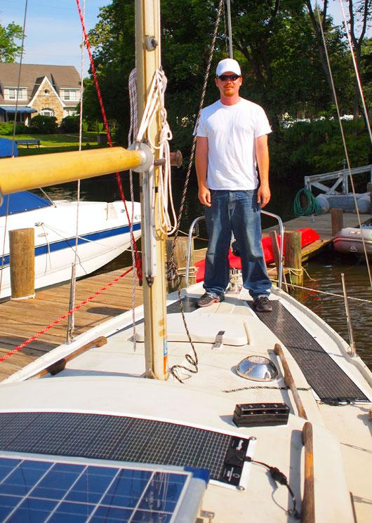
Now we had a good trip and a good boat. Then we began the huge task of raising the money for the trip and outfitting the Vega. It was difficult, but we pulled it off.
**
Challenge from the Start**
The trip officially started on June 13, 2011, when I sailed past the Chesapeake Bay Bridge Tunnel, out into the Atlantic Ocean, and headed north. I knew this 24,000-mile journey would take about 300 days, and in the beginning I didn’t know how I’d make it. I quickly decided that thinking about the trip as a whole was too difficult, so from then on, I’ve been living one waypoint at a time. Whether the waypoint is five miles away or 500, I only focus on the next one.
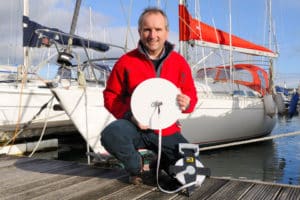
By Day 14, I’d settled into the rhythm of life at sea, but then disaster struck and nearly ended the trip. I can’t store 300 days’ worth of water, so I rely on a manual watermaker. I was pumping my watermaker and getting ready to cook dinner when the pressure-release valve failed and my watermaker popped like popcorn. For a moment, I thought the trip was over. I called my delivery friend, Simon, on a satphone. I was desperate for any ideas. He told me to call back in 24 hours. When I called again, Simon said he’d found a watermaker and a guy to bring it to me just south of St. John’s, in Newfoundland. The trip was saved, and a few days later I met a small boat a mile offshore whose helmsman gave me the watermaker and a bottle of Screech, a Newfoundland rum.
The fog around Newfoundland is incredibly thick and wet. Normally, on the ocean, I can see three miles in any direction. The endless horizon makes me feel like I live in a vast and open world. The fog restricts that world to a few hundred feet, and after being trapped in the fog for a couple of weeks, I start feeling claustrophobic. I thought the fog would dissipate north of Newfoundland, but it continued to be a major factor.
I had my first taste of heavy weather in the Labrador Sea, four days north of Newfoundland. I watched my barometer drop 14 millibars in six hours. I thought the world was coming to an end.
Luckily, it was a summer gale. It came for breakfast and left after dinner. As I sailed farther north, my luck started to improve, and I flew through Davis Strait, having several 140-mile days in a row. I was still surrounded by fog almost every day, but I was starting to get used to it.
Intimidating Majesty
At 65 degrees north, I saw my first iceberg. It looked like a white mountain off in the distance. I was closing in on the pack ice; navigation soon became much more difficult. To the north was an area of pack ice measuring 600 miles north to south and 400 miles east to west. Most of Baffin Bay was still covered in ice. It was impossible to head directly toward the Northwest Passage; I would’ve had to haul the boat over the ice. My only option was to sail up a narrow, ice-free corridor off the coast of Greenland. The corridor was free from the pack ice, sure, but was still full of icebergs of all shapes and sizes. I saw more icebergs than I could count, from giant growlers as big as office buildings to bergy bits the size of Volkswagen Bugs (see more photos of them here).
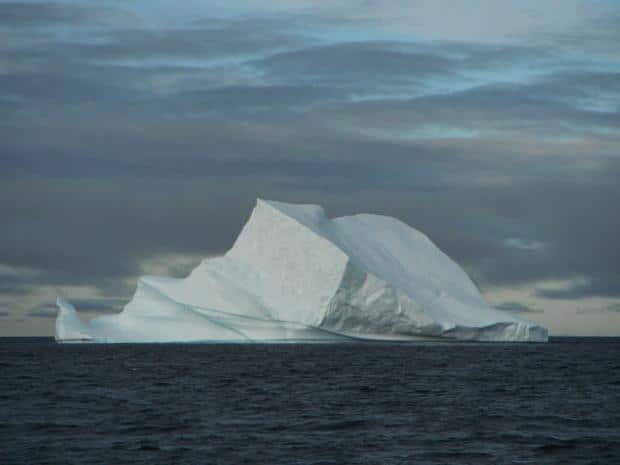
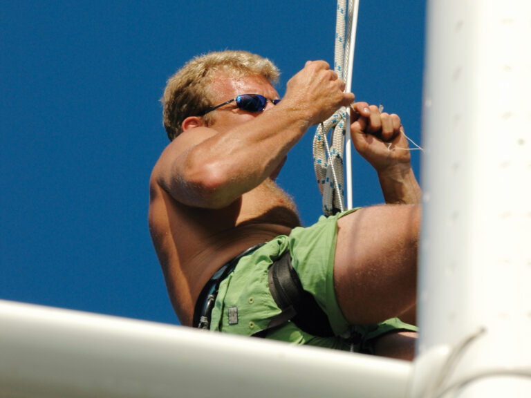
Icebergs are nature’s sculptures, each one unique; as they melt and break apart, their beauty changes and evolves. Some are bleach white, but most have a tint of blue or sometimes pink. The largest are both majestic and intimidating. They’re amazingly beautifully, but oh, man, it’s hard to sleep when they’re around. Hitting an iceberg would be like running into a giant rock, and the ice would sink my little boat in record time. But I couldn’t dwell on that; I had two days of 15- to 20-knot headwinds in thick fog, and I couldn’t afford radar. Here’s my strategy for sailing through the fog with no radar when surrounded by ice: I stand in the cockpit with one hand on the tiller. My eyes stare straight ahead. I’m ready at every moment to dodge anything that comes out of the fog. Forget about going to the head or cooking a meal. I stand there until the fog leaves or the wind dies. You’d be surprised how the time flies.
When the fog lifts and I jump below, I realize that I’ve been standing out there for 10 hours or more. When I’m deprived of sleep, time becomes a blur. And just because the fog dissipates, it doesn’t mean my watch is over. It just means that I can see how close the next group of icebergs lie. If I have the time, I jump in the cabin, get out of the wind, and warm up. If I really want to spoil myself, I make a cup of coffee. Then it’s back on deck with me.
No Time for Deep Sleep
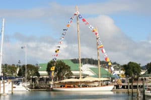
I entered the Northwest Passage on August 1, 2011, the same day that the English explorer William Parry did so in 1819. We both had 25-knot easterlies, which increased to gale force. I’d arrived in the Northwest Passage, but I was a bit early, and the middle of the passage, south of Barrow Strait, was still covered in ice. I was exhausted, so I decided to head for Croker Bay to enjoy a couple of days of rest and relaxation. The bay, which is 900 feet deep, is desolate. The mile-wide glacier at the end of it is constantly calving off icebergs.
It was weird to drift around on a parachute sea anchor for two days with the ice. Sometimes I had to fend off a piece with my boat hook. I was able to collect ice with my fishing net and melt it by strapping a pot to my engine. I also took the chance to have a Scotch on the rocks, the rocks coming straight off a glacier. Now that’s a good drink! I slept with one eye open.
I left Croker Bay and sailed west toward Barrow Strait. Historically, many early explorers made it to the strait, but it was when they pressed on to the south that things often went terribly wrong. I arrived at the strait just north of Peel Sound, and there I was again stopped by pack ice. I spent three very pleasant days drifting on my parachute sea anchor waiting for the ice south of me to melt. My plan was to go down Peel Sound to Franklin Strait, then along Boothia Peninsula to the James Ross Strait, around the south end of King William Island, into Queen Maud Gulf, and on to the west. This is the same route that Roald Amundsen followed in the years 1903 to 1905, when he led the first expedition to traverse the Northwest Passage.
I had very little wind for the next 300 miles and slowly motored my way south. My timing was perfect, and I was able to motor through the worst of the ice without any real problems. The wildlife along the way was incredible. At one point, I was surrounded by hundreds of seals, with narwhals swimming past on both sides of my boat. I continued south of King William Island and was able to turn west and make for the very difficult Simpson Strait, an area full of islands and strong currents. The currents are so powerful that at one point I was going backward with my engine at full throttle.
Once I passed through Simpson Strait and entered Queen Maud Gulf, the winds picked back up out of the east. For the next five days, I made great time sailing beyond hull speed, flying through tricky passages and between rocky islands. All was well until I entered Amundsen Gulf and was hit by a full gale. The waves there were erratic. Several times I had a green wall of water come crashing down into my cockpit, filling it up and leaving me pooped. The cockpit doesn’t drain terribly quickly; on the other hand, my boat didn’t seem to care. A couple of times when the water drained, some fish would be left flopping around in my cockpit. Unfortunately, they were always too small to eat. The water up there is so cold that when I stick my hand in it, I feel a burning sensation instead of a cold sensation. Sailing my little boat in big seas is like driving an old Alfa Romeo Spider—you’re only doing 40, but it feels like you’re going 65.
After the Amundsen Gulf, I had light winds for the next 700 miles. I spent the next seven days motorsailing along the north coast of Alaska. When I turned south and headed down Alaska’s west coast, I thought I was in the clear. But Alaska wasn’t going to let me get by that easy. I spent seven of the next 10 days getting hammered by two storms. On the other three days, I had to maneuver my boat in big seas to try to redeploy my sea anchor so I wouldn’t wreck on a lee shore. I was trapped up there. I couldn’t go south during the first storm because all hell was breaking loose to the south. I couldn’t go south in the second storm because I can’t beat into 40-knot headwinds on this lightweight 5,000-pound 27-footer.
The moisture is a problem. All my books and clothes are covered in black mold, and some of the wood inside my boat is turning black, the first signs of rot. As I write this, I’m still sailing around Alaska, still cold, still wet. At least things will warm up on the way to Cape Horn. I take heart in Shackleton’s family motto: Fortitudine vincimus, “By endurance we conquer.”
According to the Scott Polar Research Institute of England’s University of Cambridge, Matt Rutherford has set a new record for the smallest boat to be singlehanded through the Northwest Passage. At press time, he was on schedule for a January rounding of Cape Horn. Track his progress at his website, Solo Around the Americas.