Advertisement

Visualizing Ocean Currents With NASA

NASA is modeling the movement of our oceans through currents and temperatures to better understand how they work.
Visualizing the Gulf Stream: ocean flows colored with sea surface temperature data. NASA/Goddard Space Flight Center Scientific Visualization Studio

Oceans In Motion

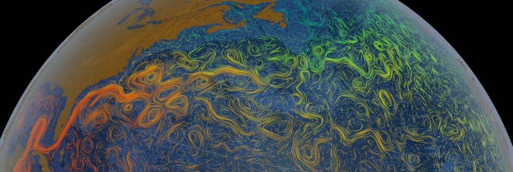
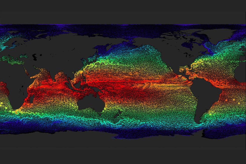
The world’s oceans are in constant motion, and this series of maps published by the NASA/Goddard Space Flight Center Scientific Visualization Studio helps provide us with a nice illustration of this movement.

The maps, which were created at various times in past years, show the many warm and cold ocean currents responsible for transporting water across long distances throughout the world’s oceans.

In addition to the ocean currents, you can also see swirly features, known as ocean eddies, on the maps. An ocean eddy is formed when currents sometimes pinch off into sections, creating the circular current. Sometimes significant eddies are given names, according to NOAA.

Advertisement

Here are a few selected images of ocean currents around the world.

Gulf Stream and Ocean Temperatures This map show something that all sailors should have heard of: the Gulf Stream. This major current flows from off the coast of Florida to near the North Carolina coast, and then northeast from there into the north Atlantic. You can also see various eddies in the images. The Gulf Stream flows at an average speed of about four miles per hour, with a max speed of 5.6 miles per hour. It slows to one mile per hour on its north end. The color shadings show the water temperatures from warm (orange) to cool (green or blue). NASA/Goddard Space Flight Center Scientific Visualization Studio
World Sea Surface Currents and Temperatures The orange and red shadings in the middle of the map correspond to the warmer waters in tropics. Cooler waters depicted in green and blue are located north and south of this as you head towards the poles. NASA/Goddard Space Flight Center Scientific Visualization Studio

Gulf Stream Modeling

Currents and Eddies Near the Southern Africa Coast Pictured in this image are several well-defined eddies near the southern coast of Africa. NASA/Goddard Space Flight Center Scientific Visualization Studio
Kuroshio Current This warm current moves northward near the coast of Japan, eventually dividing near a latitude of about 35 degrees north. A branch of it then flows east towards Hawaii, while a northern branch merges with the cold waters of the Oyashio Current to form the North Pacific Current.

For more information on ocean currents and to see more visualization models, visit the nasa website here.

Advertisement
Advertisement