For over 20 years, participants in the Marion-Bermuda Race have followed this simple credo. It’s a successful strategy that’s based on a simple premise: By sailing up to 30 miles west of the rhumb line, sailors can compensate for the strong Gulf Stream current that flows generally northeastward. With advanced forecasting and navigational equipment, however, racers can capitalize on warm- and cold-water eddies¿pockets of clockwise or counterclockwise currents that spin off the Stream¿or on meanders in which the Stream takes a northerly or southerly direction.
Aboard Allegra, navigator Jim Mertz has always headed west of the rhumb line in a Marion-Bermuda or Newport-Bermuda Race. This year, it was business as usual¿we went west, or at least we tried to. But where did others go, and why?
The first boat to cross the line, Veritas, a Frers 46 owned by Philip Hutchinson, glided in at 0232 on Thursday morning. (The race had started the previous Friday!) Ron Noonan’s Sabre 402, Wildflower, was the third boat to finish overall, about an hour later, and he won the A1 Class for celestial navigation on corrected time. Noonan based his pre-race strategy on weather and Gulf Stream analysis provided by Herb Hilgenberg the night before the start. Herb predicted a southeasterly breeze would eventually go south and an unfavorable current would greet racers who emerged from the Gulf Stream to the west of the rhumb line. Noonan’s strategy? After heading west to avoid a warm-water eddy and its clockwise-moving currents just east of the rhumb line, he¿d head east to capitalize on a southeast meander in the Stream and a high-pressure ridge north of Bermuda that was forecast to produce winds out of the southwest. However, when on the second day the forecast position of the southeast meander shifted 50 miles farther to the west, Noonan decided not to go for the carrot. ¿I would’ve had to go about 55 miles to really get into it, in a direction that’s perpendicular to the mark. Our original plan had been to go east, so we stayed east,¿ Noonan said. After crossing the Stream Sunday night, he took a morning sunline, and then he took two more in disbelief. All three confirmed Wildflower’s position: 75 miles east of the rhumb line. ¿The Stream was a lot stronger than we thought,¿ he said. ¿Fortunately, when the wind went west-northwest and got light, all the boats to the east were on a faster track to the mark.¿
The A2 Class trophy for electronic navigation went to Nick Cannistraro and Despedida, an Alden 54 that just missed line honors but won on corrected time. His plan to head west was foiled first by headwinds, which forced him to enter the Stream 25 miles east of the rhumb line, and then by the strong Stream itself. John Knipper, Nick’s navigator, says, ¿At one point [in the Stream], we were tacking through 160 degrees¿you had to be there to believe it! The starboard tack, 95 degrees, gave us a more favorable velocity made good, but we were still being set slightly to the north. On port tack, we were on a track of 255, where we were only able to make a knot of vmg. We would’ve been in the Stream for days unless we went east.¿
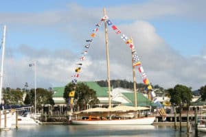
Later, over beers and rum swizzles at the Royal Hamilton Amateur Dinghy Club, the big question wasn’t east or west but ¿How far east did you end up?,¿ to which, after a startling confession, the most brazen of the bunch replied with a wink, ¿We planned it all along.¿