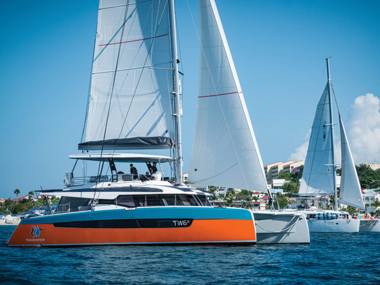
I can still clearly remember the day when I first saw an iPad used for piloting on a long-distance passage. We were headed north on Puget Sound aboard my friend’s boat when someone nonchalantly tethered an iPad to the chart plotter, which was down below at the nav station. Via a Wi-Fi connection, we immediately had on-deck access to all navigational data. While it certainly felt cool to sail along with a wireless information feed, what struck me as even sweeter was that we were leveraging our existing nav system and getting more out of it without a major investment in new gear. Here’s a look at 10 ways that you can improve life aboard using today’s electronics (OK, and maybe an additional sensor or transducer) and some out-of-the-box thinking.
1. Anchor Wisely
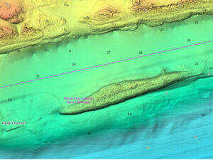
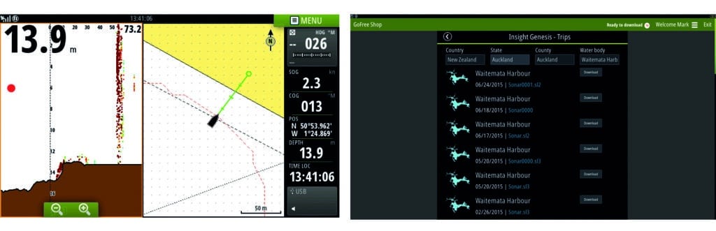
Successful anchoring involves targeting the right bottom type, a task that’s made easier with an aftermarket down- or forward-looking sounder. While some navigation systems, such as Furuno’s TZtouch2, come bundled with a sonar sensor and software that help determine the bottom composition, Jon Josephson, Garmin’s regional sales manager, says that if you have a fish finder installed on your sailboat, you can use it to determine the bottom type and find good holding grounds. Some sounders are designed to also help you determine the bottom composition, while more traditional sounders require that a user learn to “read” the imagery, much like when using radar.
In anchorages that don’t have a pure sand bottom, B&G business acquisition manager Matt Fries says, skippers will benefit from forward-looking sonar, which can be used to sound out an area to make sure there are no submerged hazards in a proposed swing path. B&G’s ForwardScan or Garmin’s Panoptix both have this capability. If you have a compatible B&G or Garmin display, consider adding one of these easy-to-install transducers on your next haulout.
Once the hook is set, Fries recommends that in addition to setting an anchor alarm, sailors should turn on the “tracks” feature on their chart plotter and leave the device switched on, allowing them to see, graphically and in real time, if they are dragging anchor. Better yet, turn on the tracks feature as you approach the anchorage so you have a clear escape path should you need to find your way to open water on some dark, stormy night.
2. Store It for Later
Electronics manufacturers recently started offering off-site data storage as mobile connectivity options have improved. “For added reliability and security, users can upload waypoints and routes to the cloud,” says Eric Kunz, Furuno’s senior product manager, detailing the cloud-storage features on Furuno’s TZtouch2 display. The devices can connect to the Internet via Wi-Fi or a cellular hotspot. Cloud storage is not a Furuno exclusive, however. Navionics’ Plotter Sync feature allows Raymarine multifunction displays to download charts and updates, while Raymarine’s latest operating-system update provides cloud services as well, as does GoFree, which allows B&G users to download cartography.
Cloud storage can also allow you to plan long routes at home on your computer, upload the route (and all of its waypoints) to the cloud, and then download this information to the chart plotter once aboard, provided there’s a good marina Wi-Fi network (or, in some cases, a cellular hotspot).
3. Link Your Screens
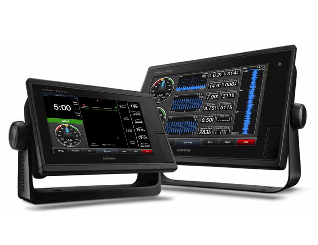
Dimming the backlighting on your instruments and displays helps preserve night vision and battery life. Provided that all your displays are compatible, most manufacturers allow you to electronically link and adjust all screens using a master control screen.
“In our system, you can set up zones,” says Jim McGowan, Americas marketing manager at FLIR Maritime, whose brands include Raymarine. The feature is called Network Brightness Control. “You might have units that are in the cockpit and down below, and you want them to be at different levels so you can set each zone accordingly. This way, all of the displays in a zone dim at the same time.”
4. Cure Oversteering
When you’re navigating using a series of waypoints, some plotters will show you if a driver is holding the right course. “You can turn on the track-recorder feature and compare your sailed route with your plotted course,” says McGowan, adding that Raymarine users can adjust their track-interval recorder settings to match conditions. You use higher, more accurate intervals for inshore sailing, where your track can be updated every second. Less frequent intervals — say, a point every two minutes — are for bluewater passages. On screen, says McGowan, this should display any “S-ing” that might be happening due to over- or understeering, and in tight places, it should show if you’re veering toward danger.
While track recorders display a helmsman’s historical performance, “highway mode” on a chart plotter graphically displays the course ahead. If equipped with this capability, the plotter removes the cartography elements from the screen and instead shows a 3-D highway leading to the next waypoint, with the rhumb line as its centerline stripe. This allows drivers to see at a glance if they are on course and helps avoid cross-track error. On some systems, users can set up an alert on their display or use an external speaker to sound an alarm if the course wanders beyond a certain number of degrees.
It’s important to remember that the wind constantly shifts, so using cross-track error and waypoints can be tricky, especially if the waypoints are generously spaced. Because of this, Fries and Josephson recommend that drivers also keep an eye on their boat speed, wind angles and heel angle, as these are obvious indicators of a significant wind shift or, if the breeze is steady, a change in the direction steered.
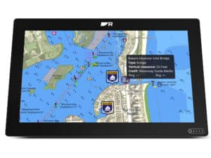
5. Plan for Ports
The ActiveCaptain website and app revolutionized cruising thanks to its extensive user-reviewed database of marinas and anchorages. Now, depending on your multifunction display and cartography, you may be able to access and enjoy that same crowdsourced information directly on your chart plotter. For example, Furuno’s TZtouch2 can populate chart-plotter screens with ActiveCaptain points of interest, which are updated whenever the display has Internet access. Additionally, ActiveCaptain content was recently integrated across all of C-Map’s electronic cartography, giving C-Map users access to the latest data each time the company publishes a cartography update.
6. Identify Hazards
Most contemporary radar systems come with an automatic radar plotting aid (ARPA), which automatically identifies and tracks targets, or a mini automatic radar plotting aid (MARPA), which requires users to manually select targets to track.
ARPA and MARPA are powerful tools, says Kunz, but when Doppler capability is added to the mix, it lets even novices quickly identify threats with just a glance at a display screen. Among other features, Doppler can determine a target’s speed and direction of movement.
With Furuno’s Target Analyzer, which integrates Doppler technology, Kunz says, “you don’t have to acquire targets; you just look at the colors.” Furuno’s DRS4W-NXT radar display paints threatening targets red, while nonthreatening targets are colored green. “It’s nice for cruisers who aren’t sophisticated radar operators,” Kunz says.
Some non-Doppler radars offer an “echo-trails” mode that shows a moving target’s progression across the screen over a period of time. This information can help determine a target’s threat level and differentiate it from a static target like a rock or buoy.
Finally, if your plotter’s display allows you to overlay AIS and radar onto your chart, it’s wise to practice using all these features on a clear day, when you can see what the radar and AIS “see.” And just so you know how it works when the time comes, try directly calling an AIS target (say, your buddy) via the VHF’s Maritime Mobile Service Identity number.
7. Monitor Fuel
Calculating one’s remaining burn time is typically a powerboater’s trick, but cruising sailors can also benefit from this information, especially if the wind’s light and they’re doing a lot of motoring. While a contemporary NMEA 2000-enabled engine (or an older engine that’s paired with an NMEA 2000 gateway) and sensors on the fuel tank are required, most contemporary chart plotters can calculate your remaining fuel range at a given rpm. Some systems can display the number of remaining engine hours on a given tank using either metrics or a graphical display — known as a fuel-range ring — overlaid onto a chart. Using this feature simplifies the guessing game of when to go into fuel-conservation mode.
8. Sail Smarter
The advanced sailing features that now come bundled with many navigation systems can be used once the display unit has been networked with a calibrated anemometer, wind-angle sensor, and through-the-water paddle wheel.
“With B&G’s SailSteer feature, the true-wind angle indicator on your display screen fades from green to blue if you’re not sailing your target true-wind angle,” says Fries. Provided that your wind speed hasn’t changed, a blue SailSteer true-wind angle indicator shows that either the wind has shifted or your sails aren’t properly trimmed. Some systems also record the wind history and direction to help you spot building breezes (meaning it’s time to reef) or trends in wind shifts that would indicate a favored tack.
“Rudder angle is a good one to know,” says Fries, who explains that some chart plotters pull rudder-angle information from a networked autopilot. “Most modern boats are designed to sail with some weather helm, so you can use rudder angle as a guide to power up or power down.” For example, says Fries, if the rudder-angle indicator reads zero degrees, the boat needs more power from its sails. The skipper then might adjust the mainsail outhaul, raise the traveler, or sheet in the mainsail. Conversely, if the rudder-angle indicator reads, say, 6 degrees when sailing straight, there might be too much weather helm, and it’s time to de-power the rig.
9. Watch the Kids
Instead of sending the kids off in the kayak or dinghy with a portable AIS transponder, Josephson suggests handing them a DSC-enabled handheld VHF radio that’s set to allow automatic polling. Using the “buddy-tracking” feature found on most contemporary multifunction displays, a cruiser can poll each VHF radio to track its position on screen, and, unlike with an AIS transponder, can also switch to voice communications should the dinghies venture too far from the mothership.
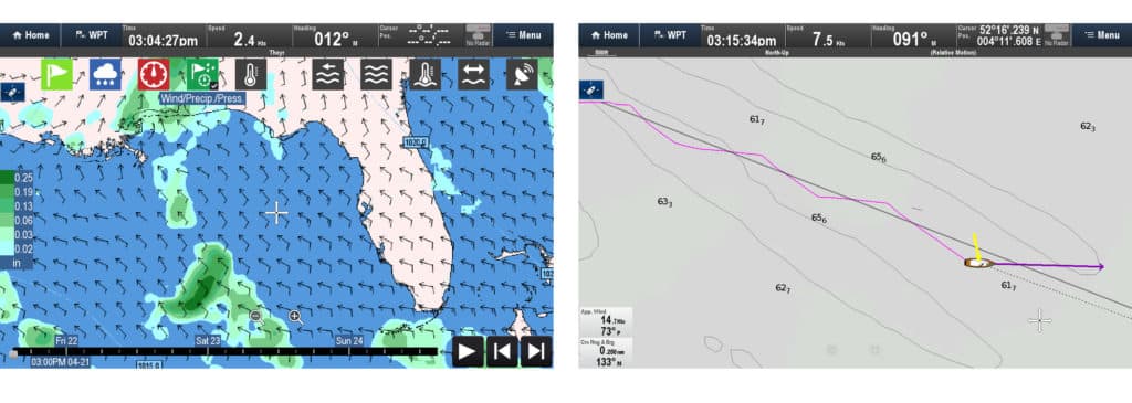
10. Mind the Weather
Good seamanship includes monitoring pertinent weather information. While there are numerous aftermarket services available that allow you to access GRIB files, Furuno and Raymarine have simplified this by bundling marine weather-forecasting software into their plotters’ operating systems. Provided that Wi-Fi, cellular or satellite-communications connectivity is available, Furuno users can access NavCenter weather data for free for the life of their product. Raymarine customers can subscribe to Raymarine’s GRIBview Global Weather service. The app graphically presents weather information on screen, and users can select which layers — wind, waves, temperature, rain — they wish to display.
David Schmidt is Cruising World’s electronics editor.