MarElecBessingerSt
On one of my first offshore passages, the 1981 delivery of a Columbia 50 from Newport, Rhode Island, to Bermuda, we relied on paper charts, Loran, RDF, a sextant, and, once we got close to Bermuda, a place mat on which was imprinted a chart of Bermuda. The place mat was the result of a forgetful skipper and poor planning, but I’ll never forget that long November night we spent tacking back and forth off St. David’s Light while waiting for daylight, all the while trying to keep track of the lit marks and listening for Bermuda Harbour Radio to warn us when we strayed too close to the reefs.
On my most recent trip to Bermuda last June, my nav station was packed with electronics. We had two dedicated chart plotters and a flat-screen monitor showing our position (it was accurate to within 1 meter) on Nobeltec’s Passport digital charts. If those all failed, I had two handheld GPS units ready to go; both were loaded with charts and waypoints. We’ve come a long way in 25 years. We’ve also come far enough for most cruising sailors to understand that there’s nothing unseamanlike in using these digital aids to navigation. In this article, I’ll take a look at today’s navigation software in hopes of making a complicated subject easier to understand.
To use navigation software, you must be comfortable with computers. Installing the software and charts and getting the program to send and receive data to and from your GPS and other instruments aren’t tasks for beginner computer users, no matter which product you’re going to use. If you’re uncomfortable using computers, get a chart plotter instead. (See “Touch-and-Go Plotting,” October 2006.) If you’re comfortable with a keyboard and a mouse, though, you’re a perfect candidate for nav software. You’ll be able to add charts, update the programs, and figure out the inevitable glitches.
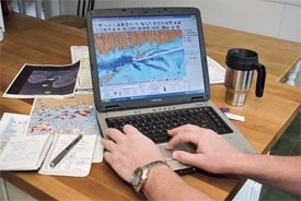
In order to get an overview of the nav software available today, I asked manufacturers to submit working versions of their products along with charts for the U.S. East Coast. I loaded each program into a 3-year-old Toshiba Satellite laptop running Windows XP. The laptop has a 4.2-gigabyte Pentium 4 processor, a 100-gigabyte hard drive, and almost a gig of RAM. The one thing the laptop is missing (as are most laptops these days) is a serial, or RS-232, port, which allows the computer to send and receive in the machine language that most marine instruments use to communicate with one another, NMEA 0183. I used a Radio Shack converter cable that allows a USB port on the computer to be used for this purpose instead.
Once I’d loaded the software, I installed the charts. Some charts were easy to install, but others weren’t so simple. The chart installation, however, paled in comparison with getting the programs to send and receive data from a handheld Garmin Map76 GPS and a Garmin 192C plotter. Part of that is due to Garmin’s proprietary language, which not all of the software products have the ability to see. Once I’d gotten everything loaded and hooked up, I started planning a trip from City Island, New York, to Martha’s Vineyard in order to gauge how easy or hard it was to perform simple tasks.
Most of the software programs I tested either asked for charts they could read or went ahead and looked into the laptop’s hard drive for such charts. Most also came with a disc packed full with free NOAA charts, which can also be downloaded from a NOAA website (http://chart maker.ncd.noaa.gov/mcd/enc/index.htm).
The Programs
One of the programs that’s been around the longest, The Cap’n, was bought by Map-tech and almost immediately discontinued. Any version that may appear in the future will be aimed solely at the commercial market.
By far the easiest software to install was Maptech’s Chart Navigator Pro ($500). The process was intuitive, downright user-friendly, and quick. A port-detector program looked for the GPS and configured the program to use it with absolutely zero fuss. CNP asked if I wanted to import charts it found on the hard drive, then told me how much hard-drive space it needed. When I inserted the CD of electronic NOAA charts that came with the program, CNP automatically began loading them, prevented duplication, and asked whether I wanted to load some of the larger data files, such as contours. The laptop never crashed while using Chart Navigator, I found that setting up routes was a snap, and getting used to the interface took very little time. CNP supports AIS, weather GRIBs, and allows radar overlay. Unlike any other program I tested, it sends and receives in both NMEA 0183 and next-generation NMEA 2000.
One of the least expensive products I tested was Marine ENC 4.0 ($200) from Fugawi. The program installed quickly and relatively painlessly, although I had some problems loading charts. Fugawi looked in the hard drive for any charts already installed and registered them in its database. It should be noted that many of the programs took time to go through the 1,500-strong chart catalog on my laptop’s hard drive. Fugawi reads an impressive list of raster-chart types as well as ones based on the S-57 standards, its own brand of vector charts, and the excellent vector charts created by Navionics via an included Navionics card reader. For the money, the Fugawi program is a good, solid program, and it supports AIS but not radar overlay.
I’d been looking forward for quite a while to trying Maxsea ($500 to $5,500, depending on the modules ordered or added after the initial purchase). Since its inception many years ago as a navigation system designed for the Apple OS (it’s strictly a Windows program now), it’s been a favorite of European racers and fishermen. Since being acquired by Furuno, Maxsea has been making inroads into the U.S. market, but it still has a distinctive Euro feel, which you’ll notice especially when using the manual.
Installing Maxsea was a no-brainer, but it requires a connection to the Internet for registration purposes. Maxsea uses a USB key dongle attached to a USB port to prevent piracy. One of the things I liked about Maxsea was its modular design. Users are able to buy and load specialized modules after the program has been installed. The performance and routing module is aimed at racers, but the routing will be a welcome addition to any boat that sails offshore. Maxsea is an extremely capable, powerful, and feature-laden program, and it will probably take a user some time to get used to, but is well worth the effort. Maxsea supports AIS as well as weather GRIBs.
I’ve been using various versions of Nobeltec’s nav software for almost a decade, so it was hard to look with complete objectively at its two offerings, Visual Navigation Suite 9.0 (the base price is $490) and Admiral 9.0 (prices start at $1,200). Jeppesen, a big name in the aircraft-navigation software industry, recently bought Nobeltec and has been steadily upgrading its marine software. Suffice it to say that these are both extremely capable programs, with proprietary Passport charts that are prime examples of what vector charts should be. Both programs read a long list of raster formats, GRIB files, and AIS, but only Admiral 9.0 supports radar. Nobeltec offers add-on modules called Plus Packs. There are Plus Packs for performance, weather (which includes built-in software to automatically retrieve GRIB files from various sources, including Ocens and XM radio’s WxWorx), and bathymetric recording, which takes data from your depth sounder and turns it into a database. Both versions of Nobeltec also have great real-time tide and current software and a trip planner, which takes into account tides when predicting arrival times.
Raymarine’s RayTech RNS 6.0 was recently honored with the 2006 Best of Show award from the National Marine Electronics Association, so I was eager to test it, even though it’s designed to work with Raymarine hardware and its proprietary SeaTalk networking machine language. After loading the software, though, I quickly realized that without the necessary Raymarine gear, the test wouldn’t be possible. That said, I’ll wait to test it until I’m on board a Raymarine-equipped boat; then I’ll report back as soon as possible. Users with Raymarine gear, meanwhile, will appreciate such features as Navionics and C-Map support as well as both the route-optimization and weather-forecast capabilities.
In my search for nav software, I discovered a couple of lesser known programs. Norwegian sailor and programmer Fred Jenssen wrote the Navigator Pro ($130) software from Tiki, and it’s obvious that he’s pretty good at both disciplines. What I especially liked about Tiki was the ability to purchase the software online and to download it immediately. Tiki only supports raster charts, and it doesn’t receive AIS or weather GRIBs, but for the price, you get a lot of features and an especially friendly interface, perfect for newcomers to navigation software. Loading Tiki was easy, and the program looked for charts on the hard drive automatically. It didn’t take long at all to figure out how to set courses and waypoints. I can see how Tiki has become a favorite low-cost navigation solution for many loyal users.
BoatCruiser 2.0 ($550) is a program originally created by Canada’s National Research Council Institute for Marine Dynamics, which spun off NavSim into the commercial marketplace. It’s available as an online download or from CDs. The program supports AIS, radar, weather GRIBs, the latest C-Map Max and C-Map Max Pro vector charts, and S-57 data. The user interface is clear, and it takes little time to get the hang of it. I especially liked the Device Setup Wizard and the fact that BC 2.0 ships with a C-Map Max unlock code for one user-chosen area.
So there you have it, a look at some of the programs and features that can make your voyage planning and piloting under way easier and safer. But even with your computer fired up and your chart plotter humming, there’s still plenty of art, science, challenges, and potential pitfalls at the nav station. No matter how much RAM and processing power you’ve brought on board, don’t forget to heed those few simple words that appear on all paper and digital charts in the United States: “The prudent mariner will not rely solely on any single aid to navigation.”
Tony Bessinger is Cruising World’s electronics editor.