navigators 368
Over the years, I’ve seen a handful of natural conditions repeat themselves in various locations around the world, and whether it’s a current overfall in the Sulu Sea, a nine-knot ebb in Australia’s Dundas Strait, or an avalanche of wave energy unleashed by Africa’s infamous Agulhas Current, knowing what to expect helps you to prepare for similar encounters. And both taking advantage of them and avoiding their effects go hand-in-hand with sound seamanship.
First off, consider ocean currents and the sea floor. Littoral currents are wind- and wave-driven sand-transport systems that scour every coastline. Along the New South Wales coast of Australia, shallow water and a tenacious down-coast current can cause northbound sailors to take note of the relationship between the sea and the seabed. In this region, the friction between moving water and a shallow bottom diminishes the drift. The sandy bottom also weakens the current by sapping energy as tons of sediment is lifted and carried down coast. Savvy Aussie sailors take advantage of this region of diminished current and sail with “one foot on the beach.” Doing so overnight is far too anxiety provoking for most cruisers headed north toward the Great Barrier Reef, and a tack offshore with a dawn return toward shallower water seems to make more sense. At least that’s what I thought some years ago during a passage I made from Sydney to the reef.
At dusk, we headed offshore, beating into a head wind and a significant down-coast current. Staying clear of land during the darkness and returning on the opposite tack the next morning, I was dismayed to see the same lighthouse that we’d bid farewell to the previous evening. The name of the headland was Tacking Point, and once again Aussie humor had prevailed. That day, “one foot on the beach sailing” was a lesson learned!
And today I cope with such situations, whether in Australia, Baja, or just off the New Jersey coastline, by short-tacking in shallower water with appropriate caution devoted to good navigation and a perpetual stare at the depth sounder. Another alternative is to motorsail to weather while staying well inshore and capitalize on the lighter breezes of early morning. Best of all is the cruiser’s prerogative to change plans, visit a new port, and wait for a favorable wind shift or tide.
Safety and Deep Water
A westward passage across the Indian Ocean can be much like the month of March, starting out a lamb and winding up more like an angry lion. Not only is arrival in Durban, South Africa, often punctuated with rough squally weather; the final hurdle to be crossed is the powerful Agulhas Current, a south-setting gyre that can make the Gulf Stream seem benign. Part of its bad reputation stems from the funnel-like effect caused by a confluence of the Natal Basin, Mozambique Ridge, and the continental slope of Africa.
During a passage from Mauritius to Durban, we had the good luck of being at the tail end of a small fleet of cruising boats separated by about 150 miles. A nasty gale developed, and we found ourselves safely ensconced in, ironically, the worst part of the storm. Friends farther ahead saw a little less wind and higher pressure readings, but they were caught in the grasp of the Agulhas Current, and treacherous opposing wind and sea conditions rolled and dismasted two of the boats. We hove to in mountainous swells and howling wind, but the deep ocean basin and the absence of current keep the waves from becoming steep and unstable. From that experience, I should’ve learned to steer clear of powerful currents when bad weather is in the picture, but it’d take another encounter, much closer to home, to drive home that golden rule.
The second lesson came with a foolish sprint from Florida to the Bahamas and a race against a fast-moving cold front that was forecast to cross southern Florida within 24 hours. We departed with the wind already veering south and trending southwest, a sure sign of the approaching front. The Gulf Steam and wind were running in the same direction, and Wind Shadow, our Ericson 41, was going north about as fast as she was going east. It was during this passage that I learned firsthand what a “pre-frontal-trough” is all about.
In essence, it’s a dense band of torturous thunderstorms that are often more violent than what’s found in the cold front itself. But on this particular night, the cold front around 0200 proved to be just as nasty. The only wise decision I made was an early swap of the double-reefed main and staysail for a storm trysail and storm jib. When the northerly wind shift finally slammed through and the wind-on-sea effect began to take hold, we hove to in a fierce tempest, this time not off the Cape of Good Hope but embarrassingly close to Palm Beach.
Monday-morning quarterbacking showed that the vigorous winter cold front and a midlevel trough had teamed up to turbocharge the Gulf Stream squalls. By early morning the next day, we’d ridden Benjamin Franklin’s “river in the sea” to the north end of the Little Bahama Bank. We learned an important lesson about racing a cold front across the Gulf Stream: it’s a shaky gamble with a big downside.
Capes and Shoals
Several round-the-world voyagers have found worse conditions rounding Cape Hatteras than they’ve encountered rounding Cape Horn. There’s even a fleet of Volvo Ocean racers who’d echo that opinion. The region can be justifiably called a confluence of woe. It’s a part of the ocean where coastal lows deepen rapidly and the heat energy of the Gulf Stream actually moves quite close to the shore. Add to this a labyrinth of shallow sand shoals projecting well out into the Atlantic, and it’s easy to see why when bad weather stalks Cape Hatteras, the deck is stacked against those caught in the shuffle.
I well recall one early fall passage from New England to the Bahamas, a mini-cruise that could’ve gone markedly wrong had we not opted to tuck in at Norfolk and do the inside route around Cape Hatteras rather than gamble against a low-pressure system forecasted to deepen off the Carolina coastline. By this point, I’d seen firsthand what being in a powerful ocean current could be like when the weather deteriorates; I wasn’t eager to duplicate the experience.
In this particular instance, my wife, Lenore, and I had left Maine astern in early September and cherry-picked our way south using post-cold front northwesterlies to put the wind on the quarter and lay seas flat. In between frontal passages, we gunkholed at Martha’s Vineyard, visited quiet harbors along Long Island Sound that had been abandoned since Labor Day, and saw how glaciers deposited moraine and sculpted an estuary. Granite ledges gave way to the sandbars and muddy bottom of the mid-Atlantic region, and western Long Island Sound narrowed, morphing from seaside suburbia to the high-rises and bedrock of Manhattan. We rounded Sandy Hook on the heels of a cold front, with clearing sky and a three-day fair-weather forecast in hand.
The passage south tracked along the coastal 10-fathom curve, inside the route big ships ply but right where coastal barge traffic is common. Careful watchkeeping was imperative. With a westerly wind, the sea quickly calmed, and by evening the wind had settled down to an even 15 knots; sailing couldn’t have been better. The next morning, the glitz of Atlantic City rolled by, and despite the clear sky, rising barometer, and friendly forecast, we began to notice a sizable long-period swell moving in from the south. Ocean swells are often a harbinger of bad weather; their very existence announces that a gale is brewing not that far away. And in this case, the foreboding signs of weather were amplified by the fact that despite the northerly wind shift and the drag of shoal water, the prominent southerly swell survived. So it came as no surprise that a day later, as we sailed down the Delmarva coast, the forecast announced a developing gale off the Carolinas. It would likely remain stationary and intensify over the next 48 hours, and that was bad news for us.
In such conditions, easterlies scour the coastline, and entrances to shallow, sandbar-choked small-craft harbors along this stretch start looking like scenes from Ride the Wild Surf. Boats attempting to negotiate these channels are in danger of being spun broadside, and in really bad weather, they can be swamped by the breaking seas. The condition is exacerbated by shallow water that steepens wave faces, causing them to break well offshore. When caught in such conditions, it makes sense to carefully track soundings and bottom contours, plotting a course for deeper water or preferably picking a safer inlet to seek shelter.
Along the New Jersey shore, Cape May, Atlantic City, and Manasquan Inlet get tricky in really bad weather. The entrances to Chesapeake Bay, Delaware Bay, and Ambrose Channel are the preferable heavy-weather options. This time, our plan of action was to avoid the confrontation with the fall gale by ducking into the lower entrance to Chesapeake Bay and taking the inside route around Cape Hatteras. Another option would’ve been to sail into a Little Creek or Willoughby Spit, Virginia, marina and wait for the system to pass to the north and east.
When a gale is in the works, it makes sense to avoid the maze of sand bars, dunes, and barrier islands that comprise North Carolina’s notorious cape. Waves pile up and cause gutter rips, which move sand out to offshore sandbars that are constantly migrating, in much the same manner as barrier islands themselves are moved. Those who cruise the skinny water off the Delmarva shore and the sand shoals of coastal North Carolina and South Carolina always pay special heed to chart updates and local knowledge.
Heading Off Soundings
As a cruiser transitions from inshore to oceanic conditions, a number of noticeable sea-state changes take place. The bumpy rollercoaster ride of relatively shallow continental-shelf water, impacted by waves, tidal currents, and inlets, gives way to the steadier cadence of the open ocean. One of the early lessons learned is just how much effect the transition from continental shelf to continental slope actually has on vessels leaving the coast astern. Along the East Coast of the United States, the downward plunge from the shelf to the deep abyssal plane of the ocean floor coincides with the north wall of the Gulf Stream. And the mixing of warm North Equatorial Current water and cold Labrador Current helps to create a three-dimensional volatility. In this region, I adhere to three simple rules. The first? When headed toward the Caribbean, look at the weather forecast with as much focus on how things will be when you reach the Stream as on what’s up on the day of departure. Second, lay a route that allows you to cross the Stream in as narrow a segment as possible, and alter course even in order to cross as perpendicularly as possible. Finally, when headed north in settled weather, use the Stream as an escalator that improves progress without making the vessel motion too violent. But carefully track weather information and recognize that being caught in the current is the last place a sailor wants to be when a gale rolls into the region.
West Coast Wisdom
Downstream and upstream passagemaking along the U.S. West Coast are anything but two sides of the same coin. During the decade I spent cruising and racing off Southern California’s rocky continental borderland, I figured out why so many West Coasters end up sailing around the world. It all stems from what adds up to two friendly headings out of four. Sailing south and east puts smiles on crews’ faces. Conversely, crashing into the down-coast current and bucking the prevailing down-coast westerlies are no one’s idea of a picnic. Fortunately, every wily West Coast navigator has a few secrets that make climbing back up the hill a little easier. For example, take the back eddies and diminished down-coast current that exists inshore, where the punishing westerlies are also somewhat diminished. This is another chance to use the beach hugging and motorsailing I mentioned earlier to improve progress up the Baja coastline. Early morning coincides with the least down-coast wind, and like surfers looking for waves, sailors headed up the coast prefer the glassy conditions that end up getting blown out by the afternoon.
Making use of countercurrents is an art in itself, and one of the most fascinating opportunities to do so occurs in between the two trade-wind belts that circle the globe. This equatorial countercurrent snakes its way across the Pacific. Situated between the northeast and southeast trade-wind belts, the inter-tropical convergence zone offers a reliable easterly setting current in a tropics dominated by two westerly setting equatorial currents. Originally called the Doldrums, this zone of flat seas, hot sun, and occasional punch-packing thunderstorm is a good place for cruisers with fuel to spare to make some miles against the dominant trade winds and equatorial current.
Charts, Moon, and Tide
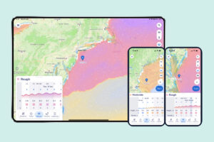
One of the big epiphanies for an apprentice navigator is the realization that the current and tide, though related, are far from directly proportional. In fact, in many areas, the tide can be dropping while the current is rushing into an inlet, and the opposite can also be true. Add to this the cyclic nature of the phases of the moon and there’s good reason for every passagemaker to carry both tide charts and current tables or a digital rendition of each.
Carefully timing a coastal passage can do more than simply add a couple of hours of fair current to a cruise. My favorite example of putting current diagrams to good use, and feeling like you just outwitted gravity, can be encountered during a passage from Newport, Rhode Island, to the Lower Bay of New York via Long Island Sound. By timing your departure from Newport to coincide with the last part of an ebb, a crew can scoot out of Narragansett Bay, pick up a flood current rushing toward Long Island’s Plum Gut, and be well into the sound when the set turns foul. Add an easterly breeze to the equation, and a harbor midway down Long Island Sound can be reached in one tidal cycle. Plus, in this part of the sound, ebbs and floods are often measured in tenths of a knot rather than in whole numbers.
The second session of smart current planning calls into play the time it will take to reach Hell Gate, a tidal strait in New York’s East River. It’s a calculation that’s based upon the time when the flood turns into an ebb at this point. This isn’t when the tide is high at Hell Gate; it’s when the flow up the East River and in from Long Island Sound actually reverses. Just as with the run from Newport, a flooding current can be ridden right to the slack-water point, and then the ebb will carry you down the East River into the Upper Bay and Lower Bay of New York. Picking favorable current conditions can cut the transit time in half, and the slower a vessel is under power, the more valuable this natural lift phenomenon becomes.
As one voyages around the world-or close to home-a veteran cruiser translates lessons learned into nautical wisdom, cues that warn about hazards ahead or deteriorating weather conditions. He or she pays heed to coastline features as well as bottom contours, soundings, and other benthic attributes. By understanding their influence on sea state, and merging the information with the surface weather maps and the 500-millibar forecast, a sailor can construct a very informative sea-state perspective. The process blends the science of the oceanographer and meteorologist with the art of effective seamanship, and the outcome is a safer, more enjoyable voyage.
Ralph Naranjo is a seasoned ocean voyager, author, and CW contributor.