Every October, yachts by the hundreds leave New England ports and head south for warmer latitudes. This annual migration follows two basic routes, offshore to Bermuda and then on to the Caribbean, or else along the coast, where destinations might include Florida, the Bahamas, or eventually a sail along the Thorny Path to the Virgin Islands and beyond.
In Bermuda, cruisers frequently wait for another spell of fair northerly winds to continue toward the Caribbean. But the island, located east of the Gulf Stream, can be difficult to reach, and isn’t by any means an ideal place to weather strong autumnal lows springing eastward from the mainland, nor an occasional tropical system barreling through in October or even November.
Most “snowbirds” instead stop in Block Island, at the eastern end of Long Island Sound; at the Hudson River; or in the lee of Sandy Hook, New Jersey. From there, they take off southward along the Jersey coast when a cold front is followed by northerly winds. New Jersey ports like Atlantic City and Cape May offer safe escapes when the wind switches to the south, signaling the approach of the next low.
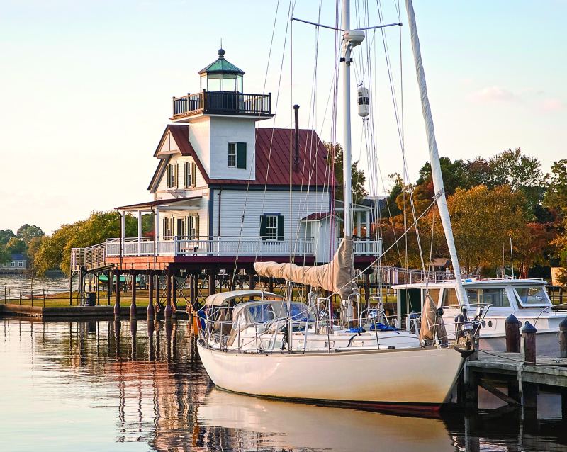
Farther south, cruisers often wait for a break in Ocean City, Maryland, or Cape Henlopen’s Port of Refuge, on the edge of Delaware Bay. Then, somewhere off Cape Charles at the Chesapeake Bay entrance, it’s time to decide the next move. When a sailboat’s mast height exceeds 64 feet, the course around Cape Hatteras is the only option, since ICW fixed bridges have 64 feet of clearance at high tide. Considering that the mighty Gulf Stream flows north at a good clip, southbound yachts avoid it by sailing close to the shores of North Carolina’s barrier islands.
Weather plays a key factor in rounding Hatteras. Ocracoke Inlet — tricky, but the only usable one on that outer coast — can get quite nasty in onshore swells, so most offshore-bound yachts discount it. When conditions threaten the Cape Hatteras route, southbound boats, rather than get caught on the exposed coast, can divert to the marinas in Little Creek, Virginia, 10 miles west of Cape Henry, at the mouth of Chesapeake Bay. Little Creek is reached via Thimble Shoal Channel through the Chesapeake Bay Bridge-Tunnel. There, one waits for a good forecast before tackling Hatteras.
Those with a mast height under 64 feet, however, have more options. They can, of course, await a suitable weather window and head outside, but they can also take advantage of the protection offered by the Intracoastal Waterway.
A glance at the chart indicates the ocean route is shorter than the meanders of the ICW. However, when measured from Little Creek as a departure point, to Beaufort, North Carolina — the next important port on the way south — the two routes are about the same, at 190 nautical miles.
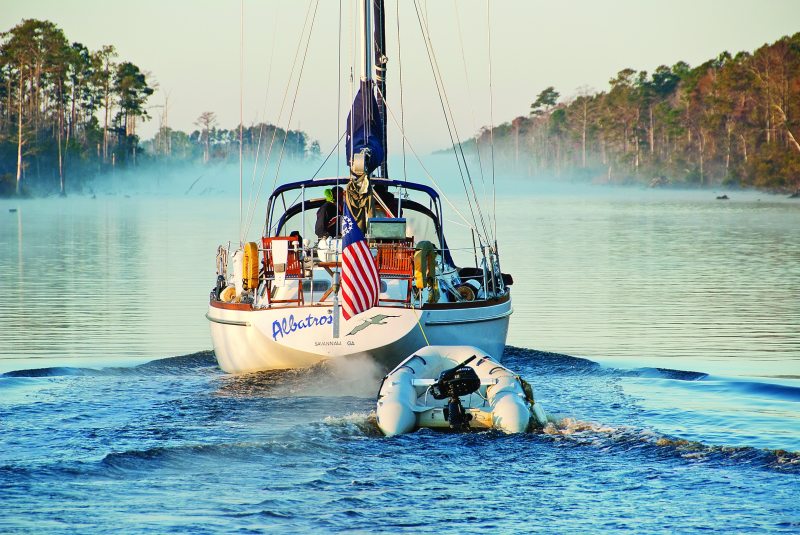
So on a recent transit, when the weather forecast rattled out three days of imminent southerlies, we sailed on through the Chesapeake Bridge-Tunnel gate. The waters smoothed out, and the ICW route, which I nicknamed the Great Hatteras Bypass, began to look very inviting. We’d move in daylight only, spending nights at anchor. The trip would take a few more days, but my wife, Nancy, and I figured, “Hey, let’s turn this passage into a cruise.” We’d be hobnobbing with nature and visiting a few interesting towns along the way.
The sky turned a livid purple, a sure sign of rain the next day, when, after passing a formidable gathering of U.S. Navy ships, we dropped anchor at Hospital Bight on the outskirts of Portsmouth, Virginia. Portsmouth offers good services to yachts: marinas and a large boatyard, as well as a free-of-charge yacht basin right downtown. A small ferry keeps chugging between here and the Nauticus National Maritime Center, a naval museum, and the battleship Wisconsin on the Norfolk side of Elizabeth River. The area has an industrial air that spans a few miles around it.
With our 7-foot draft, we had to miss a true natural wonder, the Great Dismal Swamp Canal, whose entrance is 6 statute miles south of Portsmouth. (Mileage along the ICW is measured in statute rather than nautical miles.) Our previous boat drew just under 6 feet and had allowed us to take this route on earlier trips. To transit the swamp is to travel through a green tunnel of forest trees with their branches locking overhead, surrounded by resounding birdcalls.
Instead, we chugged on 12 statute miles to Great Bridge Lock. South of the lock, the industrial vistas gave way, and the first sights of nature kicked in as flocks of Canada geese herded fuzzy chicks alongside the moving boats. Great Bridge, or strictly speaking, the town of Chesapeake, Virginia, was an easy place to stock up on groceries for the next few days. Yachts in need of inexpensive fuel and competent boat services of all kinds can dock or haul out at the Atlantic Yacht Basin just south of the lock and bridge. The bulkhead wharfs south of the lock and another south of the bridge welcome visiting yachts free of charge.
The Albemarle-Chesapeake Canal begins here. It’s a gateway to a freshwater passage all the way to Pamlico Sound. Although no tides vary the water levels, prolonged, strong northerly winds can reduce the depths by 3 to 4 feet for the next 100 miles. With our restrictive draft, we paid attention to the wind direction before taking off for North Landing River and Currituck Sound in North Carolina. This is a real osprey alley, with massive nests crowning channel beacons. Currituck Sound merges into Coinjock Bay and leads to the town of Coinjock, North Carolina; it’s a straight channel banked by yacht docks and restaurants famous for prime rib the size of wakeboards. From there, North River winds between shoals and marshes southward to Albemarle Sound.
Finally in the wide, deep waters of Albemarle Sound, sailboats can spread their wings. About midway across, we spotted an armada of lucky shallow-draft yachts running downwind from Elizabeth City after a passage via the Great Dismal Swamp Canal. I noticed no one carried on eastward and then south via Croatan Sound, toward Pamlico Sound, most likely because of the 45-foot bridge spanning that route.
In a fresh northwest breeze, we trimmed up for a fast close reach across Albemarle Sound toward Edenton, 35 miles away and a definite departure from the beaten track. “You go there and you will never want to leave” was a typical line we heard about the charms of Edenton.
A few hours later we tied up inside the boat basin downtown. Two minutes into a chat with a fellow fishing off the pier, he told us, “We came here from Wisconsin — the best move we ever made.” Edenton has undergone a phenomenal transformation since being known as “Rogue’s Harbor” in the 17th century. Within a few generations, in 1722, it became the capital of North Carolina. Joseph Hewes, a Northern, Quaker ship owner, moved to Edenton, became the first secretary of the Navy in 1776, and even gave his own vessels to reinforce the young naval fleet. John Adams called him the father of the U.S. Navy. Today Edenton is a genteel town of happy people with great walks among pretty homes that are typical of 19th-century Southern architecture.
A brisk sail two days later took us to the Alligator River swing bridge at the south end of Albemarle Sound, and on to the deep waters (11 feet or more) of Alligator River, its banks pure wilderness. Nature crowded closer in the Alligator River-Pungo River Canal, which cuts through flooded forests. Ashore, bald eagles perched on dead treetops and scanned the autumn-gold marshes for stray rodents. A flock of white geese or maybe trumpeter swans winged westward overhead, an unexpected visual bonus.
On this day of wafting light airs, the forecast announced 40-knot northerlies. Even with our 7-foot draft, there was usually a choice of anchorages among low marshes — good enough for moderate winds. Now we needed more protection. When a long stand of tall pines appeared on the upland shore a few miles east of Belhaven, we headed in and dropped anchor in 10 feet, less than a tenth of a mile from shore. All afternoon boats streamed to the marinas in Belhaven. Breakwaters protect the harbor there from the south, but its funnel-shaped inside waters face north, promising a choppy, windy night. A varnished mahogany 1920s-vintage motoryacht passed nearby and then vanished into the creeks on the backside of Belhaven, where a hidden boatyard thrives. The yacht’s skipper obviously knew the unmarked vein of deeper water winding through the very shallow approach.
All night, gusts whistled and rattled the rigging, the offshore wind blowing the water out of the bay; by morning the depth sounder read 8 feet, the water having been blown down 2 feet. Eventually the northwesterly eased and gave us an easy run southward under power and genoa, all the way to Oriental, at the western border of Pamlico Sound.
Oriental is a place famed among veteran cruisers. The harbor being too shallow for our draft, we took advantage of a calm, anchored outside the breakwater, and dinghied in. Ashore we slipped a couple of available bicycles from the rack in front of the Inland Waterway Provision Company, a marine hardware store, to tour the streets. Oriental has an irresistible atmosphere with lovely homes and a port with sailboats in the majority, but a few salty trawler yachts and three shrimp boats remain to remind us that this little town began as a fishing village.
The deeper navigable waters of Neuse River, which joins Pamlico Sound off Oriental, end at New Bern. The community was once yet another capital of North Carolina (1776 to 1794) and the hub of commerce during colonial times. Surprisingly for us today, the merchant sailing ship traffic from Europe once reached New Bern through Ocracoke Inlet, then a deep, straight channel leading toward the resources of the New World. On the south edge of the town, a friendly bridge operator let us through to Trent River, with its two large marinas; filled with local craft, both keep a few slips open for transients. And like other coastal towns of North Carolina, New Bern maintains a free wharf and a floating dock in the waterfront park by the swing bridge.
Ashore, this town of 30,000-plus inhabitants is like nothing else on the East Coast. The skyline is right out of a Grimm Brothers fairy tale, with solid brick buildings —churches, banks and schools — that soar into towers that could belong to the castles in the medieval Swiss Alps or German Black Forest. The town founders, religious misfits from Switzerland and Germany who escaped persecution to England, made themselves such a nuisance that Queen Anne granted land in the Carolinas to their leader, a bankrupt Swiss baron. The town celebrated 300 years in 2010 and, since the word bern means “bear” in old German, challenged local talent to create bear sculptures. Now bears — hundreds of them — shaped in all manner of styles and materials dominate the town. A large mosque, complete with a giant onion dome, is such a surprise that one may easily miss a sign nearby commemorating a local chemist who concocted the Pepsi recipe in the 1890s.
We dropped down the Neuse River to Adams Creek, which leads south toward Beaufort, and soon the boat slowed down; the tides were back.
Beaufort would be our last stop on the Great Hatteras Bypass route. From there, we’d head back offshore, the next stretch of ICW being plagued with extremely shallow waters. Strong tides flow through Taylor Creek off the Beaufort waterfront, where a score or two of yachts try to anchor each afternoon. Add a strong wind against the current, and the place gets exciting. Taught by experience, we timed our arrival in Beaufort for late morning. By then, large numbers of moderate draft boats had left to continue on the ICW south of Morehead City.
If you stop in Beaufort, while ashore don’t miss a visit to the North Carolina Maritime Museum, with its unique presentation of traditional shoal-draft craft and a very complete library of maritime literature on yacht design and adventure under sail. A couple of full-service marinas and four boatyards in the immediate vicinity help prepare yachts for their offshore destinations ahead: either crossing the Gulf Stream on the way to the Caribbean, or sailing south along the East Coast to the many other winter destinations that await.
– – –
Tom and Nancy Zydler cruise the East Coast of the United States and Canada aboard their Mason 44, Frances B.


