The deceptively simple question – how do you know where to anchor? – is more nuanced than some imagine. In our hyperconnected world, it’s the kind of straightforward information that lends itself to a single source…except there isn’t one, and it’s actually not that straightforward anyway. Choosing where to anchor is a little more complicated than picking a spot of decent depth that appears to be reasonably protected. Here’s a quick review on considerations and sources.
Charts
The obvious first stop: when plotting a route, the destination is first considered based on practical, charted data. Is the depth reasonable? What’s the bottom composition? Consider how sea state is affected by the shape of the coast, and how winds are affected by land formations. Charts often indicate if no anchoring is allowed, whether because of man-made features (underwater cable) or regulations (harbor limits). Occasionally you’ll even get a helpful anchorage icon.
Generally speaking, if the chart doesn’t indicate you can’t anchor there – it’s probably OK. It’s just imperfect information: you still might not want to. Where else to look, what else to glean?
Cruising Guides
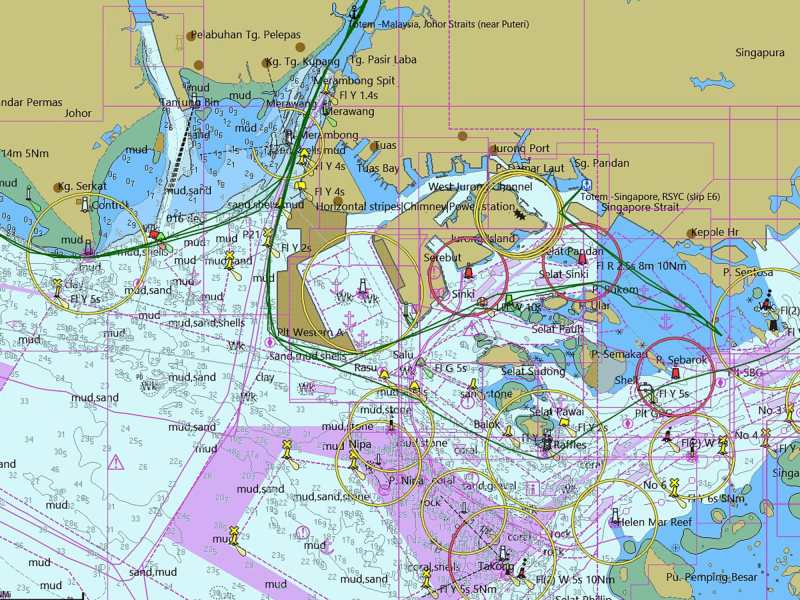
Cruising guides often help with subtleties. For example, an anchorage may check out on the practical points gleaned from a chart, but the chart won’t tell you that a high-speed ferry tosses a wake that virtually guarantees an unpleasant early morning alarm. A spot in the lee may be subject to swell wrap. At other times, you may not want to be in a place that’s marked as an anchorage area; if the vessels using it are large commercial boats that may not notice you, well, time for another spot, a fact cruising guides would tip you off to (note, Singapore chart above!). Even though a printed guide can be quickly dated in some ways, anchoring information is less likely to be affected – like knowing that the lush looking lagoon at the corner of a particular bay is mosquito festival to avoid!
Local restrictions
This varies; local knowledge is king. Here in Mexico, the local port captain has oversight for marine activity. They can define an anchorage area, and it might not actually be recorded anywhere you can find. You find out by asking, or running afoul of their good will. We’d always prefer to ask permission (vs forgiveness), but sometimes it’s awkward.
Arriving into Puerto Peñasco last August under gnarly conditions, we were glad to be tucked safely into the harbor and out of nasty chop in the pre-dawn hours after an overnight jaunt north—the roadstead anchorage outside the breakwater was untenable. Sometime around sunrise, the port captain’s office hailed us over VHF and made it clear anchoring was not welcomed. Our haulout occurred within hours, but we were required to take a slip in the interim.
How do you learn about these restrictions? Hailing the port captain upon arrival to ask guidance is a reasonable tactic, but one that we didn’t consider at 0400 after a stressful passage. This information is often knowable in advance with little research and asking around. We’ve been well informed by the Cabrales Boatyard where we hauled out that PD there was strict and appreciated prompt compliance. Regional Facebook groups are another good way to stay on top of information like this.
Shifting situations
What’s noted in the chart for anchorage data may not be current, and even if digital and “updated,” should not be taken as gospel. Our charts for Singapore were way off, despite being relatively new, thanks to the pace of land reclamation work. In Borneo, our similarly new charts were also very inaccurate thanks to silting as a result of deforestation—depths were dozens of feet off, at levels that mattered. In French Polynesia some communities have taken anchoring restrictions into their own hands, to protect the coral that is their livelihood and legacy; these changes aren’t marked in charts.
In those situations, how do you know? In Borneo, we simply proceeded with caution when it was clear the datum didn’t align with reality. Singapore’s tendency to be inaccurate is well known among the local cruising community, and French Polynesia’s growing issues with visiting boats similarly gets chatter; the coconut telegraph gets it done. In that case, staying in touch with boats around you—whether as analog as knocking on nearby hulls to share information, or joining a regional cruiser’s Facebook group, can be helpful. Reaching out to boats whose wake you travel in can be helpful, too; countless times we’ve been on both the giving and receiving end of the cruiser karma.
Remote protocols
Cruisers are responsible for being respectful guests, and following the rules of the locales we visit. Sometimes these are obvious (such as a closed border due to COVID). Sometimes they’re not (unwritten cultural rules). In Fiji, after anchoring adjacent to a village, the first thing a cruiser must do is seek out the chief and present sevusevu. This bundle of kava roots may feel like a token gift to the boater, but it’s an essential cultural step for gaining permission. It’s a beautiful opportunity to make friends and share in cultural learning as well.
RELATED: Attend to your Anchor
In remote islands, beyond being aware of official regulations, consider the community whose front yard you have parked in. As in Fiji, we seek to go ashore soon after the hook is set to ask permission. Technically, the chart and the cruising guide and the regulations may give it the all-clear. But an arrogant move is to assume that people want you there, or in that spot, and don’t have an opinion. The right thing to do? Would they prefer you anchored on the north side? Are there local protocols to be mindful of? Go in, find someone, and ask—even if you don’t share a language, it’s possible to work it out. It’s a simple act of respect, it sometimes gleans invaluable information (beware the saltwater crocs at the river!). In Papua New Guinea, we always brought a small gift with us: usually a fish caught on arrival. It was a priceless step for our own safety in a place where rule of law is controlled at this very local level; acceptance and discussion of local mores with the chief provided protection with his blessing.
Covid-19
The pandemic has brought a new filter to evaluating if any given place is OK to anchor. Here in Mexico, it’s not always easy to have clear information: we have multiple sources, and they typically do not align (the local municipality, the local port captain, the state, and the federal guidelines). For example: in the southern part of Baja California Sur, the state we’re in, national park anchorages near La Paz are closed. But here in the northern part of Baja California Sur, it’s OK to anchor at the national marine park near Loreto. We try to stay aware and make the best choice we can, with the information we have available. I keep a list of websites to check for the latest and vet that with local knowledge through regional Facebook groups. Sadly, the SSB nets we listened to briefly this spring have not been helpful on this front; failing to acknowledge that cruisers took actions which were clearly in conflict with COVID guidelines.
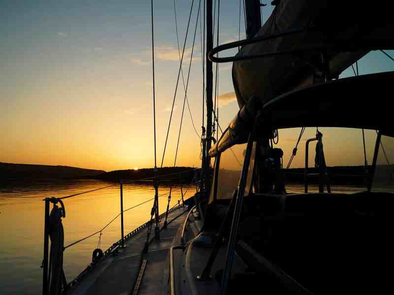
Today’s scene
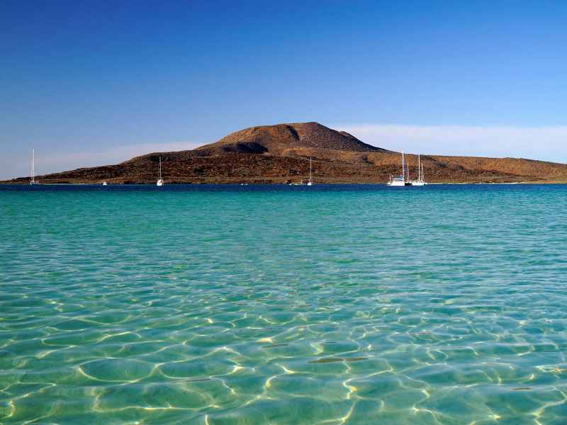
Totem is tucked in the lee of a sandspit reaching out from the softened cone of a volcanic island. Our anchor is set in a nice patch of sand, protected from prevailing conditions. To the west, we gaze past seagrass fields where a feeding turtle pops up now and then. To the east, sunrise behind the aged peak. It’s a good anchorage in most conditions, a place we’re allowed to be. How did we know? It’s really a combination of nearly every method referenced above. Is that an undue burden? Not at all.


