The Big Empty
I left New Zealand because I wanted to sail oceans again, not along coasts. The end of my first passage found me in Cairns, Australia, about to sail 400 miles along a coast. But this is a special coast.
From May to October, you can reach all the way to Cape York, at the northern tip of the peninsula, across water sheltered by the Great Barrier Reef with almost guaranteed east to southeast wind and good anchorages—all but the penultimate one. In the 1980s, I passed this way in my previous boats, Chidiock Tichborne and Resurgam and remembered it as one of the great sails in the world.
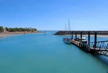
After clearing with the officials in Cairns, I remained in the Marlin Marina for six days, enjoying fresh food in the restaurants that line the shore, performing boat maintenance, and provisioning.
I hadn’t been in Cairns for 21 years. Of course places change in that time, but Cairns, which had been a big country town, was changed out of all recognition. In the interval, the marina had been destroyed by a cyclone and rebuilt inside a massive concrete seawall, and Cairns had become a resort with a landscaped shoreline, hotels, casino, and even a Louis Vuitton store.
I’d been assigned a downwind slip and wanted to leave it before the wind came up. At 0615 on the day of departure, I pushed The Hawke of Tuonela halfway out against a breath of pre-dawn air to clear the bow of a neighboring day-trip boat and was through the looming breakwater entrance at first light.
By 0700, enough wind was coming off the high land to unfurl the jib and cut the engine. On The Hawke of Tuonela, the mainsail isn’t the main sail. It would be set only once before Cape York and twice all the way to Darwin.
In a couple of hours, the wind backed from southwest to southeast, and I jibed. Pleasant sailing before a 15-knot breeze and one- to two-foot waves, but that’s what I remembered and expected: sailing at its level best.
I’d been told that Port Douglas, 25 miles north of Cairns, had grown dramatically, too, and I wondered if I’d find the Low Islets filled with day-trip boats.
As the sand cays rose—slightly—above the water before noon, I saw several masts. A mile off, I furled the jib and started the engine. When I rounded the reef, I was surprised to see that the boats were on moorings, which often complicate an anchorage. Two were day-trip boats, but the other two looked like cruisers.
Passing close to the first of these, I called, and a man came on deck and confirmed that some of the moorings were public and free. Another man appeared on the next boat and said there was a mooring beyond him. These are industrial-size moorings, with hawsers as pendants. He considerately climbed into his dinghy and putted over to hand the pendant up to me. It was too big for The Hawke of Tuonela’s cleats, so I temporarily draped it over the windlass drum until I could rig a bridle.
Thirty-five miles of perfect sailing. Time for lunch.
Racing Against Darkness
The Low Islets are a pretty anchorage, wide open to the north, but the cays provide good shelter from the trades and are the home to many birds and a small lighthouse.
With a glass of wine in hand, I watched the sunset over the mainland seven miles to the west of us. The Great Barrier Reef was eight miles east. The land was still high and would be until near Cooktown.
Renewing my acquaintance with Alan Lucas’ excellent—I’d say indispensable—Cruising the Coral Coast, I expected to take 10 or 11 days to reach Cape York. I was well within the tropics—Cairns is at 17 degrees south, and Cape York is above 11 degrees south—so daylight and darkness were about evenly divided.
There was no need for me to be off at first light the next morning to reach Hope Island 38 miles north, except that I hadn’t tied the tiller down tight enough and the rudder woke me early, and I like being under way at dawn. I also like to reach anchorages with time to spare in case of the unexpected, a policy whose worth was about to be proven. So 0615 again found me on deck, dropping the mooring and powering past the other boats. Lights were on in their cabins, so I expected they would be away soon.
The dawn wind was again off the land, and I cut the engine and was sailing under the jib within a few minutes. As the sky lightened, I saw rain falling from dark clouds ahead, which drizzled on us as they moved offshore. Sails appeared behind us.
Rain persisted, sometimes light, sometimes heavy, and the wind weakened. When our boat speed dropped to two knots, I turned on the engine and powered for half an hour, until the wind filled from the south. I set the jib again and we were doing six knots.
At 1000, we were off Captain Cook’s Cape Tribulation, so named because their tribulations began there. The sky was mostly overcast, and rain was falling in several places but not on us. We’d sailed the other boats below the horizon.
By 1100, the wind had increased to 18 knots, and I was beginning to have doubts about Hope Island. I’d been there in Resurgam and remembered an approach through coral heads.
An hour later, Hope Island was in sight and beyond consideration. The wind was gusting to 24 knots, and rain was falling behind us. Not a reef day. Captain Cook’s sentiments exactly. Endeavour Reef, where he went aground, was five miles due east.
My alternate choices were Cooktown, where Endeavour was towed by her workboats to be repaired, 15 miles away, or Cape Bedford, 33 miles distant. Because Cooktown’s anchorage in the Endeavour River is small and shallow and because, with the growth of the town, it might be crowded, I headed for Cape Bedford.
In what became a race with darkness, I had to partially furl the jib to enable the tillerpilot to maintain control, as the wind increased to 26 knots. Conditions were on the edge of the tillerpilot’s capability. At sea, I would have used the Monitor windvane, but we had to pass between several reefs and coral patches that afternoon and needed to steer compass courses. In this, the chart plotter proved invaluable. I simply moved the cursor to the next channel ahead of us and had instant bearing and distance.
The wonder of modern electronics was somewhat tempered as I watched the autopilot tiller bracket bend from the force of two- to three-foot waves pressing against The Hawke of Tuonela’s big spade rudder.
With a boat speed of six and a half to seven knots, we flew north, and the math was promising as Cape Bedford became visible at a distance of 17 miles with three hours of daylight remaining.
My Spade anchor went down in 15 feet of water in its lee with a few minutes of twilight remaining.
We’d come almost twice as far as expected, covering 74 miles in 12 hours. If I’d planned this, I wouldn’t have let us loaf along at three knots for half an hour in the morning.
Not a beautiful day, but beautiful sailing.
Off Schedule
The Hawke of Tuonela was in a peculiar mode, neither passage nor harbor. I’d left the good slipcovers on the cushions and was sleeping in the V-berth, though on a sleeping bag, because I felt too grubby for sheets, and I’d put a passage pillowcase on the pillow.
Bags of provisions were stowed on the cabin sole in front of the V-berth and on the quarter berths. The solar panels were on the quarter berths instead of on deck because the batteries were getting sufficient charge from running the engine when leaving and entering anchorages. And objects left on the upper berths in the main cabin and in the galley didn’t need to be secured.
The sky cleared after sunset, and just over half a moon was shining when I took my evening drink on deck. The rigging was an illuminated spider web. I was facing the Southern Cross. At sea the last few days before arriving at Cairns, I’d seen the Big Dipper. I turned north, but it wasn’t visible.
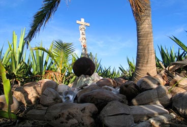
To my left were the dark shapes of the two buttes at the end of Cape Bedford. Several miles away to my right was a single light. This is Aboriginal land. From here for thousands of miles, all the way around the northern coast of the continent and almost all the way down the west until Perth, there are only four or five towns. In the United States, this distance would stretch from New York City north and west and south to Los Angeles.
Having come so far in one day, I sailed only 20 miles the next, anchoring behind Cape Flattery, so named by Captain Cook with rare irony because after repairing Endeavour, they flattered themselves that their troubles were over.
While there are few people in northern Australia, there is much mineral wealth, and those who are there, other than Aboriginals, are usually mining. A Japanese company runs a silica-sand strip mine near Cape Flattery and exports half a million tons of sand each year from a jetty on the south side of the cape. From where I anchored on the north side, I could see several work boats to my west, but any buildings were obstructed by a hill.
That afternoon, I removed the tillerpilot bracket and inspected it for cracks. In our first year out of Boston, we’d broken several brackets. It appeared to be sound, so I bolted it back in place. I checked for spares and found I still had three.
I also reassessed my plans. I’d traveled so far so fast that I was off schedule. The next logical stop was Lizard Island, 18 miles to the north. Lizard is a high island with a good anchorage, an expensive resort, and a climb to Cook’s Lookout, where the good captain sought and found a way back to open water through the labyrinth of coral in which he was trapped. Those sailing this coast for the first time shouldn’t miss it; I’d been there twice and was in a moving-on mind-set.
At Cape Flattery, the coast, which has been tending north, falls away to the northwest for 70 miles, then scallops west for 50 more before turning north again for Cape York.
I was 15 minutes late the next morning and didn’t get the anchor up until 0630. I switched the engine off a few minutes later. I realized that it would have been easy to sail off the anchor and only started the engine in case I had trouble winching in the chain against the wind. I wasn’t certain how far I’d go that day, and I ended up once again going even farther.
A sunny morning of 15-knot trades sped The Hawke of Tuonela along a coast of low hills and sand dunes and at noon brought us to our first possible anchorage at Howick Island, an offshore sand cay. I anchored here in Chidiock Tichborne; in The Hawke of Tuonela, I couldn’t find less than 34 feet of water at low tide and decided to continue on to Ninian Bay 22 miles ahead. But when I got there, Ninian Bay was closed. The wind was too far east, turning it into an unprotected lee shore.
After a brief exploration of a spot marked as “trawler anchorage,” I turned north for Cape Melville. With only two hours of daylight left, I’d reach it near sunset, then have to work my way around a two-mile-long, one-mile-wide shoal on its west side to anchor in its lee. This would definitely be after dark, but the sky was clear, and we’d have a waxing gibbous moon.
The last orange glow faded to black as we passed between Cape Rock and Boulder Rock at the tip of Cape Melville, and I made Captain Cook’s mistake of flattering myself that my trials were over. Although we had to harden up to a close reach as we turned south, I expected to find smooth water and decreasing wind in the cape’s lee. Instead, the wind gusted to 29 knots, the waves became jagged, and enough spray came over the deck so that I raised the dodger for the first time since Cairns.
With depth sounder and chart plotter, we painfully punched our way around the shoal and anchored in 18 feet of water near high tide an hour later. The anchor set instantly, but I let out 100 feet of chain, more than my usual 3-to-1 scope.
The chart plotter indicated that we’d covered 77 miles. The howling wind confined my evening drink to the cabin.
Again, a short day followed a long one. It was only 15 miles to one of my favorite anchorages along this coast, at the Flinders Islands group on the other side of Bathurst Bay, the first of the two scallops west of Cape Melville.
The anchor was fouled on something that morning, and I had to power from side to side to free it. Later, I read that almost all the land in this region belongs to three national parks (I imagine they’re very rarely visited; there isn’t a paved road for hundreds of miles). One of them is used for crocodile conservation. I’m glad I didn’t have to dive to recover the anchor.
Blessed Silence
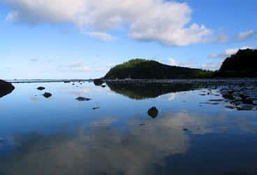
The Flinders Islands are continental islands, high hills rather than sand cays, and the anchorage is in a channel between them. It’s a pretty, peaceful place that I had all to myself.
Anchored before noon, I caught up on a few minor maintenance jobs, then enjoyed the solitude and space, which usually I only find at sea, but which here also enter the mind from the vast, empty land. I’m often struck by the ugly clutter of modern urban life. There’s a soothing purity to emptiness.
I was off early the next morning for a last leap west across Princess Charlotte Bay, followed by a turn north to Morris Island, 60 miles in all and, unexpectedly, 60 miles we’d do under power.
The wind never was more than slight. Usually it couldn’t even fill the jib, and when it did, it added only three-tenths of a knot to our speed. It was a perfect day for powering, if that isn’t an oxymoron.
We passed a trawler early and then two more anchored behind a cay halfway across the bay. I moved around the deck seeking shade and listened to music on noise-canceling headphones, bought for long flights but useful for banishing Yanmars as well. (Later experimentation established that I could still hear the audible engine alarms with the headphones on.)
True blessed silence finally came in late afternoon when my anchor went down behind Morris Island, a sand cay covered with low scrub and a lone palm tree on the west side of an extensive reef.
Another boat was already there, a Valiant 40. I didn’t see the crew, and I anchored 100 yards away.
At sunset, I was on deck. No music. I had heard enough during the day. The only sounds were ripples lapping on the shore and cranes wading in shallows and calling “Kelrupp. Kelrupp.”
After its unaccustomed usage, I checked the engine fluids and fan belts the following morning and heard the other boat getting under way. By the time I winched in the Spade, the Valiant 40 was a mile or two north and west. Although we’d share a few more anchorages, I didn’t actually meet its owner, Jim, until Darwin.
This stretch of the coast and reef offered several possible stops spaced at 20-mile intervals, and I was determined not to power. After its rest day, the wind now provided the best sailing of the passage, with 14 to 16 knots on a broad reach encouraging me to set the mainsail as well as the jib and bringing us in late afternoon past Restoration Island, where Captain Bligh made land on his open-boat voyage after the mutiny, and to Portland Roads before dark. We covered the same distance as the day before—60 miles—but sailed 57 of them. Better.
For reasons that I’ve never understood, there’s a tiny settlement on the hillside of Portland Roads.
Three local boats were there before me, and the Valiant came in later. A small private helicopter arched over the hills and landed on the tiny beach.
The noise brought me on deck, where I found a divided sky: To the south, it was dark with rain and a rainbow; to the north, clear and sunny.
I stayed on deck and raised my glass to the much-maligned Captain William Bligh, the second greatest open-boat sailor of all time.
Pleasant Surprise
Another day, another 47 fast miles found us behind Cape Grenville, only 90 miles from Cape York, and faced with the worst leg of the journey. Other than continuing nonstop, the sailor has only two choices along this stretch of low, sandy coast: cover 70 miles to the Escape River, and a few more across a bar to anchor, or go 47 miles to Bushy Islet, which Coral Coast describes as miserable. Not wanting to race all day, cross a bar facing into the sun, and have to make my way up a river in twilight, I’d stopped at Bushy Islet in both Chidiock Tichborne and Resurgam, and miserable it is.
At high tide, Bushy Islet almost disappears and becomes hang-on rolly. There’s never a problem leaving Bushy Islet early.
I didn’t bother to turn on Hawke’s engine, and we sailed off the anchor at Cape Grenville later than usual. I didn’t want to spend any more time at Bushy Islet than was necessary. The Valiant was already gone.
Pushed by moderate, 14-knot trade winds, we were anchored at dreaded Bushy Islet by midafternoon, and it wasn’t bad. It was, in fact, good. The water in the lee of the small sand cay was smoother than Portland Roads. But it was low tide.
With a seven-foot range, the high tide at midnight would find the mile-long reef and most of the cay submerged.
Enjoying the unexpectedly pleasant conditions while I could, I sat on deck. The low mainland covered with scrub and patches of white sand lay four miles west of us. Cape York was 45 miles north, a bit farther to the anchorage, depending on whether we went through Albany Pass or followed the shipping channel outside Albany Rock.
In anticipation of severe rolling at high tide, I slept that night in the main cabin rather than the V-berth. It turned out to be unnecessary. I woke several times, and near midnight I got up and didn’t even need to grab a handhold.
Bushy Islet, which has lived in my memory for decades as one of the worst anchorages I’ve ever used, behaved itself all night, or at least until 0300, when I sailed off the anchor and headed north under jib and the full moon.
A ship was passing as we spun away from Bushy Islet, and there was a dim loom of light to the north that I assumed was the settlement at Thursday Island, in Torres Strait.
The Hawke of Tuonela sailed through lovely pre-dawn coolness to a Schubert sonata, and dawn found us off the Escape River, from which two boats were emerging. To starboard, silhouetted against the rising sun, a tug pulled a barge south.
The shortcut through Albany Pass wasn’t on for us that morning, being directly downwind through an area of overfalls, where the Arafura and Coral seas collide. The jib was constantly on the edge of collapse and jibe, so I turned 30 degrees east to sail the shipping channel at a more comfortable angle.
The tillerpilot became hysterical trying to compensate for conditions it didn’t understand. The overfalls weren’t extreme, but eventually I had to take the tiller myself. Even with 16 knots of wind in the sail, The Hawke of Tuonela’s deck canted wildly and often to windward as we bounced over bands of dark and tortured water.
At 0945, the light on Albany Rock was abeam, and we turned west to reach the anchorage in the lee of Cape York.
Cape York isn’t a dramatic headland, merely another hill tapering to the sea. But there’s always satisfaction in rounding a significant cape, the extremity of a continent, even if it isn’t quite up to Hope or Horn.
The sail from Cairns, I realized, had lived up to my memories. I let my mind wander south and knew that I’d never sail that coast again. And I must confess to being glad that ahead, beyond Torres Strait, lay open water.
Webb Chiles divides his time between sailing The Hawke of Tuonela, a 37-foot Heritage One-Ton sloop based in New Zealand, and a Moore 24 on Lake Michigan. Five of his books are available in Kindle editions, including The Fifth Circle, from which this article is excerpted. Keep up with Chiles at his website (www.inthepresentsea.com).