Cruisers often bypass the small and lesser-known southeastern Bahamian islands on their windward passage through the Exumas on their way south to the Caribbean. But they shouldn’t. Take the advice of Bruce Van Sant, legendary sailor and author of The Gentleman’s Guide to Passages South: “Don’t rush through the islands; they are too perfect.” So, Google up a map, friends, and follow along.
Because the Bahamas are shallow, the water they occupy in the North Atlantic Ocean is that much lighter, and, frankly, more beautiful than the Caribbean Sea. You can sail for miles in 10 to 15 feet of the lightest hues of blues and turquoise, suddenly plunge into thousands of feet of dark blue ocean, and return to shallow turquoise toward the edge of the next island. The shelf acts and feels like a large V.
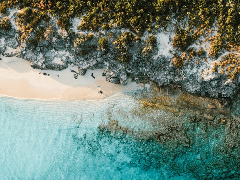
Conception Island is possibly the most beautiful of all the Bahamian islands and is only 45 nautical miles northeast of popular George Town on Great Exuma Island. As Van Sant suggests, to reach Conception Island, anchor the night before just south of George Town at Fowl Cay, an uninhabited island with a small swimming beach. This will save you 4 miles of motoring to exit Great Exuma. Raise your mainsail at first light, and a southwestern wind will give you one long, straight starboard tack to Conception Island. Uninhabited and pristine, the beach has water so clear, you’ll swear you can drink it. The whole island is less than 3 miles at its widest, and it’s low-lying like all the small Bahamian islands, making it almost unnoticeable on electronic or paper charts.
The Bahamas National Trust has designated Conception Island a national park, which protects conch, fish and lobsters. The coral heads and reefs that surround the island make for great snorkeling and diving. At high tide, an entrance to a creek two-thirds of the way down the western side allows you to dinghy into mangrove flats to see turtles, sharks, conch and other marine life.
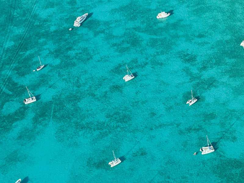
To relax, simply walk the deserted white sandy beach and let your mind wander in your escape to this stunningly beautiful anchorage. Or, from the deck of your boat, simply stare at the magnificent crescent-shaped beach, and imagine why no more than five sailboats and catamarans are anchored outside the island on any given day.
Like this solo sailor, you might chance upon the only other sailors on the beach who happen to know the Bahamas like the backs of their hands. If you are fortunate, like me, they will buddy-sail with you 35 nautical miles northeast to San Salvador. There, anchor in deep white sand just east of the only town on the island, and your new friends will take you to their favorite coral head, where they will spear two huge spiny lobsters and share their spoils in a tasty dinner on their catamaran. For thanks, buy them cocktails the next day at one of the only open bars overlooking the beach.
Sparsely populated and somewhat larger than Conception, San Salvador Island hosts a handful of small resorts and, surprisingly, an airport that brings in daily flights from Florida. Still, it maintains the feel of a quiet and secluded Caribbean island. You can walk the traffic-free main road, and a friendly local might drive you to one of the two small grocery stores on the island. Much controversy surrounds the claim that Columbus made his first landfall in the New World at San Salvador Island, though a plaque on a building in the middle of town states that he landed there October 12, 1492.
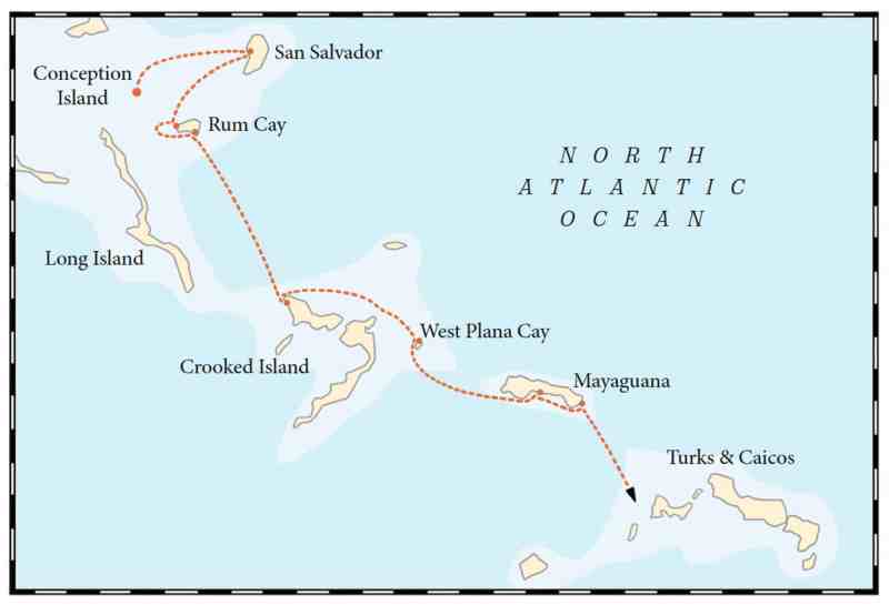
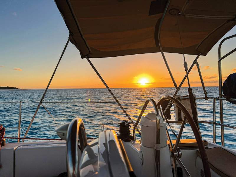
From San Salvador Island, you can sail 30 miles southwest to Rum Cay in prevailing east winds. (An island with the word rum in it must be good.) Find yourself wind-protected on the absurdly beautiful, quiet and pristine Flamingo Bay on the western edge of the island. Your charts will show a submerged wreck, giving you fair warning to watch the depth and weave the coral heads using eyeball navigation. You can sleep soundly under a clear sky and shining stars in tranquil water. Among life’s finer experiences, one should enjoy a morning cup of coffee on the bow of a gently swaying sailboat in a warm, clear bay that is yours and yours alone. Dinghy to the deserted shore to create the only tracks on the white-powder beach.
On a rising sun, sail out of Flamingo Bay against an east wind to seek civilization around the corner to Port Nelson, the only inhabited town on the island, with reportedly fewer than 100 residents. With a handful of tacks, you will turn a 6-mile sail into 15 glorious sailing miles where you will see small flying fish burst out of the water to escape predators. At 30 miles in total area but still tiny in size, Rum Cay dwarfs Conception Island.
Port Nelson consists of a welcome sign and a government dock that accepts a mail boat three times a month. Near the dock, you might find yourself at The Last Chance, a ramshackle bar with sand floors, a pool table and a book rack. Kaye Wilson, the proprietor, will sell you a Bahamian beer for $3, a dozen eggs for $8 or a bag of frozen green beans for $6. She also will make you the tastiest burger for $12 and serve it in a foil wrap rather than on a plate.
You might chat up the only other patrons, two Bahamian police officers also enjoying a lunchtime burger. Even though the island is crime-free and all residents know one another, the officers are on daily foot patrol. One might be wearing a polo shirt, while the uniform of the other is a ball cap and T-shirt that say “police.”
Don’t shy away from requesting a police escort to the only other open eatery, the Ocean View Restaurant, an establishment with wood floors that’s been proudly owned for 45 years by Ruby Bain. Her son will serve you a Guinness in a bottle delivered to the island on a mailboat. I watched in awe as she affectionately taught one of the officers a local song. After you share a beverage with the police and they insist that you stay on the otherwise sleepy Rum Cay for a weekend festival, you know that you have met some of the friendliest people on Earth.
To seek protection from an oncoming stiff and persistent eastern blow, depart Rum Cay at 4 a.m. and motorsail 30 degrees off an east wind to reach the western side of Crooked Island in daylight, some 60 miles southeast. You might find several sailboats and catamarans already there seeking shelter.
At Crooked Island, it is impossible not to make new sailing friends, either on the beach or at Gibson’s Restaurant, where they seat customers, mostly sailors, cafeteria-style on a long table. They serve everyone the same delicious fare of locally caught fish, meat and vegetables.
Take the advice of legendary sailor and author Bruce Van Sant: “Don’t rush through the islands; they are too perfect.”
At Crooked Island, you also might be lucky, like me, to find a stainless-steel spear pole washed up on the beach that you can use to spear your own lobsters. If you need diesel and water, motor a few miles to the Crooked Island Lodge and Marina, the only marina on the island. You might as well spend one night there instead of rolling on anchor in the big blow. The marina’s knowledgeable general manager will show you the nearby coral heads to hunt lobsters. (Using the newfound pole spear, this novice fisherman came up empty-handed, but the marina’s chef prepared a lobster dinner for me, the restaurant’s only customer for the night.)
Sailors can do major provisioning at the marina for Bahamian beer, wine, local fish, vegetables, frozen hamburgers and delicious rolls. And what the marina does not have, the general manager will drive you 4 miles to find at the small grocery store. The marina is undergoing big renovations, including new hotel rooms, small cabana-like lodges, a new restaurant and a pool. It is also enlarging its jetty, so boats will enjoy a swell-free dock experience.
So far, you will have had days of pain-free windward sailing. That might end as you sail east toward the lightly populated Mayaguana Island, a staging ground for a southeast run to Turks and Caicos. If you have no time to wait for a favorable wind north of east, you might experience moderate bow-bashing and wave-crashing sailing to the small and uninhabited West Plana Cay, a good stop-off 43 miles toward Mayaguana. After you pass Acklins Island off your starboard and you steer 30 or so degrees south, the waves begin to behave, and you will reach West Plana Cay in calm conditions.
Again, you will have all to yourself another beautiful turquoise-blue bay protected by an east wind, and you will ask why you are not spending long days there reading, beachcombing, fishing, sleeping, and just enjoying your escape from civilization.
Last, the 37-mile east sail from West Plana Cay to Abraham’s Bay on Mayaguana will likely be similarly uncomfortable. Protected by a barely visible long stretch of coral reef, Abraham’s Bay will feel like you are anchoring in 15 feet of open ocean, but the overnight roll will be moderate and easy to handle.
The next day, sail east in 14 miles of pain-free tacking across a small bay to Southeastern Point, where Van Sant suggests that you stage your departure to Turks and Caicos. From this point, you will have a better southward angle to sail a reach to Sapodilla Bay on the Caicos banks.
Damian LaPlaca is currently in Puerto Rico aboard his Jeanneau Sun Odyssey 39i Performance, Beckon.


