The beauty of bluewater sailing is that once the lines are cast off, we enter a vast, complex and powerful natural system over which we have no control. Every captain’s challenge and responsibility is to develop a fundamental understanding of the elements involved and align them in the safest, most efficient manner possible. To paraphrase an old alliterative saying, “Prior planning promises pleasant passages.”
There are far too many world cruising routes to offer specific advice for each herein, but no matter where you wish to sail, a review of the tools available and general principles of route planning may help in your initial stages of preparation.
The three major factors in successful planning are when you sail (selecting the right season and window within that season), where you sail (shaping your route along the path of least resistance), and how you sail (matching the vessel and crew to the anticipated conditions and carrying the appropriate reference materials, sails and equipment).
Pilot Charts
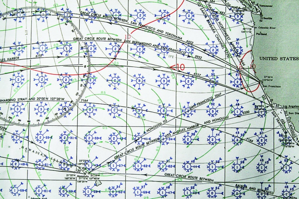
As simple as that sounds, the devil is in the details. And no more detail can be found in any single source than in the Atlas of Pilot Charts, first compiled in the mid-1800s by Lt. Matthew Fontaine Maury, U.S. Navy, recognized as the father of modern oceanography and maritime meteorology. These weather charts encompass the globe and have evolved into a stunning compilation of historical averages regarding wind direction and strength, storm frequency and tracks, major currents, iceberg limits, fog, air temperature, great-circle routes, magnetic variation, and more. For the big passage overview, they are collated into a three-month-per-page format, and for more specific planning, on a one-month basis. There are five volumes in all, categorized by geographic region.
The graphic symbols are easily interpreted. Wind circles are placed in evenly spaced squares across the charted areas, broken down into the North Pacific, South Pacific, North Atlantic, South Atlantic and Indian Ocean. Each circle is surrounded by arrows emanating from the eight cardinal and ordinal directions, with the wind flowing in the same direction as the arrow flies. An arrow’s length, relative to the other arrows, indicates the proportion of time the wind is from that direction.
If the wind is so dominant from a single direction that the arrow’s length would interfere with the neighboring square, the arrow is broken with a numerical percentage. The “feathers” on the arrow indicate the average wind speed, with each feather representing one force on the Beaufort scale. A number at the center of the circle indicates the number of days in a month with either no recorded wind or wind so light as to be variable.
Intense as they are, tropical depressions do not statistically affect the wind roses, because they are so short-lived. They do, however, affect the sailor caught in them. Therefore, on each page a sidebar uses red lines to record the tracks of significant hurricanes (also called typhoons and cyclones), and a separate section discusses the details of gales and tropical depressions for the covered time and area. This is important because once you understand when and where hurricanes are most likely to develop, and the probable track they will take, it may be determined that with a good extended forecast, one could set sail — even though officially in the hurricane area and season — with the hopes of vacating the danger zone before a significant system could develop or converge with one’s outgoing track.
By sifting through the data, one soon discovers that although the rhumb line may appear to represent the shortest distance between two points, it is not necessarily the quickest route to take. Though a great-circle route may be shorter, by following a reasonable arc of favorable winds (rather than adhering to a strict A-to-B course and mentality), your speed over ground and velocity made good will usually be fast enough to compensate for the extra mileage sailed. Plus, being a little off the wind makes the sea motion better, reducing wear and tear on the rig, sails and crew.
A passage we made from Canada’s Vancouver Island to Hawaii illustrates that point. A direct course would have taken us through the middle of the North Pacific High, replete with contrary currents, frustrating calms and unpredictable wind directions on the approach to Hawaii from the north. By sailing down the coast to the latitude of San Francisco, and then bending a course south and west until reaching Hawaii’s latitude, we were assisted by favorable currents running down the West Coast and caught steady northeast trade winds on the starboard quarter (a wind angle our 36-foot Roger Henry loves) all the way into Hilo.
Current Affairs
The green lines on the Pilot Charts identify the major currents of the world, including the Kushiro, Gulf Stream, Humboldt, Agulhas, Californian, North Equatorial and South Equatorial. These currents are powerful forces, and any prudent mariner will shape a course to use them to his or her advantage, or at least mitigate their detrimental influence. It is not just a matter of a countercurrent sapping your SOG. When a major current runs contrary to strong prevailing winds, the resulting seaway can be nasty.
A classic example of this occurs in the passage from any East Coast seaport to Bermuda and beyond. The Gulf Stream flows in basically a north-to-northeasterly direction, averaging up to 4 knots. When this flow is contrary to strong prevailing winds, dangerously steep seas develop. But the stream is not consistent; it meanders in bends that nearly turn back on themselves, and widens and narrows often. Using real-time observations as recorded on a NOAA website, one might decide to head in a direction oblique to Bermuda in order to cross the stream in a narrow area or where it flows in a safer direction.
In some cases, even where you sit in the current can be critical. The Agulhas Current runs south down the east coast of South Africa against frequent southeasterly gales. Inside of the 100-fathom line, vessels traditionally fare well. Outside of it, even supertankers have been known to break in half. These differing conditions lie nearly within sight of each other.
The Pilot Charts do not deal with wave heights, as they are too unpredictable. What is predictable, however, is the turbulence caused by wind over shoal water, sudden depth rises, and convergences of known currents. Plan to give a wide berth to large banks and prominent headlands, such as the Grand Banks or Cape Hatteras.
Remember that large landmasses can have significant effects on winds. Many a cruiser has felt the sting of the Tehuantepec or Papagayo winds off the west coast of Central America. A large saddle in the cordillera (mountain range) accelerates the winds crossing from the Gulf of Mexico in what is known as the Venturi effect. And yet, sailing north from Chile along the South American coast, we took advantage of not only the north-flowing Humboldt Current, but also the onshore breeze that developed early in the day due to heating air rising up the Andes, as well as the offshore breeze that developed at night as the air cooled and fell from the heights.
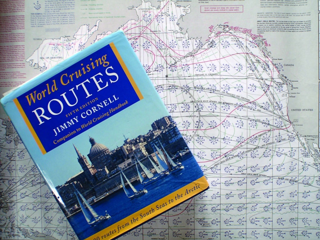
All this data has, in a sense, been given training wheels via Jimmy Cornell’s comprehensive book World Cruising Routes. Cornell has interpreted and reduced the mountain of data into specific routes to and from nearly every destination on the planet. Logically organized, this tome includes specific timing windows, GPS waypoints to follow, distances to cover, and more. It’s a carefully researched and edited work.
Either resource can be considered a stand-alone reference, but I believe that by first mastering the Pilot Charts on your own, and then confirming your conclusions with Cornell’s book, you will have laid the foundation of personal competence and confidence while remaining open to the advice of other experienced sailors.

Locals’ Knowledge
In aggregate, historical data proves quite accurate, but each year is different, and anomalies occur. The effects of a pronounced El Niño or La Niña year can dramatically change prevailing winds and currents. The intertropical convergence zone drifts north and south in irregular cycles. Listen to the accredited weather pundits for long-term outlooks. Seek advice from cruisers, but assess the source; the right to an opinion, however ill-informed, is issued with every captain’s hat. Also listen to the locals, as they have seen their weather come and go for many, many years.
I once watched a Malabar ketch depart Colón, Panama, for Florida in mid-December. A seasoned Panama hand looked up from his barstool and said with certainty: “They missed it by a week. They’ll be back.” And back they were, 10 days later, without a mast and severely shaken up.
On another occasion, we were waiting in the San Blas Islands for the fortified trades to die so we could make the passage to Florida. At the first sign of a let-up, in early April, a flotilla of impatient yachts set sail north. I asked an elderly Kuna man what he thought.
He said, quite sagely, “Coming one more storm from the north, then go.”
I took his advice, remembering the old adage “a sailor with time always has a fair wind.” That storm did come, and it was a ripsnorter. The early birds suffered dearly; we had a picture-perfect passage.
With good reference material, open ears and growing experience, you will start to develop your own intuitive sense of timing and routing. There is a well-worn track from the southern Caribbean to Panama that parallels the coast of Colombia. It is a downhill run and should not wreak the havoc it always seems to. Without being able to articulate my reasoning, I decided to make our run from Puerto Rico to the Panama Canal a full degree north of that well-traversed track. After a fast but manageable run into Panama, we heard horror stories from yachts that sailed a mere 60 miles to the south of us.
Jimmy Cornell’s second contribution to passage planning is the website noonsite.com, now run by the World Cruising Club. Here one can check on visa requirements, cruising permits, customs exemptions, ports of entry, and a plethora of other essential planning details.
Other pre-departure planning includes checking the offsets for Greenwich Mean Time along the route, and having designated longitudes recorded in the logbook at which time the ship’s clock will be corrected. Carry the tide tables for the intended areas of landfall, and verify the times relative to local time, GMT, standard time or daylight saving. A radio and light list still have a place on the navigation bookshelf.
Great Debate
The modern navigation debate is always framed as paper charts versus electronic charting. But those approaches are not mutually exclusive, and each serves a separate purpose. There is no doubt that integrated GPS, radar, chart plotters and autohelms have tamed maritime navigation. As long as they are working, we have at our fingertips our position, course, SOG, VMG, ETA and GMT. Why wouldn’t we use these marvels? Yet they are vulnerable to failure via lightning strike, flooding or even a mere power failure. You will never be lost at sea if you have plotted your position regularly on a small-scale paper chart; you can always fall back on dead reckoning.
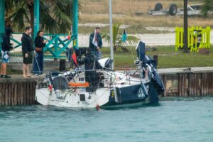
In the last Volvo Ocean Race, in 2014, the navigator aboard the entry Vestas Wind plotted the team’s course through the Indian Ocean via a small-scale digital chart. But his level of zoom (or scale) missed a pesky little detail concerning the Cargados Carajos Shoals. They were charging along at 16 knots when they crashed hard into the shoals. The after-race incident review concluded the fault lay with “deficient cartography in presenting the navigational dangers on small- and medium-scale (or zoomed-out) views on the electronic chart system in use.” Like I said.
A small-scale (large-area) paper chart gives you the big picture without the loss of detail, and serves not only as navigational redundancy but also as an efficient and consistent visual planning tool. Mark all dangers in red with a generous clearing circle, and enter their presence, in order of passing, as a list in the logbook. Once underway, check one off and identify the next as you progress.
As much as possible, program into your GPS your waypoints before setting sail, because the fatigue that sets in on even the easiest of passages almost ensures a mistake will be made. Break down your entries into small blocks, and double back to methodically check each. Then take a break, because after too many entries, your eyes will glaze over and you will inevitably transpose a number.
Never trust another person’s waypoint blindly. Do the work; own the responsibility. Collect charting, of both types, and references for areas adjacent to your planned landfalls. As Arthur C. Clarke said, “All human plans are subject to ruthless revisions by nature.”
If you use onboard weather services, such as GRIB files via SailMail, familiarize yourself with them prior to departure. Remember, the GRIB files are computer-generated wind models and not informed by human interpretation; in other words, they can miss the big picture. Practice downloading weatherfaxes, as a real-time isobar picture of your larger cruising area is the single most important routing tool on board. There is a mountain of information available, but it can be hidden in a complex menu. Keep a printed channel guide near the radio.
An array of SSB and ham radio nets offer weather reports and routing advice. All are well intended, but not all offer the same level of expertise, nor can the hosts and their frequent relief stand-ins know your particular circumstances with regard to the vessel and crew’s capability. By all means, check in if you feel more secure posting a “last known position, course and speed.” But no matter how forceful the anchor’s recommendations, they are just that: recommendations.
There are three important words regarding when to set sail: early, early and early. By that I mean, first, early in the season, because delays will inevitably add up across a wide ocean, and many cruisers are rushed out of the tropics toward the end of the safe seasons. Next, be early in the immediate weather system; don’t linger for days at the dock while good weather prevails. In fact, many an old salt will intentionally depart on the tail end of bad weather to maximize the initial favorable period. Finally, go early in the day; if all goes well, you will be well offshore by nightfall, free of most hazards and coastal shipping. If it doesn’t go well, as too often happens without a proper shakedown cruise, you will have plenty of daylight to sort out the problem or return to port before dark.
I also always adhere to my rule of thirds and halves. I divide my food, water and fuel supplies into three portions. I designate the first third to the first half of the voyage (mileagewise), the second third to the second half, and the final third as a contingency supply. The little bit of discipline involved in the early phases of the voyage pays off in dividends of safety, relaxation and enjoyment toward the end of the trip.
Finally, remember that the actual time we spend on passage is but a fraction of our entire cruising experience. In-depth planning leads to a safer and more efficient passage, and there is great satisfaction in that job well done. But it also helps us develop a deeper appreciation for the magnificent oceans we are so privileged to enter.
Two-time circumnavigator Alvah Simon is a CW contributing editor.