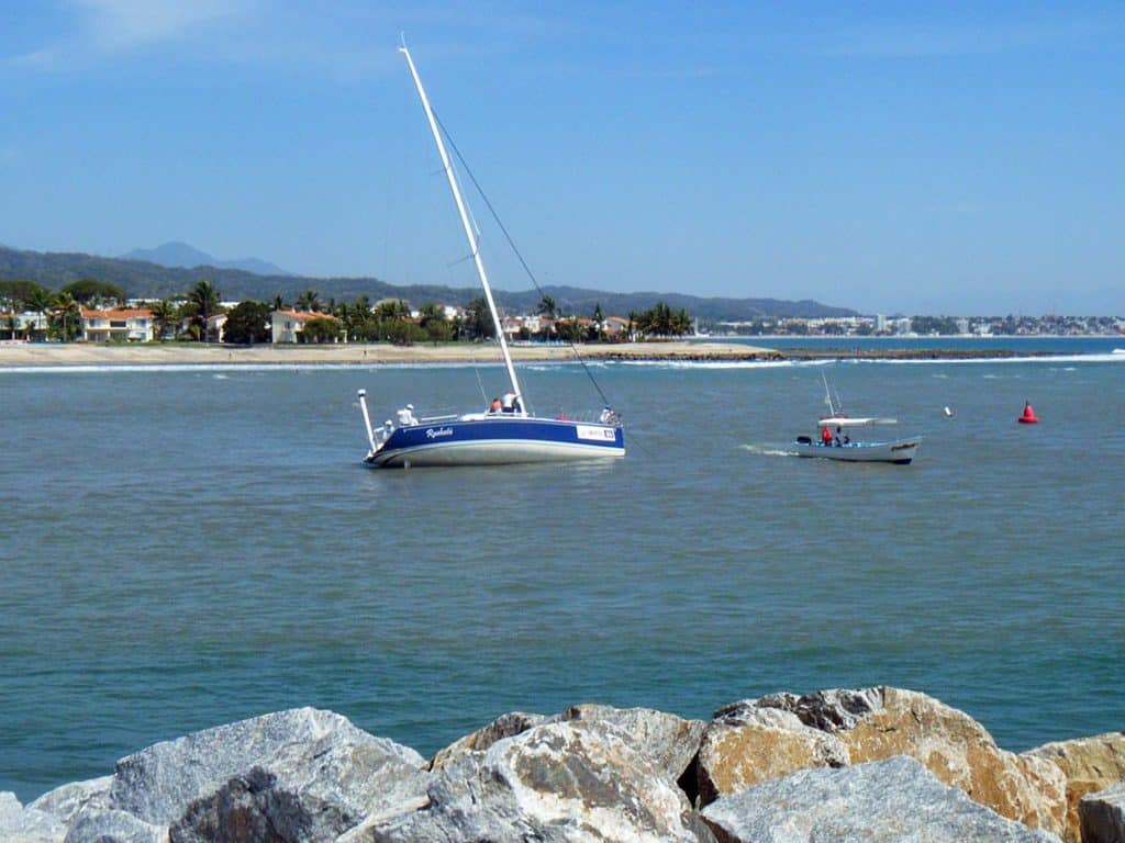
It figures that a hurricane’s projected track aimed right at our Stevens 47, Totem, while we were an ocean away from it, having traveled by jet from Mexico to Europe and South Africa. That was Hurricane Kay, in early September. Last week brought Hurricane Ian, which we watched approach Florida, glued to updates, fearing for the boats and livelihoods of friends along Florida’s west coast.
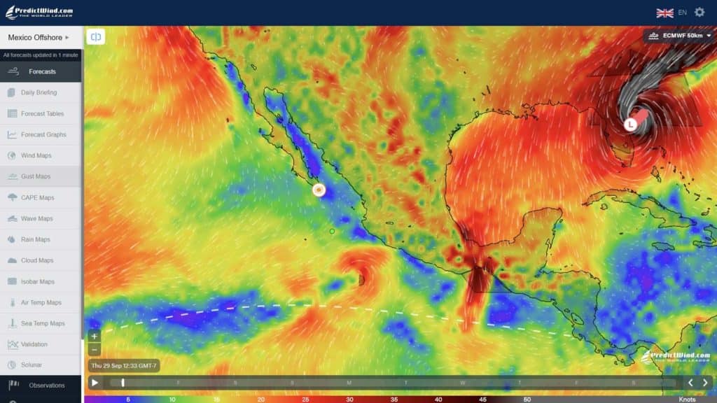
Actively tracking weather is one of the most consistent features of life on a cruising boat. You don’t just feel the elements more directly; your immediate security is weather-driven. Looking at GRIBs through PredictWind remains our mainstay weather tool. And, we love the new GMDSS addition: graphical display of GMDSS text forecast details (lows, highs, tropical depressions, fronts) over a GRIB. Anyone in my husband Jamie’s classes at Cruisers University in Annapolis from October 10-16 will see a bunch of these.
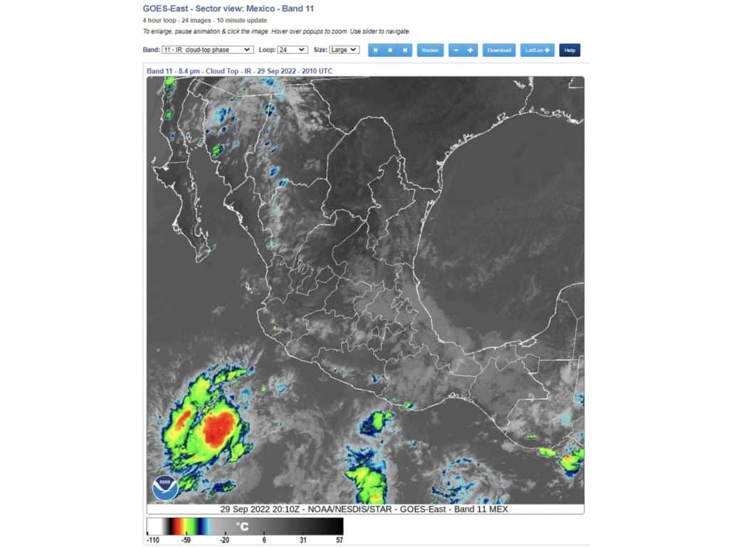
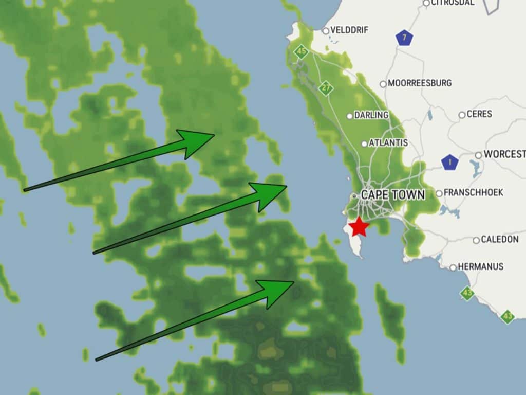
Other specialty tools provide input to keep informed and make decisions about our everyday comfort and safety. Writing recently about chubascos, a weather phenomenon in the Sea of Cortez, we focused on how valuable the GOES band 11 viewer is for anticipating these weather bombs. Here are other tools that may be less commonly tapped, but helpful for those of us living at weather level.
Weather Radar
Radar is an excellent tool when it’s available. Radar on a boat is a fine way to get squall size, location and tracking to mitigate the conditions (Squall tracking, more than avoiding hazards at the night or in fog, is the #1 use of Totem’s radar, in fact). Weather service radar, accessed via the internet, offers a dynamic wider-region view. This requires internet bandwidth.
A weather radar source with a time loop helps visualize movement and the squall or front’s increasing or decreasing footprint, to preemptively adjust course and or speed. You may not be able to bypass the weather, but even reducing the duration of your exposure to volatile weather is useful.
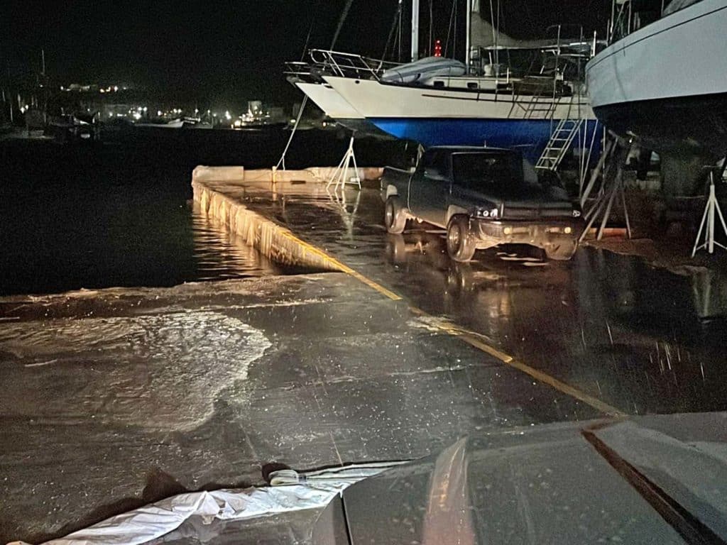
On our last days in South Africa, we actually had more wind than Puerto Peñascohad, Mexico, from Hurricane Kay’s attempted swipe—this front line brought 50-plus knots. It was wild to watch (from inside a cozy beach house), but for locals, was “just another Sunday.”
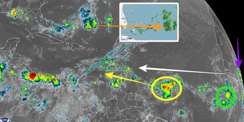
Real-Time Lighting
Real-Time lighting strike maps show where the sky is more or less electric. Like radar, this tool provides a visual for a storm’s size, intensity and track. For folks on boats, the devastating power of lightning can be even more daunting than wind and rain.
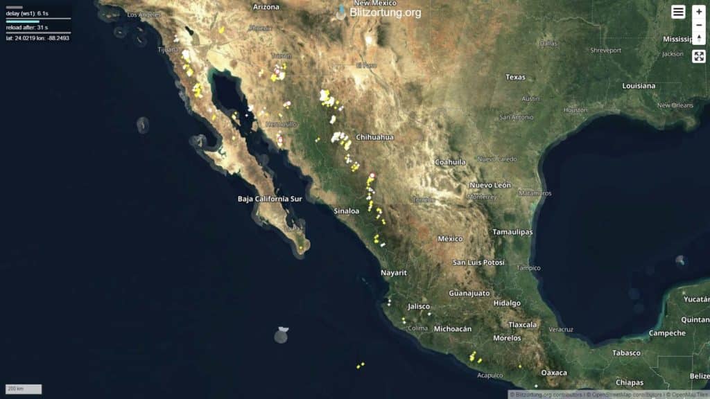
We like the display on the website Blitzortung for this, and there are a range of real-time lightning map mobile apps as well.
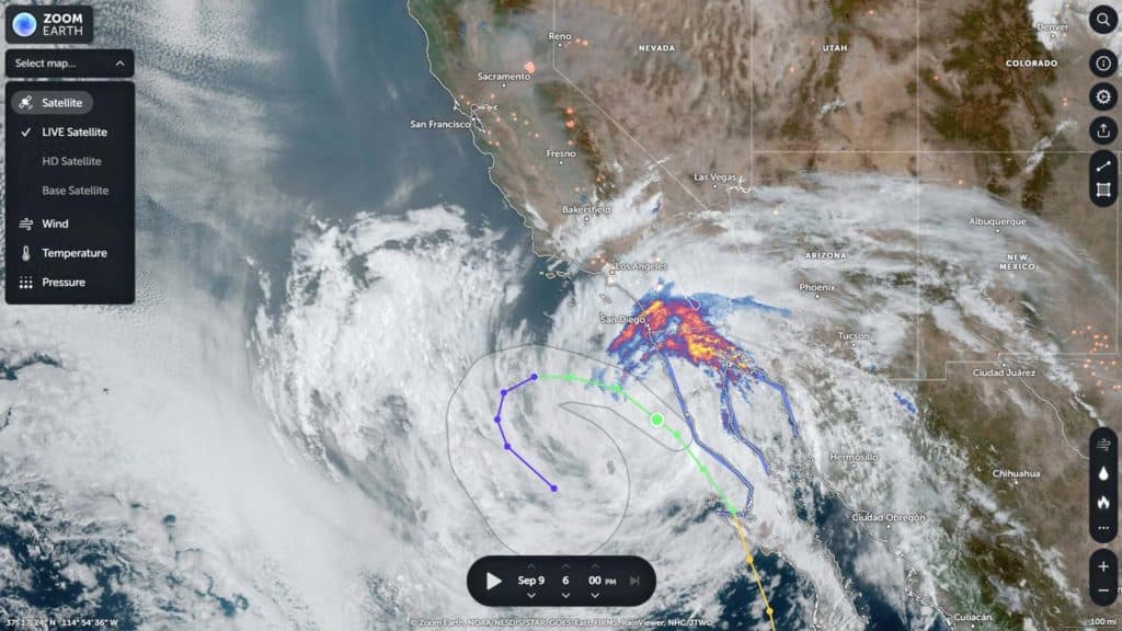
Satellite Imagery
Another satellite imagery resource is Zoom.earth. It’s instructive, but not targeted. Still, for sharing satellite-informed views of your location without freaking out your kids or in-laws, try giving them this view. The red areas show heat detected by satellites. This tool influenced our driving route to avoid hot-season wildfires.
Surge Estimators
Hurricane Kay ended up tracking outside of Baja, California, a much lower risk to Totem than it might have been if it tracked up the Sea of Cortez. But it was late when we considered that, even though the system was relatively distant, there might be a surge effect near our boat’s location. And, as Murphy’s Law would dictate, of course it would coincide with peak tidal swings in an area notorious for extremes (22 feet isn’t unusual). We watched CERA, a collaboration between the National Oceanic and Atmospheric Administration and Louisiana State University, for modeling surge. It indicated that water might not just rise above the level of the slipway, but also spill further into the yard. Not so good for boats in sand or gravel, and not good news for things on the ground. Like our new-in-the-box engine.
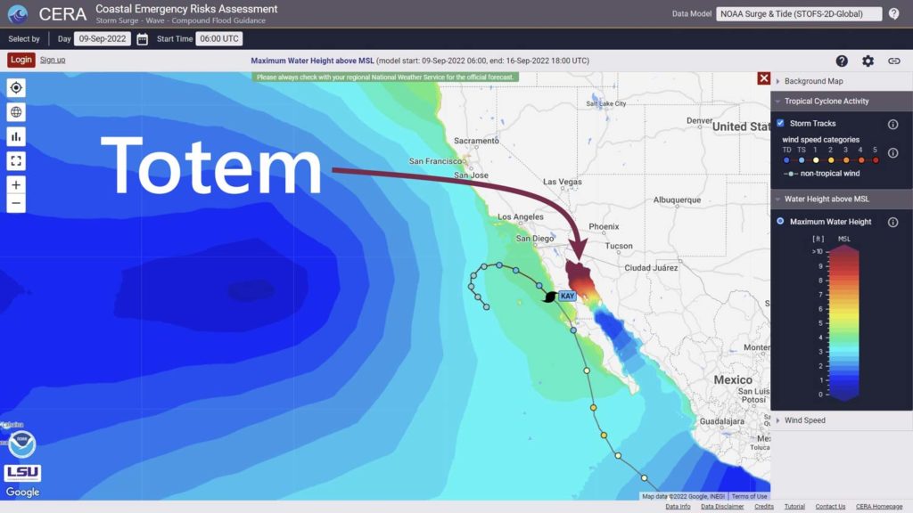
Water level exceeding the slipway would have been a first at the boatyard. (We still, by the way, feel this is the best possible option for hurricane season on the Pacific side of Mexico.) From South Africa, we watched and waited for updates.
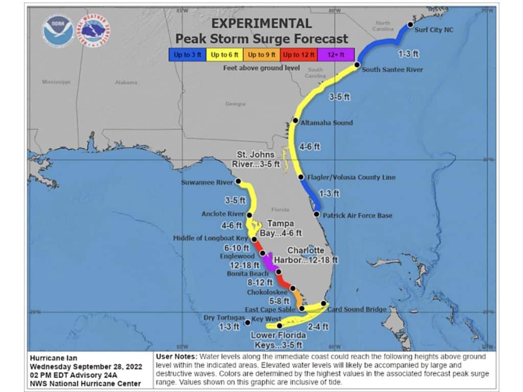
And recently, we watched as the surge forecast from Hurricane Ian developed for Florida—especially Southwest Florida, where folks we care about in Punta Gorda have their catamaran. It was tough to see the surge increase and consider the havoc it caused. NOAA’s estimate was 12 to 18 feet. There’s not much good that comes from an 18-foot surge (or even “just” 12 feet) when you’re tied to a fixed dock.
Wave And Swell
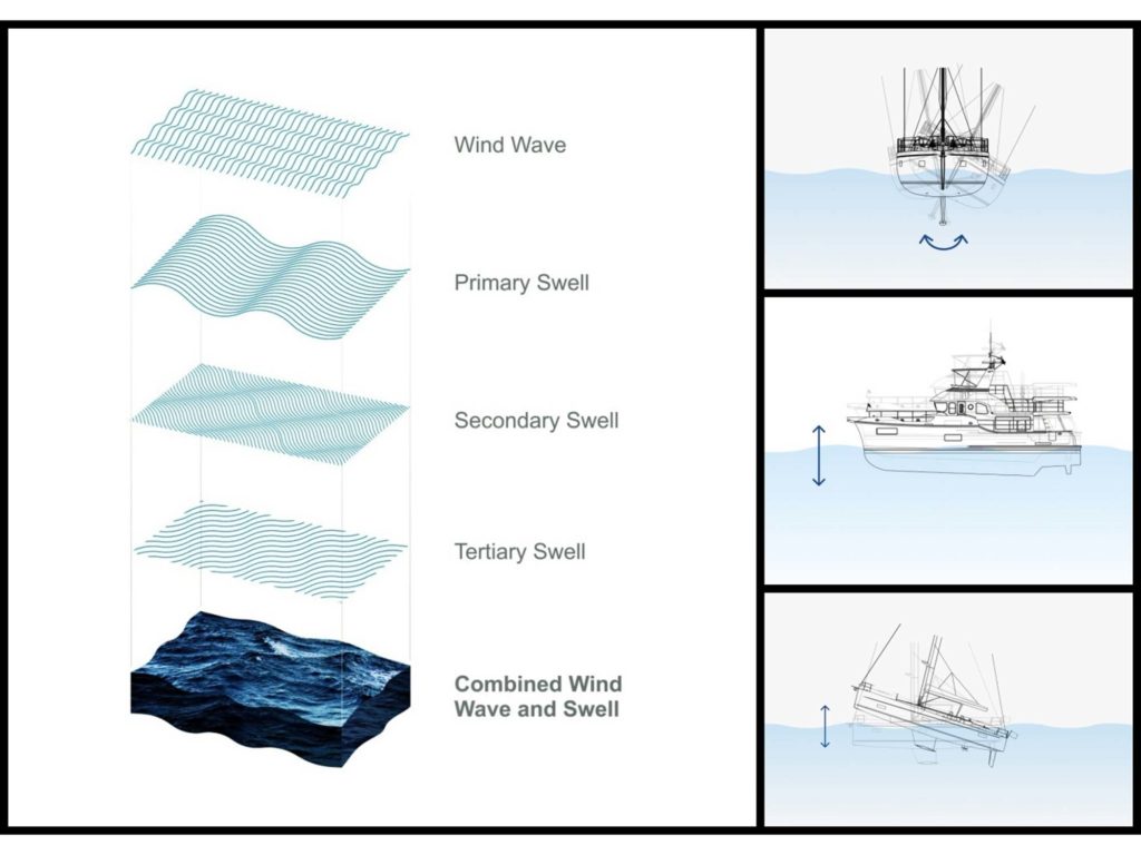
Boaters tend to focus on the wind forecast, the sea state tends to be a much bigger influence for real feel on a boat. And yet, wave and swell forecasts have long been the least accurate reflection of real feel in the weather toolkit. GRIB Wave forecasts only display one wave forecast at a time. Secondary or tertiary waves and swell, such as a swell from a far-off gale, can really increase the motion of the ocean. The information is often available, but clunky to view and interpret. PredictWind has a new tool set that uses all wave and swell data, and then models roll, pitching and slamming based on specific dimensions of a given boat. Its new Automatic Wave Routing feature is a big step toward interpreting a real-feel to make go or no-go decisions.
If we’re near a surfing region, we also sometimes use surfer websites such as Magic Seaweed to understand the magnitude of local swells. Farther offshore, there might be a weather buoy near a planned route. Looking at real-time data, such as NOAA’s National Data Buoy Center site, can help determine the accuracy of forecast information.
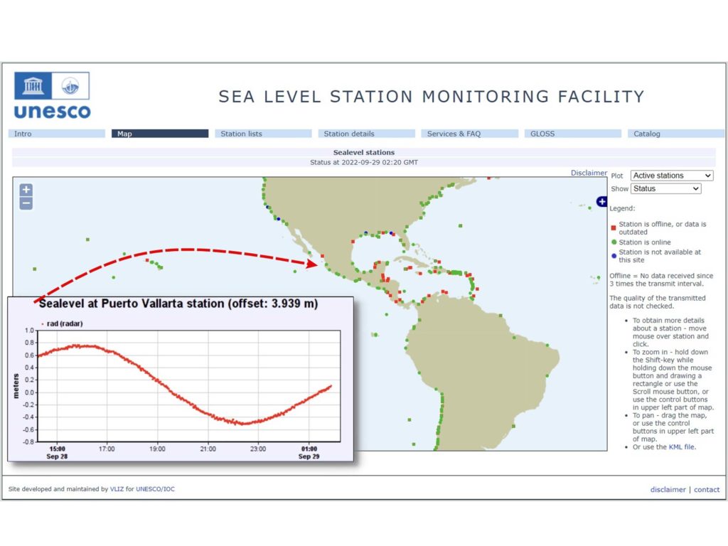
Tsunami Danger
This isn’t something we really thought about a lot before cruising, but we’ve ended up needing to track tsunamis a few times when we were potentially in risk zones. It’s no joke, and we know enough people who have had truly dangerous tsunami events while cruising.
While our first tsunami was a nonevent, the second warranted more attention: We watched as the depth changed 6 feet up then 6 feet down in 15-minute intervals. One boat missed a swing and ran aground in a channel.
What are your tools for this? A U.S. Geological Survey website details earthquakes worldwide, and a global scattering of tsunami monitoring stations are on this UNESCO-funded site.
The 2022 hurricane season finally did get spicy, as promised. While Hurricane Ian left a trail of heartbreak in Florida, we received news that our friends’ boat in Punta Gorda came through nearly unscathed. So many others did not. Neighboring boats were found sunk, or on top of the dock, or in the adjacent yard. And now, on the Pacific side, we watch Orlene. The tropical depression is expected to become a hurricane, and is tracking toward Mazatlan and the Sea of Cortez, where we lie at the northern tip.