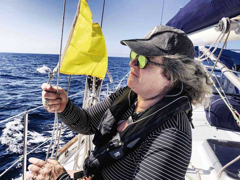
Our 1988 Passport 40, Billy Pilgrim, sailed south from Maine to Florida in fall 2021, then across to the Bahamas in what felt like a larger-than-usual migration of sailing snowbirds. In Florida, our population divided in two: those who would cross the Gulf Stream to the islands beyond, and those who wouldn’t.
The Gulf Stream stands as a threshold—by no means impassable, but daunting just the same. Flowing north through the Florida Straits as swiftly as 4 knots, it brings its own set of problems.
Setting Up to Cross Over
The Gulf Stream challenges come in three parts: departure and entry ports, weather forecasting, and old-school vector piloting. Here, we’ll focus on crossings from Florida to the Bahamas and back.
Coastal sailors quickly learn that the number of safe all-weather inlets from the ocean to inland waters is quite limited, especially south of Hatteras. In Florida, there are only seven: St. Marys (Florida-Georgia border), St. Johns River (Jacksonville), Port Canaveral, Fort Pierce, Lake Worth (West Palm Beach), Port Everglades (Fort Lauderdale), and Government Cut (Miami). Several other inlets can be transited in settled weather and good light, or with local knowledge. The print and online versions of the Waterway Guide (waterwayguide.com) are the gold standard for timely information about US coastal piloting, including inlets.
Across the Gulf Stream in the Bahamas, the number of official ports of entry is also limited. The closest of these include West End and Freeport on Grand Bahama Island, or Bimini at the western edge of the Great Bahama Bank. Of course, it’s possible to fly the quarantine flag, stay aboard the boat, and continue sailing deeper into Bahamian waters, and then clear customs in the Berry Islands, the Abaco islands or Nassau. The same principles for crossing the Gulf Stream apply.
Assuming your boat travels at 8 knots or slower, you’ll want to leave from a US port that’s south of your chosen Bahamian port of entry. Look at the coordinates of each waypoint, particularly the latitude, recalling that 1 minute of latitude equals 1 nautical mile, and 1 degree of latitude equals 60 miles. (Degrees and minutes of longitude do not correlate with distance.)
Watching the Weather
Timing for the crossing to the islands is dictated broadly by the seasons, and particularly by insurance mandates. Many yacht policies stipulate that cruising boats must stay north of some predetermined latitude (typically, the Florida-Georgia line, but sometimes as far north as Cape Hatteras) until the end of hurricane season. Some policies set that date at November 1, some at November 30.
Regarding weather, crossing the Gulf Stream in December and January means two things: prevailing fresh to strong easterlies (northeast to southeast quadrant, typically 15 to 25 knots, sometimes higher) and occasional dramatic northers. Northers are weather fronts that blow from the north and, in winter, often arrive dramatically. In the day or two before a norther, your wind will typically veer through the southeast, south, west and northwest. The front itself usually comes with a black squall, a drenching downpour and a cold blast of high wind. On the backside of the front, the northerly winds can blow strong for several days. Veteran cruisers on both sides of the Gulf Stream learn to watch for northers and seek good shelter when they come.
For the Gulf Stream crossing itself, you want neither of those two conditions: not the prevailing fresh easterlies, which would mean beating directly into the wind and waves, and not the northers, which can mean monstrous seas when the north wind meets the north-flowing current.
The moment you want is the fleeting transition between them: the moment the wind begins to veer. You want to catch it as the wind is coming from the south, blowing in the same direction as the ocean current. In winter months, this condition seldom lasts longer than a day. You have to be ready when it comes.
Tools for onboard weather forecasting have improved immeasurably in the past several years. You can still get the old standby: VHF and SSB radio broadcasts of the latest observations and forecasts from the National Weather Service and the National Oceanic and Atmospheric Administration. What’s improved in recent years is our access to multiple forecasting models.
Global Forecast System, European Centre for Medium-Range Weather Forecasts, Spire, and the UK’s Meteorological Office—all these independent weather models are now accessible through such online graphic interfaces as windy.com or PredictWind, and others. Best practice is to watch the 10-day forecasts and cycle through the different models to see the variances among predictions. If you watch multiple models every day for several weeks before your crossing, you’ll learn the typical weather patterns for your season. You can also join a subscription weather-routing service like those offered by Commanders’ Weather or Chris Parker.
For off-grid cruising, from what we’ve seen, the two most price-worthy options for continuous offshore weather forecasting are Garmin’s inReach and the Iridium Go! satellite communication systems. Our Iridium Go! cost about $700. While we’re in the Bahamas, we choose an unlimited subscription service for $150 per month (including international voice calls, texts and graphic weather downloads). We’ll cancel it when we’re back in the States. PredictWind developed a weather app called Offshore that works seamlessly with Iridium Go!
Plotting a Sine-Wave Track
If your goal is to spend time in the northern Bahamas (Grand Bahama or Abacos), then you might plan to clear customs at West End or Freeport. If you’re aiming for destinations farther south (Nassau, Exumas or Lesser Antilles), then Bimini probably makes the most sense.
The final Gulf Stream-crossing problem comes here. From Maine to Florida, nearly every leg of our passage followed the same procedure. We’d enter a waypoint in our chart plotter, zoom in to check the whole leg for hazards, and then steer to that waypoint. One of our watch-keeping tasks was to continually ensure that our course over ground matched our chart plotter’s recommended course to steer. From Maine to Florida, offshore and inland, the chart plotter and this method never led us astray.
When crossing the Gulf Stream, your chart plotter will lead you astray. The slower your boat, the more you’ll stray. The best tools for this crossing are the old-school ones: paper charts, parallel rulers, dividers and a pencil. Let’s say you’re under sail and making 5 knots. Your boat’s heading might be 100 degrees true, but when you enter the north-flowing current (2 knots, 2.5 knots, 3 knots or 3.5 knots of current as you approach the Gulf Stream axis), the chart plotter will show a COG altering ever northward, 50 degrees and more from your heading. As the velocity of the Gulf Stream current increases, if you try to resolve the COG on your chart plotter with its recommended CTS, you’ll find yourself turning ever more southerly and directly into the current—making precious little easting.
Cape Florida to Gun Cay
Rhumb Line: 45 nm at 103m/096t; Average current 2.5 kt at 017m/010t
| Boatspeed Knots |
Duration Hours |
Distance Offset NM |
CTS Meg. Deg. |
CTS True Deg. |
|---|---|---|---|---|
| 4.0 | 11.25 | 28.1 | 136M | 129T |
| 4.5 | 10.00 | 25.0 | 132M | 125T |
| 5.0 | 9.00 | 22.5 | 130M | 123T |
| 5.5 | 8.18 | 20.5 | 129M | 122T |
| 6.0 | 7.50 | 18.8 | 127M | 120T |
| 6.5 | 6.92 | 17.3 | 125M | 118T |
| 7.0 | 6.43 | 16.1 | 124M | 117T |
| 7.5 | 6.00 | 15.0 | 122M | 115T |
| 8.0 | 5.63 | 14.1 | 121M | 114T |
The solution is to recognize this problem in advance, apply an average current velocity for the entire crossing, and plot a course that minimizes the treadmill effect. Your heading will remain constant, but the resulting track across the Gulf Stream will look like a sine wave. Most observers reckon that the average velocity of the Gulf Stream through the Florida Straits is 2.5 knots.
Billy Pilgrim typically sails at 6 knots on a nice reach. In flat water, we’ll sometimes crack 7-and-change; pitching through choppy waves will sometimes knock down our speed into the 4s. To plot our course, I started with the rhumb line from Cape Florida on the mainland to Gun Cay, about 10 miles south of Bimini. (You could do the same from the Government Cut sea buoy to Bimini, or from Lake Worth Inlet to West End on Grand Bahama Island. Ideally, choose a departure point that’s south of your arrival point.) Our rhumb line came to 42 nautical miles at 103M/096T. The Waterway Guides and US chart books tend to communicate in degrees magnetic, and the Explorer Charts communicate in degrees true, so I jot down both to keep my head straight.
For our crossing, I created a table whose left-hand column lists boatspeeds ranging from 4.0 knots to 8.0 knots in increments of 0.5 knots (see the chart on this page).
The second column shows the duration of time we’d be exposed to that current (45 nm divided by each of the speeds in Column 1). Making 4.0 knots, we’d be exposed to the 2.5-knot current for 11.25 hours; making 5.0 knots, for 9.0 hours; making 6.0 knots, for 7.5 hours.
In the third column, I computed the northerly distance we’d be offset by the current. At a boatspeed of 4.0 knots, we’d be exposed to the 2.5-knot north-setting current for 11.25 hours; that means if we steered the rhumb-line course, we’d be set 28.1 nm north of our Bahamas waypoint. Making 5.0 knots, we’d be set 22.5 nm north; making 6.0 knots, we’d be set 18.8 nm north.
The final sequence of the solution is to use old-school, pencil-and-paper plotting techniques to find the course to steer. Using Gulf Stream data, I determined that the average direction of current drift for our crossing was 017M/010T between Miami and the Bimini islands. To counteract the current, find the reciprocal course by adding 180 degrees: 197M/190T. On a paper chart, I aligned parallel rulers through 190T on the compass rose, and then walked the rulers through our Gun Cay waypoint. In pencil, I drew that line through the waypoint and extending in a southerly direction.
Next, I used dividers to measure the offset distances from Column 3 in my table. If we made 4.0 knots of boatspeed, then I needed to offset 28.1 nm; making 5.0 knots, 22.5 nm; making 6.0 knots, 18.8 nm. On the 190T line, I made tick marks for each of these distances from our Gun Cay waypoint, noting the boatspeed associated with each offset distance.
The final step was to get the parallel rulers back out and draw lines from our point of departure in Miami to each of the tick marks. On each line, I wrote our projected boatspeed and the CTS for that boatspeed. Making 4.0 knots, our CTS was 136M/129T; making 5.0 knots, 130M/123T; making 6.0 knots, 127M/122T.
Working it out this way in advance becomes especially helpful once you’re out there actually crossing the Gulf Stream. If you find that your boatspeed increases or decreases in real time, you’ve already prepared yourself to make rational course adjustments.
As it happened, our 10-day forecast presented no good day of southerlies when we were ready to leave Miami in early February, so we chose a day of light easterlies and motorsailed across. We turned on our chart plotter but didn’t enter a Bahamas waypoint into it. Instead, we steered to the CTS we’d worked out in pencil ahead of time.
At first, we found ourselves sailing south of our rhumb line. As the velocity of the Gulf Stream current increased, even knowing what we knew, we were still alarmed to watch the northerly component in our COG as the minutes of latitude for our position increased well above those of our waypoint. But we held to plan. As we approached the Great Bahama Bank, the Gulf Stream velocity decreased. In the last 10 miles, we adjusted our course in small increments and saw the Gun Cay Light just where we expected. We had left the Cape Florida sea buoy at 7:30 a.m., shortly after sunrise, spent a lovely day in that impossibly deep blue, and landed at our Gun Cay waypoint by 3:30 the same afternoon, with good light to pilot visually on the banks. We had sailed a steady course, with only minor alterations for traffic. But sure enough, our GPS track shows a sine wave across the Florida Straits.
Tim Murphy is a Cruising World editor-at-large and a longtime Boat of the Year judge. He and Lesley Davison cruise their 1988 Passport 40, Billy Pilgrim (svbillypilgrim.com), between New England and the Bahamas.


