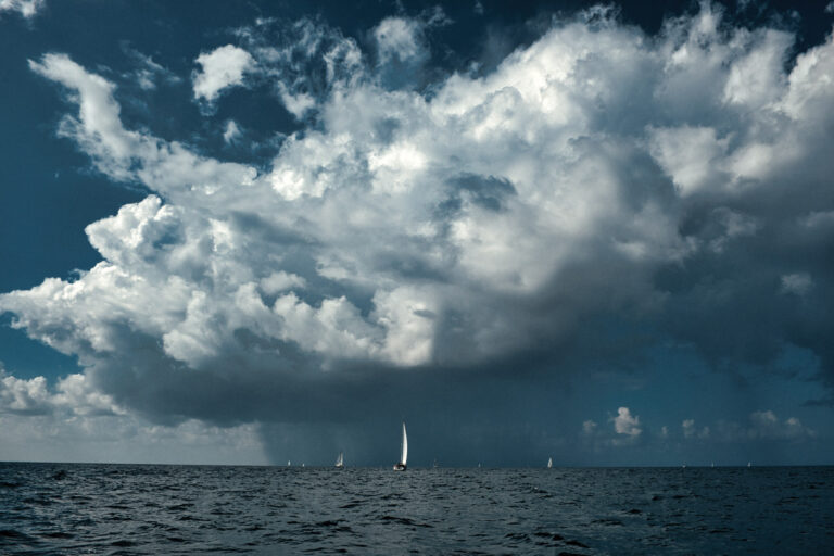
Several years ago, my family and I chartered a catamaran in St. Lucia with a plan to cruise north. Remnant Christmas winds made for a bouncy passage to Martinique’s Fort-de-France Bay, and a passing squall near Diamond Rock made it hard to spot the aids to navigation we were looking for.
Fortunately, my wife grabbed the pair of Steiner binoculars she’d brought along and quickly located the buoys. All ended well, but this story illustrates that even on a well-equipped charter boat, it’s wise to pack some essentials. While big eyes and a handheld VHF radio are obvious choices, here’s a look at some stand-alone devices and apps that I wouldn’t mind having in my sea bag the next time we head out for a sailing vacation.
Let’s Communicate
Wireless devices, including smartphones and tablets, are indispensable when you’re chartering, as they allow you to navigate using familiar hardware and software. Before you go, load up on boating-specific apps that harness your device’s cellular modem and its embedded GPS, accelerometer and location services to establish a self-contained navigation system. In addition, most contemporary multifunction displays come with built-in Wi-Fi, allowing you to pair your chart plotter with your devices so they can leverage information from the boat’s other systems or serve as a portable second display. Just make sure to pack a waterproof case and the right data plan!
If your travels are taking you well off the beaten track to charter destinations that lack widespread cellular service, you can still stay connected by investing ahead of time in a satellite hotspot and service plan. Hotspots such as Inmarsat’s IsatHub, Iridium’s Go! and Globalstar’s Sat-Fi are examples of portable satellite terminals that connect to their respective satellite networks and then create local “Sat-Fi” hotspots. Once online, you can pair multiple smartphones, tablets and laptop computers to a single terminal and make high-quality voice calls and send and receive data — including texts and emails — from pretty much anywhere. (You’ll want to check the various carriers’ websites for exact details, including coverage maps, prices and data speeds.)
In all likelihood, your bareboat sailboat will have a fixed-mount VHF radio, but tossing a handheld radio into your bag is well worth the small space it will take up. Underway, you can have it by your side should a quick call to a harbormaster or other boat become necessary, and it’s a handy way to stay in touch with the mothership when you or your crew go off in the dinghy. Plenty of options abound, including Standard Horizon’s DSC-enabled HX870, which offers up to 6 watts of transmitting power and an internal 66-channel GPS receiver. The HX870 is submersible and positively buoyant. An oversize dot-matrix LCD display and an easy-to-use interface help simplify operations, and the unit’s lithium-ion battery should provide plenty of (rechargeable) juice. Additionally, the HX870 can display position information, which comes in handy if using paper charts. A dedicated man-overboard button and built-in digital selective calling functionality are bonus safety features. West Marine offers a similarly equipped handheld radio, the VHF460, for about the same price.
Plan and Play
While there are myriad sailing apps available for Apple, Android and other mobile devices, here are five apps that should fall into most sailors’ “must-tap” category.
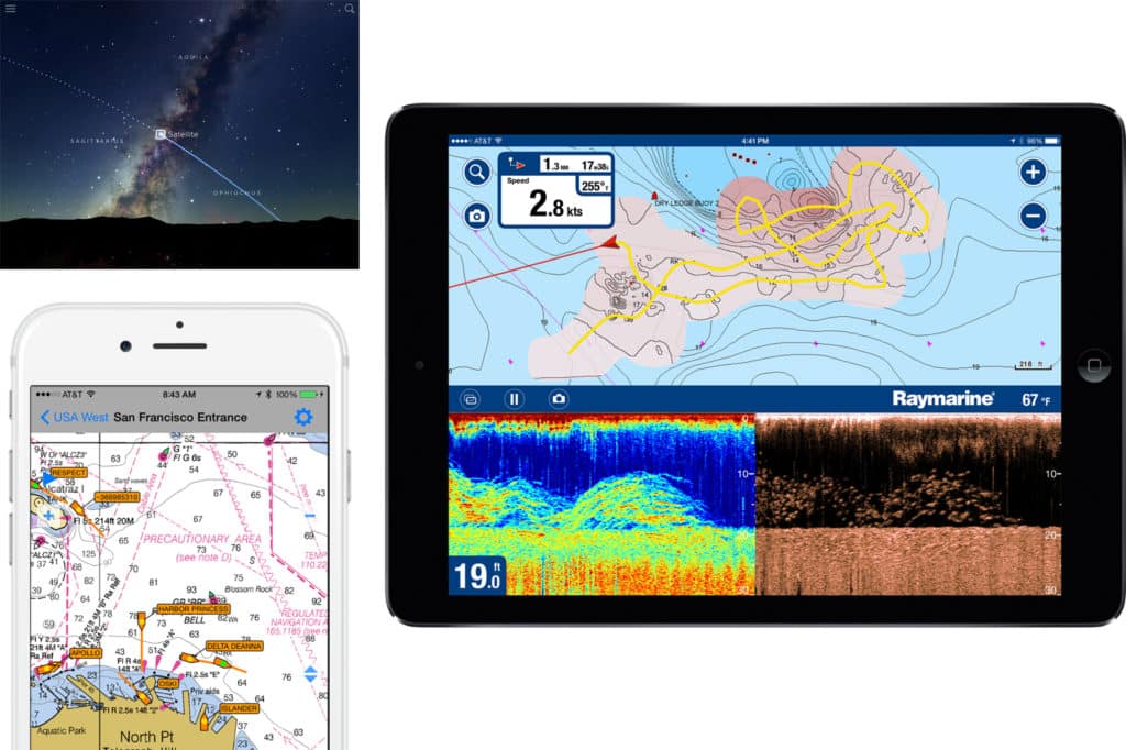
If you use Apple products, iNavX is well worth your time. This feature-rich app comes loaded with high-resolution NOAA raster navigational charts for U.S. waters and offers access to thousands of third-party charts covering seemingly every corner of the globe, from vendors including Navionics’ Fish ’N Chips, HotMaps and Solteknik, as well as official Canadian Hydrographic Service cartography via the NavX store. Navigating is intuitive, and users can create and modify routes and waypoints (or measure distances between waypoints), rotate the chart (either north-up or route-up), and export waypoint and route data. You can also print charts before leaving home. Additionally, iNavX can record tracks and features an anchor alarm, integrated real-time weather, and the ability to act as a repeater for MacENC, Momentum Lab’s Mac-based navigation software.
C-Map by Jeppesen’s Plan2Nav app plays nicely with Apple and Android devices and provides worldwide cartography coverage. Plan2Nav allows users to easily create and edit waypoints and routes, record their GPS tracks, and view data including speed over ground, course over ground, and estimated arrival time at the next beach bar. While Plan2Nav comes with worldwide background charts, in-app purchases allow users to upgrade to C-Map’s full cartography, which unlocks other features, including the app’s global weather forecasts. Choose the type of weather information you want (e.g., wind, wave, humidity or temperature data) and tap the download button, and — provided that Internet access exists — the app will selectively retrieve only the desired data, keeping download size and data charges to a minimum. Weather information is overlaid atop cartography, and users can watch animated forecasts. Additionally, users who upgrade to C-Map’s paid cartography can access C-Map’s Port Database as well as high-resolution aerial photographs.
Navionics revolutionized navigation in 1984 when it introduced the first electronic chart and the first chart plotter, and today the Navionics Boating app has become one of the best-loved cartography apps afloat. Full disclosure: Navionics Boating has long been my go-to navigation app, and one that I’ve used on numerous sailing trips to far-flung venues. Basic features include real-time tide and current information, speed data, and tracks, as well as the ability to share your position and route information via social media. While a free version of this app is available, users who subscribe to Navionics+ enjoy an enhanced cartography library that includes Nautical Charts, Sonar Charts and Community Edits, as well as one year of updates, which are stored locally on your device. Navionics Boating is available for multiple geographic regions, including the U.S., Caribbean and South America, and for Apple and Android devices. In-app purchases allow you to unlock the app’s full potential.
If you’re familiar with Furuno’s TZtouch or TZtouch2 multifunction displays, you’ll feel comfortable using Nobeltec’s TimeZero, a coastal-cruising app that shares some of the same chart-plotting functions as Furuno’s top-shelf electronics — not surprising, given that Furuno is a part owner of Signet, Nobeltec’s parent company. While TimeZero is only available to iPad users, it’s free, but users must buy MapMedia’s raster charts (about $50). Once the cartography is installed, users can intuitively navigate from waypoint to waypoint using the app’s Go-To tool; additionally, users can plan routes that are complete with tide- and satellite-imagery overlays and weather updates, which the app downloads via an iPad’s cellular connection. Users can quickly jump from 2-D to 3-D chart viewing, and the app’s customizable NavData allows you to clearly display germane navigational data on the chart-plotter page.
While chartering presents great stargazing opportunities, this timeless pursuit is more rewarding if you know the local skies. Sky Guide users can seek out specific stars, or they can aim their iOS device skyward and let the app use the device’s location services to present high-resolution imagery and descriptions of the heavens above. Load this app before you leave home, and then, once you’re anchored somewhere in paradise, head up to the foredeck with a cold one in hand and enjoy the show.

David Schmidt is CW’s electronics editor.