I saw one time, at a museum in Virginia, a curious watch with only ten hours marked on the dial. It turned out to be a rare relic of a little-known attempt by French horologists to measure time in metric. It was hubris, perhaps, that made them think they could also cram time into their newly-invented system of measure: the French had, with varying degrees of success, managed to measure a couple of things in centimeters and kilograms, and were raring to convert the whole world to their way of thought.
There was one problem, though: while arbitrary values like length and weight can be measured by means of any standardized unit, the passage of time has to be measured with a system compatible to the rotation of the earth—in short, the measure of a circle cannot, to this day, be sensibly forced into a framework limited to tens and hundreds and thousandths.
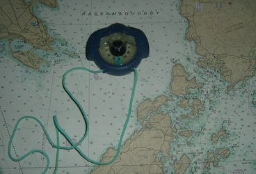
There have been several other notable things which have proved un-adaptable to Metric—marine and air navigation proved impossible with it, and are still conducted in Nautical miles. The incredibly lame UTM grid with which the Metric System seeks to replace Latitude and Longitude only works at the Equator—everywhere else there is too much distortion to conduct any sort of cartography using it.
If only the earth were a cylinder it would work splendidly. It has been the spherical nature of the earth, in fact, that has been the downfall of the Metric system since they day it was thought up. Originally the Meter was supposed to be one-forty-thousandth (a number not evenly divisible into 100, by the way, destroying the entire purpose of it from the start) of the distance from the Equator to the pole.
What the scientists tasked with cooking up an alternate system of measure forgot, or perhaps never knew (being as we have seen weak on spherical geometry), was that the earth is an oblate speroid—it is slightly flattened at the poles, therefore their base distance was not also a quarter of the way around the equator, like it was meant to be.
It took some time to discover this, since astronomy requires a working knowledge of spherical geometry (on which they were weak, remember), and by the time someone pointed that out, the newly-minted metersticks and ten-centimeter rulers were already in stores. What followed was not a return to the sensible system that had been and continues to be in use to this day—nor even a tuning up of it, or re-checking to make sure it measured up: no, instead their new standard length, the Meter, went through a series of definitions, each of which proved inadequate and was discarded until relatively recent times, when it was finally fixed as a distance requiring some serious scientific equipment and controlled laboratory conditions to figure out.
And perhaps that is the problem with the whole system: it purports to greater accuracy than Nature herself allows. So what if the old-fashioned yard is based on the length of a certain monarch’s arm? And so what if the distance around the equator isn’t exactly divisible by yards of that length?
One goes into marine navigation knowing that; knowing, moreover, that the Equator in his calculations is an average value, fluctuating with tides and oblique spots in the gravitational field. The navigator knows, also, that a day is not exactly 24 hours long, and instead of attempting to cram nature into a rigid scheme that might be simple if it worked, he adjusts and corrects and learns to live with and love the tiny variations that help to keep him on his toes. And given good conditions and decent instruments, an even mediocre navigator can get along quite well.
But here the specious cry: “So what if the Metric system is limited and based on unscientifical principles? The WHOLE WORLD is using it exept for us!” I might have believed that last statement once, but it turns out that the more foreign countries I visit, the more places I find still using gallons and fathoms and inches. The only country in Central America (and we’ve been to them all by now) that uses the Metric System almost exclusively is Costa Rica, and they’re the one least worth a visit.
Even so, your boat is measured in feet upon check-in and –out. Surprisingly, even in Quebec City, the heart of French Canada and almost more French than France itself, they asked me to translate my boat length from meters back to feet so they could assign a marina slip.
Of course, in the other portions of Canada we visited on our recent cruise, Newfoundland and Nova Scotia, the Metric System is a faraway notion that doesn’t enter into day-to-day life. I was scolded in Lunenburg for trying to buy shock cord in anything other than feet; a man in Newfoundland told me he needed “just a few more fathoms of fencing”. Firewood is measured in cords, fishing boats are measured in feet; fish hauls in pounds, codfishing depths told off in fathoms.
In fact, fathoms are so much alive in the business of navigating that old charts are far more in demand than the shiny new government issues with depths in meters. More than once we set a new-edition chart aside in favor of an older one, which wrinkled, rubbed and stained as it might have been, still had very accurate soundings where the metric charts had only a blocked-out area and a note “area not surveyed to modern standards.”
It seemed incomprehensible that people at the supposed cutting edge of science couldn’t pull off with fancy metric echo sounders what John Cabot and Captain Cook and Henry Hudson did, and very accurately at that, with lead weights on a string. Their unwillingness to print a sounding that might be a few centimeters shy of spot on has made them create a far greater hazard to navigation by not having any soundings at all, and we stood off from more than one bay we might have gone into if they’d left the old-fashioned soundings in place.
But not all their charts are metric, and all their tidal current calculations are done in knots, as well as the windspeeds in the marine forecast. They’re like a popular British sailing magazine I read from time to time, where they give boat lengths in feet, followed in parentheses by the length in metres.
Having been told they should convert, they give a nod to the metric system, but the measurements that matter are still done in standard. That’s as it should be, and I expect one day the meter and liter and kilo and UTM grid will end up where they belong, as curious museum displays alongside the failed metric watch.


