Englands first colonists to settle in North America, on Roanoke Island inside North Carolinas Outer Banks, had been lost for 414 years, and as an expat Brit, I felt it my bounden duty to go look for them. Last September, filled with a sense of mission, I borrowed a friends boat, the 30-foot steel centerboard sloop Elyse, and with Melissa, for whom this was to be a maiden cruise and a test of our forthcoming marital mettle, set off from Portsmouth, Virginia, bound for Albemarle Sound. Admittedly, a trail four centuries cold was a bit of a handicap, but so, as it turned out, would be the weather.
|
|
| |
|

|
| |
| Jeremy McGeary|
| |
|
|
| |
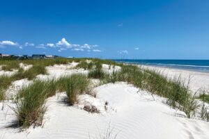
| Just days after Labor Day, Elyse has little company in Ocracoke’s Silver Lake. This tranquil spot gave few clues to the boisterous conditions we later found in Pamlico Sound.* * *|
| |
|
|
| This quest had begun 23 years earlier, in the spring of 1979, while delivering a boat north by way of the Atlantic Intracoastal Waterway (ICW). My crew and I stopped at Belhaven, North Carolina, at the southern end of the ICWs Alligator-Pungo Canal, for fuel and to partake of the nightly smorgasbord at River Forest Manor. After dinner, proprietor Axson Smith, picking up on my English accent, launched into a speech decrying Virginias claim to have hosted the first English colony in the Americas when it was, in fact, on North Carolinas Roanoke Island, in 1587, that the seed of modern America had first been sown. Inspired by Mr. Smiths passion, I vowed to return one day to the scene of a momentous event that escaped my–usually sleepy–attention in history class.
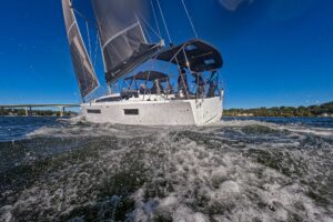
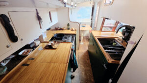
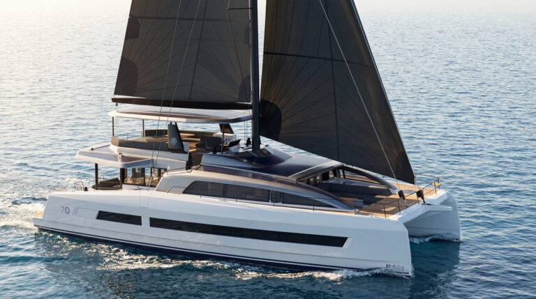
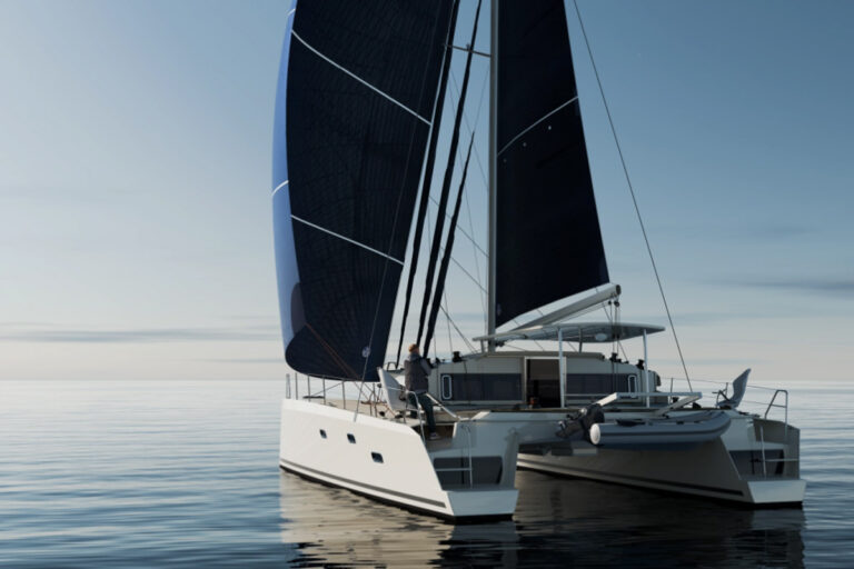
To undertake an expedition in shallow waters, it helps to have the appropriate vessel, and Elyse fit the bill. She draws less than three feet with the board up. Her 44-foot mast wouldve allowed passage either side of Roanoke Island, under either the old Route 64 bridge to the west (just) or the 65-foot Bodie Island bridge to the east. Shes beautifully fitted out below, if you can overlook the fact that, apart from a hand pump for galley water, she has no indoor plumbing, a detail I didnt reveal to Melissa until the project had gained irreversible momentum.
As for Elyses other onboard conveniences, her owner, boat professional Roxy Darling, says, “I do have a depth sounder that does everything really well except reporting the depth; that part seems to confound it somewhat, but the little light blinks merrily away. The leadline, however, is working really well at the moment.” In that regard, then, we were no better equipped than our predecessors, though I did take along a handheld GPS.
The Expedition Begins
We joined Elyse on the Friday evening of the Labor Day weekend, and it took most of Saturday to store and stow, but we had time to slip up the Elizabeth River to Great Bridge before the sun went down. Memories came rushing back at each bend in the river. Approaching Great Bridge Lock, we saw the torpedo boats still decaying on the river bank where they lay piled like logs. In my native England, they would’ve spent the last 40 years in mud berths, fitted out as houseboats.
On Sunday morning, we set off into the rain and–to the drone of the engine, occasionally drowned out by the rumble of thunder–threaded our way along the Intracoastal to Coinjock. The dinghy obediently followed at the end of its painter, which prompted Melissa to name it Finn, after her dog, whom we wish behaved that well on his leash. Once in Albemarle Sound–on the morning of our third day and 60 miles after leaving Portsmouth–we were faced with two possible approaches to Roanoke Island.
Normally, on entering the sound, the choice would be determined by wind direction. If out of the south or west, youd go east, via the sound, toward Roanoke; if in the east, youd head south to the Alligator River in the hope that the breeze would later go south or west, presenting a reach northward up Pamlico Sound to the island. However, wed made a primal passage-planning mistake and arranged to meet a third party in Manteo the following week. So, to occupy the intervening time, when we sailed into Albemarle Sound in a light southwesterly, we went south, not east.
We quickly gave up drifting to become a motorboat, thankful that 400 years of technological advance guaranteed that our steed would make it to an anchorage that evening. But this would have been a perfect day for colonists John White and Thomas Harriot to explore the shores of the sound at rowing speeds, taking soundings at leisure and making remarkably accurate measurements of the coastline. Little is known about the works and discoveries of the colonists who were lost, but many documents survive that record Whites and Harriots findings during the course of an earlier exploratory settlement in 1585 and 1586, when they made extensive probes into both Albemarle and Pamlico sounds.
Sounds, Bays, and Rivers
Melissa spent her first-ever night at anchor in that hauntingly desolate reach of the Alligator River opposite the entrance to the Alligator-Pungo Canal. We took advantage of Elyse’s modest draft to sneak far away from the other three sailboats anchored there. Save for their anchor lights and the channel beacons, no lights were to be seen, and the only hint of human habitation was the baying of hounds (what beast was aprowl in the cypress swamps?) somewhere far beyond where the trees reflected in the water’s edge. Melissa was awed–and a little unnerved–to find herself in such a remote and dark place.
We arrived the next evening in the relative civilization of Belhaven, after a day spent gasping at the exotic natural sculptures of tree and root that line the canal. Yellow butterflies to-and-frod across the water, a flock of crows followed us with seeming sinister intent, and a deer, wet from crossing the canal, cowered on the shore as we slid by.
Upon my return to River Forest Marina, I remarked to Axson Smith Jr. (“Father left us in 1979,” he said) on the number of homes that had been raised onto higher foundations. Apparently, the effects of five hurricanes in three years had exasperated the Federal Emergency Management Authority to the point that it paid most of the cost of elevating the houses above the flood level. Axson, too, was hurricane shy, having had to rebuild his docks several times.
After exploring the town in one of the manors golf carts, we returned to Elyse, and a southwesterly breeze gave us a glorious sail to Deep Bay–all of eight feet deep–in the Swan Quarter National Wildlife Refuge. The elevation of the land surrounding Deep Bay is two feet, and it only looks higher because of the marsh grass, as tall as a great egret, that covers it.
The fishing town of Swan Quarter lay a couple of miles to our east, hidden behind the marsh grass and scrub pine. Otherwise, we were probably as far from civilization as you can get on the Eastern Seaboard. The landscape lacked features from which we could take bearings, so we took them from the lights on distant radio towers to check on our position. Lightning flickered to our west and over the Gulf Stream far out to sea to our east.
By counting rivers on todays map, and counting rivers on the John White-Thomas Harriot map of 1586, I placed the Indian village of Aquscogog somewhere near Swan Quarter, not on the Pungo River, where historians place it. During the exploratory expedition of 1585, a party led by Philip Amadus and John Clarke set fire to houses and cornfields at Aquscogog, reportedly as a reprisal for the theft of a silver cup, thereby perhaps dimming the prospects for the future colony when it fell on hard times. Judging by our observations, hard times are still being fallen upon in the region.
The Invading Hordes
In Deep Bay, we were utterly alone, and this was the perfect spot to use the SunShower, which had lain on the aft deck absorbing warmth from the brilliant sun all day long. Refreshed, we relaxed in the glow of the sunset, enjoying the feel of the breeze on our clean skin, twitching the fishing line in the false hope of a fresh-fish dinner, and sending signals to tiny winged marsh insects. Four flailing pairs of naked limbs tumbled down the companionway. Once barricaded behind Elyse’s port and hatch screens (thank you, Roxy), we replaced our lost blood with red wine and the bounty of the Belhaven Food Lion. I doubt the Lost Colonists had window screens, never mind deet and Skin-so-Soft. Maybe they took refuge in rum or in the smoke of their cooking fires.
Early next morning, we breakfasted while motoring over to Swan Quarter, where the active fishing fleet appears to be smaller than the decaying infrastructure was built to support. This region of North Carolina has suffered for several decades from the conflicting needs of agriculture, logging, and fishing, mostly through clear-cutting of forests and agricultural runoff. And while these interests confront each other, Nature stealthily retakes what they turn their backs on.
The day produced a northeasterly breeze, to which we set off on a reach that became tighter as the day wore on and our course curved more northward toward Ocracoke Island and the entrance to the village of Ocracoke’s narrow approach channel. Elyse, we were discovering, is a true lady: She’s fond of off-wind sailing but has no affinity with courses close to the wind. We put in one starboard tack to make the channel, then cautiously motorsailed in. Many car ferries daily ply the shifty, sandy, dredged channel, but although they draw seven feet, their captains have the advantages of familiarity and a much higher piloting perspective than ours.
We called the Anchorage Marina (the one with showers) and were ushered into a berth by Marco the Marvelous. Not all our encounters with dock people had been without friction, and Melissa, confused by the kerfuffle with lines and fenders, was already a confirmed proponent of anchoring. Marco, though, had developed mooring and unmooring boats into a science, and he guided us in perfectly with one dock line despite my best efforts to confound him with my own maneuvers. But for Elyses plumbing arrangements, wed have been comfortable at one of the two large finger piers operated by the National Park Service, but they dont provide showers, only water and electricity.
We now had three days to get to Manteo on Roanoke Island, which would have been doable at a relaxed pace if the wind had chosen to blow from any direction but north. But the wind stayed stubbornly in the northeast, so we stayed put to resupply and play tourist for a day. Ocracoke gave us a taste of barrier-island life. Its sandy streets weave through the remnants of maritime forest not unlike that which would have covered Roanoke and made it attractive to folk accustomed to sylvan England.
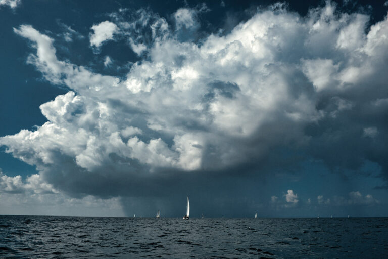
We spent our second night in Ocracoke, anchored in Silver Lake, and once the live music from the Jolly Roger shut down, we had a restful time. The only other disturbance to affect us was an extratropical one, which the National Weather Service announced was taking shape southeast of Cape Hatteras. Hence, we supposed, our northeasterly wind.
Our objective, Manteo, lay to our north, and the next day, we had to at least try to reach it. Pamlico Sound is a vast body of water, which we didnt fully appreciate until we ventured across it. Its about 50 miles long by 24 miles at the widest point, and at its most profound, its only 20 feet deep. In any wind at all, it quickly gets choppy. The tourist center of Manteo is well provided with docking facilities, and many nooks and crannies invite anchoring for shallow-draft boats. We had a couple of options for overnight anchorages on the mainland as well as in Wanchese, at the southern tip of Roanoke Island.
So Near, Yet So Far
Five hours after leaving Silver Lake, we’d made five miles good toward a destination still 20 miles distant, and I was beginning to feel for John White. Roanoke was just over my horizon, but it might just as well have been across the Atlantic. After Melissa, wide-eyed, steered Elyse over a wave bigger than I thought physics would permit in 20 feet of water, we took the hint and bore away. We doffed our foulies and basked in the hazy sunshine, admiring the antics of the sound’s many pelicans as Elyse, gurgling her approval, whisked us back to Belhaven.
Apparently, the Lost Colony was going to remain unfound for a while longer because the disturbance in the Atlantic was about to make history. For the first time ever, the National Hurricane Center endowed an extratropical storm with a name: Gustav. And Gustav was headed for the Outer Banks.
Leaving Elyse in the company of a couple of other boats in the marina, we repaired to the comfort of River Forest Manor’s finest room, with its 14-window view and six-foot bathtub. Since Gustav had declared a lay day, we divided our time between attending to chores on Elyse and watching Gustav on the Weather Channel. Soon it became clear that, Gustav or no Gustav, we no longer had time to sail to Manteo.
I called Roxy to tell her Elyse was snug. “Rent a car,” she suggested. “Drive to Manteo.” In my 16th-century mindset, Id forgotten about other forms of transport. So we rented a car and, mindful that Axson might want us to move Elyse before evening if Gustav veered our way, sprinted eastward down Highway 64.
Squalls of wind and rain thrashed around us as we drove over the just-opened Route 264 bridge to Manteo, and looking down at the spume-streaked water below, we were thankful we weren’t down there looking up. We were also thankful that Elyse wasn’t in Manteo because the marinas there were more exposed and closer to Gustav’s path than her cozy quarters in Belhaven. In Manteo, we toured Elizabeth II, an approximate replica of one of the ships of the 1585 voyage, the museum, and Fort Raleigh, the site of the original colony, now preserved along with its remnant of maritime forest.
In the latter part of the 16th century, the English decided that it might be worth claiming a chunk of the big piece of dirt Columbus had run into nearly a century before. For a base that could also serve to support the version of piracy known as privateering, the English chose a spot that was close to the Gulf Stream/Atlantic-crossing route but sufficiently far north to be safe from Spanish reprisal raids. It’s no accident that Blackbeard and his contemporaries later chose to operate from the same stretch of coast.
Roanoke Island lies inside the Outer Banks, so its protected from the oceans illest humors. At that time, an inlet called Trinity Harbor existed just north of Roanoke Island and gave ready access to the ocean, though only for shallow-draft vessels. Concealed from coasting Spanish ships, surrounded by well-stocked water, and populated by deer and a small number of nonhostile Indians, the northern end of the island had the makings of an ideal colonial toehold.
However, there were downsides to the location. Expansion in the swampy and impenetrable mainland across the sound would have been a challenge. Trinity Harbor, which closed centuries ago, lacked sufficient depths for even the colonists smaller ships to gain the shelter of the sounds. Anchored off the barrier islands, they were vulnerable to the Hatteras areas violent weather, which, along with the treacherously changeable inlets, made resupplying the colony a risky business. There was every reason for the colonists, with no assurance that John White would succeed in bringing supplies, to simply move on. Or, given their precarious relationship with the natives, with whom they were competing for available habitable land and food supplies, they may have been driven out.
By the time we returned to Elyse, Gustav had taken a turn to the north, and it appeared that wed get no more wind than wed already had and the water level wouldnt rise any higher. Axson, relieved, let the boat stay in the marina. As forecast, Gustav was chased off that night by a cold front, so the morning dawned crisp and clear, swept by a cool breeze from the west. We made a last forage at the Food Lion, dropped off the car, and prepared to depart. Our delay now meant we had to push north quickly, so with no further ado, we sailed off toward the Alligator-Pungo Canal.
Reflections on Cruising
As experienced cruisers know–and neophytes quickly learn–expected arrivals are frequently not met. Though unfulfilled, our mission gave us purpose. We spent two happy weeks on a lovely boat in a fascinating, and overlooked, cruising ground in the middle of America’s East Coast. And we learned that austerity and luxury, each in small proportion, make for greater appreciation of both, and that they can both be enjoyed in counterpoint on the same journey.
Gustav delayed us but left in its wake three days of typical early fall weather, which provided us with head winds (down the Alligator River), fair winds (across Albemarle), and a magical misty dawn in which to hasten up the beheroned Pasquotank River to the Dismal Swamp Canal and Portsmouth. All the way, Melissa wore a little smile that seemed to say, “Well be doing more of this in our future.”
Jeremy McGeary, a Cruising World associate editor, and Melissa were married three months after their cruise.