We wondered what Joshua Slocum would have replied to the questions put to us by Great Lakes Cruising Club member Jim Wooll on the dock in Little Current, Ontario: “Where are you headed?” (Somewhere in northern Georgian Bay was our plan.)
“Have you ever been into West Desjardin Bay?” he asked. (We’d never heard of it.)
“It’s a white area; no soundings on the chart. Want to join us?” (Hmm …)
Now my wife, Jennifer, and I have had our share of encounters with Georgian Bay rock; bits and pieces of the keel on Catamount, our Caliber 38, still decorate the bottom here and there. And those were in charted areas. Jim was inviting us to follow him into Lake Huron’s unknown.
Would Joshua have gone? Having just finished rereading Sailing Alone Around the World, I found his answer on the final page: “To find one’s way to lands already discovered is a good thing.” That was good enough for us. We told Jim we’d follow him.
Northern Georgian Bay consists of 4-billion-year-old granite that was shoved vertically by tectonic forces, then eroded by glaciers into hundreds of parallel ridges that run for miles out into the bay itself. Find a way into their sheltered waters, and you’re in paradise. Get lost as you try, and you will need a new keel, rudder or worse.
The first European to visit the area was Samuel de Champlain, who paddled down what is now called the French River in 1615; he knew where he was only because he had Indian guides. He was followed by the French voyageurs as they headed west looking for beaver pelts; they knew where they were because Champlain had an astrolabe and made passable maps. Generations of fishermen and steamer captains knew where they were because the British Navy mapped the Bay in the 1820s using sextants, chronometers and lead lines.
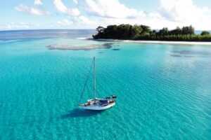
The Canadian Hydrographic Service has improved on the old British charts over the years, using sonar, aerial surveys and most recently satellite images, but a large part of northern Georgian Bay has never been sounded. The water in dozens of inlets and bays, some of them very large, is simply colored white or blue on the charts based on the cartographer’s interpretation of those aerial photos. White water might be safe and blue water probably isn’t, but no soundings have ever been done. These are Georgian Bay’s white areas, the only uncharted water in the entire Great Lakes system.
But Jim’s been there, armed with his handheld depth finder and a GPS-enabled iPad loaded with CHS charts. He and his wife, Bobbie, have sounded many if not all of the Bay’s white areas over the years for the cruising club, sharing their data with GLCC members like ourselves.
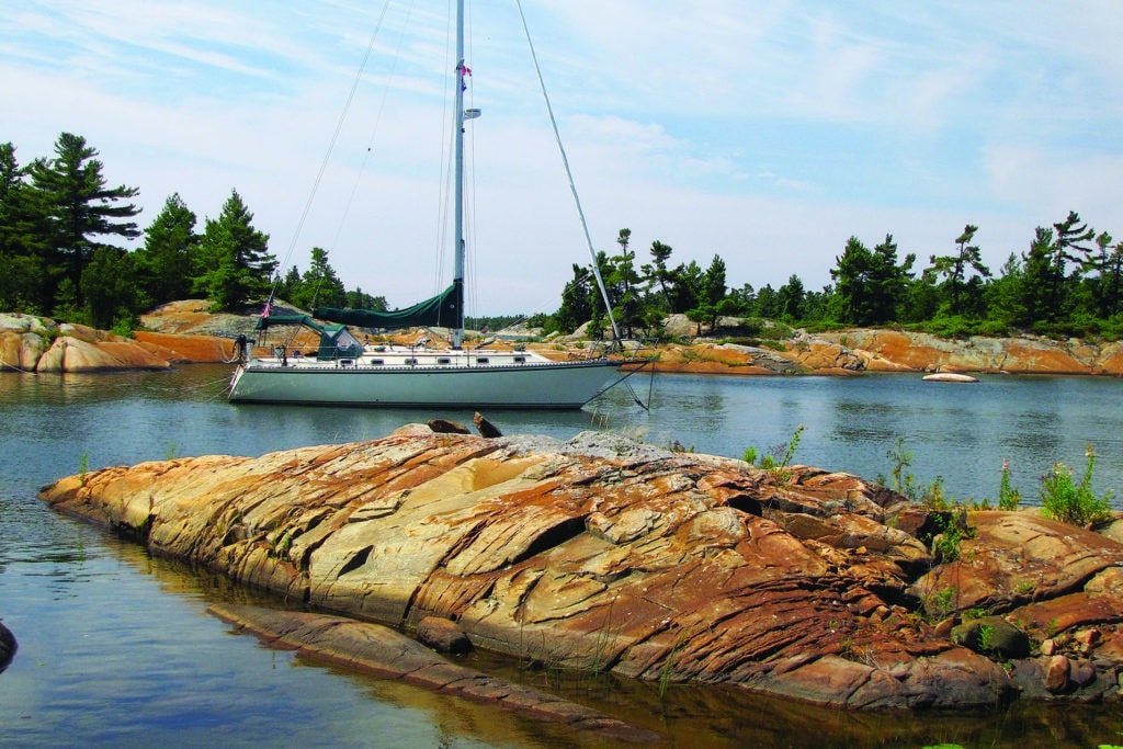
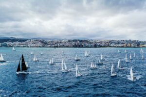
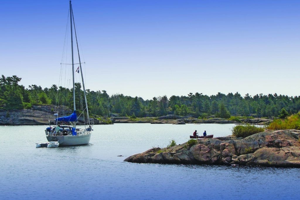
Sailing east from Little Current, we followed Jim and Bobbie on their Island Packet 36, Reverie, as they dodged shoals and islets on the charted areas of the northern bay. Then we said a silent prayer as we followed them into our first uncharted white area. The west wind pushed us faster than was comfortable for us, so we took in our main, but they marched ahead wing and wing. Reverie disappeared behind a maze of identical-looking islands to drop anchor in unsounded West Desjardin Bay as we circled warily offshore, waiting for Jim to come out in his dinghy to guide us in.
We were hooked. The next day we met up with Ron Dwelle, the longtime editor of the GLCC’s cruising guide for club members. He and his wife, Jo, have also explored the white areas on their Niagara 35, Annwfn. (Their boat name is Welsh, pronounced en-NU-ven, which we suspect means skinny water).
We followed Ron farther east for 20 miles, reaching leisurely in light westerlies, then rounded up into the sounded channel of the French River. Then Ron took a right into another white area. Gulp. Hard on Annwfn‘s stern, we turned to starboard past a rocky islet, then starboard again past an unseen ledge, then back to port past two tiny islets the aerial survey photos had missed, then past two more unseen rocks and voilà, we were back on the chart soundings.
Even then we weren’t home free. Chart errors persist in the sounded areas in spite of the best efforts of the CHS. Our chart plotter, which knew exactly where we were on the Earth’s surface, frequently showed us sailing through a peninsula or sitting in the middle of an island.
After a series of hairpin turns we followed Annwfn into Beacon Rock Bay. Ron had never been there, so with Jo as his bow watch and Catamount trailing behind like a meek child, he meandered back and forth, tried one potential anchorage, passed up another and finally declared the water was too rough to proceed farther.
We sailed out to a safe anchorage and joined Ron and Jo for dinner. Ron whipped out his iPad and then, zooming in and out, scrolling north and south, he showed how he had taken CHS charts and plugged in Jim Wooll’s soundings for the GLCC. Ron also gave us a DVD with the latest GLCC information for our computer.
Since they were planning to go up into vast and uncharted Fox Bay, we assumed they had been there before. Indeed they had — only once, 20 years ago. And they had left more than paint on a rock; they tore off the rudder of a previous boat when they grounded. Then they announced they had to head farther east for provisions. “You go on ahead,” Ron said airily between bites. “Just follow Jim’s soundings on the GLCC chart,” he said, “you’ll be fine” — this from a man who lost his rudder there.
We scribbled down all the notes we could and rowed back to Catamount after dinner to compare the CHS chart white area with the GLCC notes from Ron. We were as ready to go on our own as we would ever be.

The next day was flat calm as a midsummer high settled overhead. It was crummy weather for sailing but perfect for exploring. We followed the CHS soundings to the entrance of 4-mile-long Fox Bay and turned north. With the CHS chart in one hand and the GLCC notes in another, I stood on the bow and navigated for Jennifer at the helm, taking us into our first white area.
It was a good day for water clarity, maybe three feet visibility since Fox Bay does not have as big a watershed as some other areas. We crept up the east shore of the bay, noting several rocks and islets that the CHS aerial survey had missed. We held our breath as the depth meter went from 44 feet to 12 and back to 26. So many islands! Where was Jim’s channel? We turned cautiously into a small indent 2 miles up the east shore and dropped the hook in 18 feet of water.
In an hour of sounding the anchorage from our dinghy we found a 5-foot-deep area too close for comfort, though the water was too dark for us to see the bottom. Rock? Muck? We couldn’t tell. The forecast was for thunderstorms so we re-anchored, then strung lines off our stern to shore, spider-webbing ourselves into place.
Our only visitors that night were two canoeists exploring the old voyageur routes and a black bear swimming across the cove. Loons warbled at sunset, followed after dark by whippoorwills. At dawn, a sandhill crane bugled a coarse rendition of reveille. Otherwise, nothing. Just silence. Paradise redux.
The next day we explored the rest of Fox Bay by dinghy. There are dozens of steep-sided islands (so many they have numbers, not names) and hundreds of rocky islets. No houses, no motorboats, no people and, oh yes, no soundings.
Ron and Jo joined us for the second night, inching their way into our anchorage. They congratulated us, and maybe felt just a bit better themselves as they displaced the memory of that damaged rudder from their previous excursion into the bay. Ron brought a fresh supply of worms and helped me land a 4-pound smallmouth bass off Catamount‘s stern.
As we shared a fish dinner and a chilled bottle of Ontario chardonnay, we toasted the white areas. Our adventure here wound down much as our trip had begun: with questions. Had the CHS done us a favor by not sounding all of northern Georgian Bay? Should Jim and Ron even share their data with other GLCC members? Should we explore nearby uncharted Sandy Bay? Or uncharted Whistler Bay? Should there still be uncharted areas you have to explore by yourself, even if your keel or rudder is at risk?
Every cruising sailor will have his and her own answer. Joshua Slocum’s answer was to carry detailed British Admiralty charts for his circumnavigation. We weren’t taking Catamount around the world; our cruise into Georgian Bay’s white area was decidedly more modest. Call us chicken, call us soft, but we were glad Jim and Ron, armed with their depth finders and GPS-enabled iPads, had been there first.
Vermont sailor Fred Bagley and his wife, Jennifer, are frequent visitors to the Great Lakes’ wide array of cruising grounds.