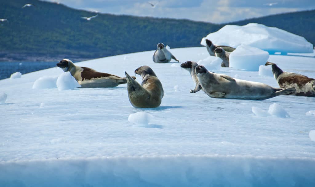
A pod of orcas caught up with us in Gray Strait, off the northern tip of Labrador. They closed in as much as possible without bumping the hull; I could have touched the 6-foot dorsal fin of the leading male if I had dared to lean over. A couple of days earlier, my wife, Nancy, and I had sailed through the Button Islands, watching the sheer cliffs at the northern entrance through a blizzard of flitting birds — thousands of fulmars and kittiwakes. Inside the channel, seals frolicked, keeping wary eyes on a massive polar bear scouting the water’s edge for a meal.
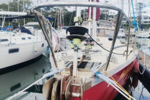
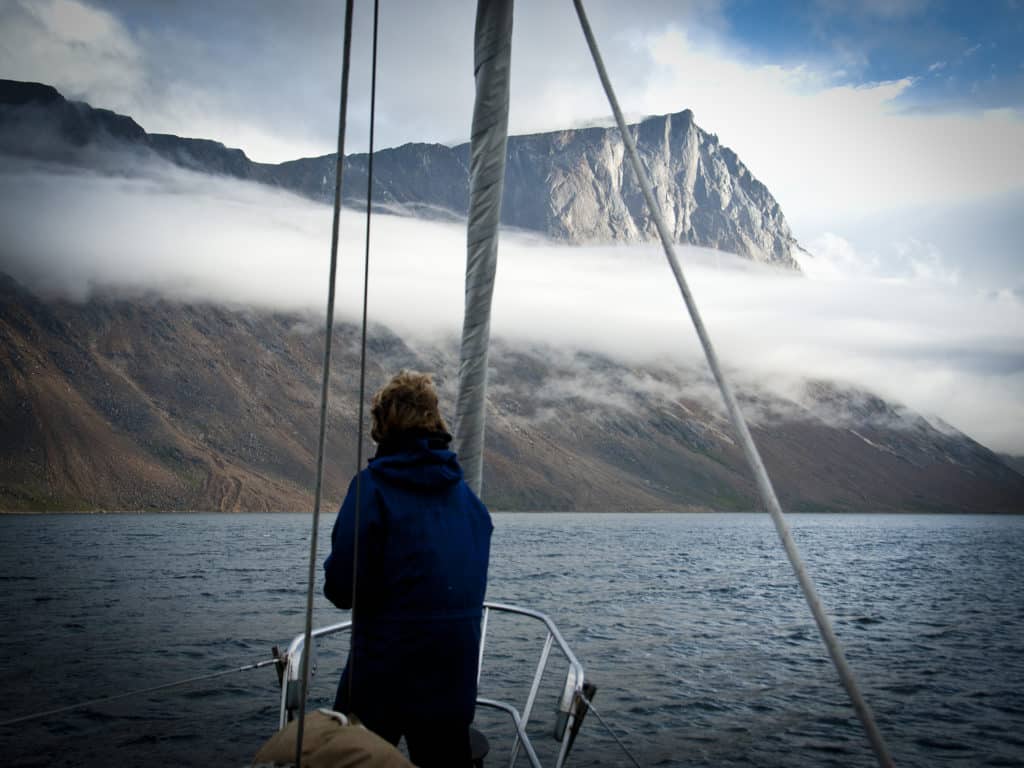
Welcome to Labrador, where the 200 miles of northern coast rise high above the water. Mainland rivers run out into the Labrador Sea through long fjords. The primary surveyed boat channels lead close to precipitous cliffs, so our Mason 44, Frances B, often navigated by what looked like the ramparts of gigantic fortresses. Mountaintops, sliced flat or molded into giant mounds, told of the destructive movement of ancient ice caps. Above them stood higher peaks, 3,000 feet and more, of hard granite patched with winter snow. Caribou lolled on the snow near the coast, seeking a cold breeze to keep away black flies and mosquitoes. The fjords are deep, and we often found icebergs planted in spots where the depth was perfect for anchoring. Most of the time, Frances B dropped the hook on a shelf of river detritus. The river outlets had the best view of the action ashore.
At the end of one fjord, caribou came to graze on a mound of gravel and grass abeam of Frances B. When the incoming tide changed the pasture into an island, the animals swam away. Across the water, a large inland lake sent out a roaring stream — just the place to do laundry and have a cold bath. Burdened with buckets, green soap and towels, we brought the dinghy to the rocks and looked up right into the eyes of a polar bear. During summer, seals — the main food source for polar bears — migrate out of this area; hungry bears will stalk humans. We sailed without firearms on Frances B, and the flare pistol and whistles we carried seemed puny when facing a 9-foot, 800-pound carnivore. We quickly backed out, the noise of the outboard sending the bear into the hills. In another fjord we watched a foraging polar bear cross a river. An equally massive black bear fishing there took one look at it and sprang for the hills, leaving no doubt about who was at the top of the power heap.
Strong winds off the highlands funnel through ravines and gaps in the hills, accelerating into violent williwaws. After getting boxed by stray squalls in Kangalaksiorvik Fjord, we tried to make sure to anchor in places facing across the axis of any hills to windward. It worked. Afterward, only once did we make such a mistake again, when we trusted the name Calm Cove on the south side of a mountainous landmass stretching west from Mugford Tickle. A frontal passage brought north-northeast gale winds that hurled down the river valley at the head of the anchorage. White-spume squalls raced across the bay, whipping up waterspouts; 40 hours of 50-plus-knot gusts made this a memorable visit. The 3⁄8-inch chain on our 72-pound Bruce anchor held well even though the boat tacked through 90 degrees, the gunwales hitting the sea. We did break a venerable 3⁄4-inch three-strand snubbing line and had to tie in a spare braid.
Most of the fjords lie within Torngat Mountains National Park. The park’s base camp on Saglek Bay afforded us a chance to see new faces after weeks in the wilderness. With a lecture/library tent, electric bear fence, helicopter, two ex-longliner tripper boats on moorings, hot showers, and cafeteria meals — civilization has some advantages — the camp hummed with students, geologists from Japan, Inuit children, and rifle-toting bear guards. South of Saglek, the coast returns to wilderness, with the exception of caretakers in Hebron, an old Moravian mission station being revamped as a historical monument. Both the base camp and Hebron stay open only about three months each summer.
When an east wind arrived, we sailed from Mugford Bay, avoiding the offshore fog and swell. As we made our way south, a low, dense forest stretched behind the foreshore. Four wolves pranced at play on an open meadow. They spotted our movement and bounded into the green shadows as we pulled out cameras. Downwind, a black bear grazing through low grasses suddenly rose on his hind legs and swung his head, sniffing.
Labrador fishermen of the past had a way with words. A “tickle” warned of a narrow passage, but a “rattle” was more serious. Although the 25-mile Port Manvers run is more than a tickle, the tides race through the Second Rattle at the north end and the First Rattle at the south. We anchored off the northern end to time the currents.
Each morning, before going berry-picking ashore, we first made sure that the black bears had already made their rounds. In August, blueberries and cloudberries ripen, and bears like to eat them. Most of our way south from Port Manvers led through inner channels interrupted by occasional sorties into the Labrador Sea. Wherever trees thickened and the land greened, there would be black bears. Mostly on a vegetarian diet, they reputedly don’t attack people. Still, they tower over other American black bears and may not like competing foragers.
We were on our way south and home after our third summer at the tip of the North American East Coast’s end. Now that it was August, Labrador was at its best: warmer air, fragrant meadows, and small flocks of eiders feeding for the flight south. The ice — both offshore bergs from Greenland and the native winter floes — was mostly gone, except for a few persistent bits here and there. The sky stayed clear and the winds eased out before the autumn onslaught. Even the severe, stony mountains looked softer. At Nukasusutok Island, just south of Nain, the setting sun painted the bare rock cliffs red.
We navigated mostly among islands, both for interest and safety, as the charts showed accurate depths along the “track usually followed” but only blank spaces farther out. Some major headlands required poking our bow into the big seas outside, but we were able to use tides to squeeze by inland of most of them. Three years ago, we’d been scared out of visiting Cape Harrigan Island by giant, confused swells and a lack of wind. Now we used the rising tide to sneak our 7-foot-draft vessel inland. While waiting for the right tide in a bay on the north shore of the island, we trekked to the top and counted icebergs still afloat far offshore. But we made sure to have our bear spray and noisemakers ready, as the area is a veritable black bear garden.
Normally you can’t dine out when cruising Labrador. In Hopedale, however, we had caribou burgers and caught up on emails in a restaurant overlooking the wharf. Hopedale was once the site of a Moravian mission to convert the Inuit to Protestant beliefs, foods and writing. The mission buildings stood well maintained and included a museum. Hopedale was probably the northernmost harbor to see large numbers of the Newfoundland schooners that once worked the coast every summer to collect fish. For close to 300 years, cod fishing constituted the livelihood of thousands of people here. There were “livyers,” who came to fish and stayed in Labrador for good, and “floaters,” the seasonal fishermen from Newfoundland. When a moratorium in 1992 closed the dying fishery, countless seasonal stations began to crumble.
Small-scale, strictly regulated fisheries continue for crab, shrimp and turbot. The processing plant in Makkovik welcomes longliners from Newfoundland at the well-maintained wharf and has a small yard with the only Travelift in these northern waters. Yachts are also welcome. At the end of August we sailed to Cape Harrison, the only headland we couldn’t cheat. A wet northeasterly wind carried a bite of autumn. Running down big swells, we sent immense rafts of shearwaters flying, their wing beats loud over the water. Farther on, we passed a slew of little bays that had served as cod-fishing stations, with names like Indian Tickle and Ice Tickle.
At Hamilton Inlet, a vast wedge of the sea slices into the waist of Labrador for some 125 miles. It ends in Goose Bay, a major hub connected by roads and air to the rest of Canada. To us, the heart of Hamilton Inlet was in the Gannet Islands, just south of the mouth of the inlet. There aren’t any gannets there, but there are thousands upon thousands of puffins and razorbills. The air was thick with birds streaking between the islands and the water at astonishing speeds. Stationary puffins stood by the breeding burrows, and razorbill sentinels watched over their eggs, laid in the open on flat rocks. Protected from human invasion by law — and by 30 miles of open ocean from the closest town of Cartwright — this breeding colony thrives. The last researchers we heard of were chased from their hut by a polar bear stranded by receding ice.
Soon after leaving Hamilton Inlet, we followed the coast south. For the next 80 miles or so, we found cove after protected cove, joined by inner runs that used to shelter cod stations. Some houses still stand: piles of gray, weathered planks, a few maintained as summer cabins and used by descendants of the old fishing families who now live full time in half a dozen nearby small towns. In one harbor, we slipped between the towering cliffs of a long bay and then passed a ghost assemblage of timber sheds careening on broken legs into the sea. At low tide, the beaches around our anchorage appeared, covered with hundreds of scallop shells. On an island nearby, splashes of blue guano covered the rocks; gulls like blueberries too.
Cod wasn’t the only quarry in the sea. There was a whale slaughterhouse started in Hawke Harbour in 1904 that lasted 55 years before being destroyed by fire — just about the time whales joined cod on the way to oblivion. Frances B had to squeeze by three awash rocks to reach the inner sanctuary of the harbor. Ahead, against a green slope glared an industrial dump of rusty red tanks and boilers. A gutted vessel leaned against the shore nearby.
We needed to top up our fuel and groceries. Conveniently, the wharf of a defunct Fox Harbour fish plant always keeps a free spot for a visiting yacht. Just behind the wharf began a planked trail with steps over the hills to the outer coast. From the top, we could see dozens of blue lakes to the northwest and sparkling white dots of ice on the ocean to the east. After tunneling through a tangled forest, we met a fork in the trail that descended to Deep Creek, once a small fishing hamlet, where heavy swell foamed almost all the way into a small cove.
“How hard was the life there?” I asked new acquaintances Elaine and Warrick Chubbs, sitting in their home in town.
“Well, it was handy to the cod-fishing grounds,” said Warrick, who grew up in Deep Creek. To keep the past alive, he maintains a fishing stage complete with boats and a cod-curing shed on the shore of Fox Harbour, a few steps down from their new house.
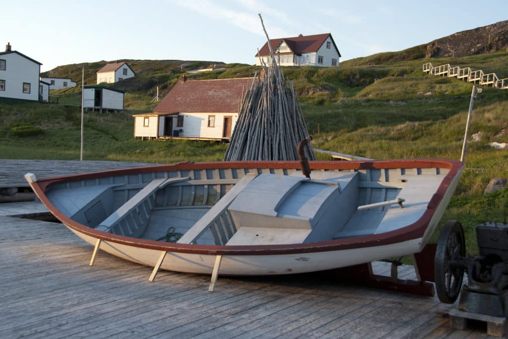
About an hour’s sail away lies Battle Harbour, with hot showers and laundry. For more than 200 years — until 1992 — this was the virtual capital of Labrador fisheries, thronged with schooners and fishing boats. In 1909, explorer Robert Peary telegraphed the world of his success reaching the North Pole from the Battle Harbour Marconi station. Battle Harbour lives on as a museum; the village, fish factories, doctor and missionary Sir Wilfred Grenfell’s clinic, and dories are preserved by the tenacity of the descendants of the old Labrador hands. During summers they come from Mary’s Harbour (10 miles away) to talk, in their lilting accents, of “them old days.” Tourists rumble to Battle Harbour from Mary’s Harbour on Iceberg Hunter, a venerable classic itself.
A strong northeaster filled in, and we carried the fair wind into the Strait of Belle Isle. The strait has a bad reputation for fog and odd currents, but this time luck was with us. Unexpectedly for September, Frances B passed a clatter of ice — what looked like tabletops, watchtowers and giant, glossy meringues. One icy hillside sloped into a flat skating rink that served as a beach to a harem of seals, only mildly stirred by the white apparition sailing silently by. And then, suddenly, it was all open water and fair wind until the west coast of Newfoundland.
Tom and Nancy Zydler are cruising the western coast of Greenland, north of the Arctic Circle.