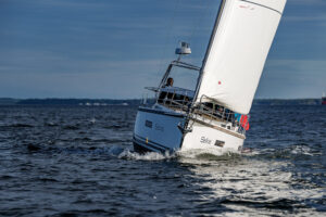
A voyage to the islands of the South Seas figures in most sailors’ long-term plans, but their remoteness, which is one of their main temptations, keeps them beyond the scope of the average voyage. This is why, despite the proliferation of yachts worldwide, the number of boats cruising in the South Pacific Ocean is still relatively small and isn’t likely to increase much in the foreseeable future.
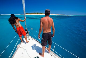
No other part of the world offers so many cruising opportunities and diverse attractions as the South Pacific, from French Polynesia’s spectacular anchorages in the Marquesas to the turquoise lagoons of the Tuamotu Archipelago, from the giant statues of Isla de Pascua, or Easter Island, to the traditional villages of Vanuatu, the sheltered waters of Vava’u, in Tonga, and the remote island communities of New Zealand’s Tokelau and the nation of Tuvalu. The vastness of the Pacific Ocean, and the great distances that separate most island groups, make long passages a normal feature in this part of the world. The islands’ isolation and scarcity of facilities require that boat and crew be well prepared and self-sufficient.
Voyage Planning
The safe sailing season in the South Pacific is well defined, with the weather usually fairly benign in the eastern part of this vast ocean. For sailors arriving from the east, the most critical decision concerns the timing of one’s arrival in the first tropical island group. Most boats transit the Panama Canal before the onset of the hurricane season in the Caribbean (June to November), with the most transits occurring in February and March. This is also the time when boats sailing from Mexico and Central America should start leaving for the South Pacific. Those who plan to sail in one season all the way to Australia or to the Torres Strait north of it need to reach the Marquesas not later than April to be able to cover the considerable distances ahead of them in only five months. Those with more time on their hands may decide not to sail the usual route from the Galápagos to the Marquesas but to make a detour to Easter Island and arrive in French Polynesia by that route. From Tahiti, in French Polynesia’s Society Islands, the classic trade-wind route continues to the Cook Islands, Tonga, Samoa, Fiji, Vanuatu, and Australia, with countless worthwhile diversions en route.
For sailors starting from the eastern coast of the United States or Canada, a voyage to the South Pacific may be easier to accomplish if it’s planned as part of a complete circumnavigation, because the prevailing conditions are then used to best advantage. Sailors hailing from the U.S. West Coast who aren’t tempted by a complete round-the-world voyage have the choice to return home by way of a shorter Pacific circular voyage. The turning point of such a voyage can be either Australia or New Zealand, from where the return route must dip south to make the necessary easting in the area of prevailing westerly winds. Having reached the Austral Islands, the southernmost island group in French Polynesia, sailors on this route turn north to Tahiti and continue via the Line Islands to Hawai’i and eventually home again to the States.
Weather and Seasons
As in other tropical areas of the world, the best weather conditions in the South Pacific are a feature of the winter months, May to October, and for this reason, most sailors plan to arrive in the Marquesas in late March or early April. Although officially the South Pacific cyclone season lasts from November to April, the Marquesas are very rarely affected by tropical storms, and such an early arrival can be considered to pose a low risk. The main attraction of such an early arrival, especially for those on a tight schedule, is the opportunity to use the safe cruising season to its full extent. Despite the huge distance between Panama and the Torres Strait, boats regularly cover the 9,000 miles in one season.
Most boats follow the traditional route that sweeps in an arc from Panama to the Torres Strait. Favorable southeast trade winds are the usual feature of this route during the winter months. However, normal weather conditions can be affected by various factors, such as the El Niño or La Niña phenomena.
For centuries, the people of the fishing communities in northern Peru and Ecuador have used the term “El Niño” to describe an annual warming of the offshore waters during December. Because this phenomenon usually occurs around Christmas, it was called El Niño, or the Holy Child, Current. El Niño is now used to describe extensive warming of the ocean surface across the eastern and central equatorial Pacific. It’s now accepted that El Niño affects weather far beyond the South Pacific. The latest El Niño episode occurred between 2009 and 2010. When the ocean temperatures revert to a colder period, it’s now commonly referred to as La Niña. During a period of La Niña, sea-surface temperature across the equatorial eastern Pacific Ocean can be lower than normal by 5 F to 8 F.
During a La Niña episode, a mass of cold water from the eastern South Pacific is pushed westward by the easterly winds and accumulates in the western part of the South Pacific. The rapid evaporation of the cold water as it collides with the warm air mass can cause widespread climatic disturbances. This happened during the current La Niña episode, in January 2011, when torrential rains caused disastrous flooding from Queensland, Australia, to Sri Lanka, off the southern coast of India.
A constant feature that affects weather conditions throughout the tropical South Pacific is the South Pacific Convergence Zone. The S.P.C.Z. stretches in an east-southeast direction from about 5 S, 155 E to 20 S, 150 W and can influence weather conditions all the way from Tahiti to the Solomons, although its effects are particularly felt in the central area between French Polynesia and Tonga. The S.P.C.Z. moves northeast during El Niño and southwest during La Niña events. The location and movement of the S.P.C.Z. are monitored by the Fiji meteorological office.
Route Planning
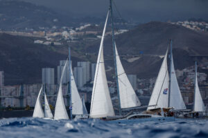
The route from Panama to the Torres Strait passes through some of the most attractive cruising destinations in the world, with a choice of alternative itineraries all along the way. There are three major alternatives to reach Tahiti from Panama, each with its own attractions. Those who are keen to reach the South Seas as quickly as possible have the choice of sailing the direct route from the Galápagos to the Marquesas. While this is the fastest way to reach Tahiti, a tempting alternative is to sail a more roundabout route that swings south from Galápagos to call at such rarely visited places as Easter Island and Pitcairn. The latter is still home to the descendants of Bounty’s mutineers, and visiting sailors are always assured of a warm welcome. By this route, landfall in French Polynesia is made at the Îles Gambier, where, as in the case of arrivals in the Marquesas, those islands shouldn’t be reached before the end of March as, occasionally, cyclones, or at least their effects, have been felt as far east as the Gambiers and even Pitcairn.
An even more ambitious alternative is to sail due south from Panama to Ecuador and Peru, then continue from there to Easter Island and beyond. The main attraction of this route is the opportunity to gain an insight into some of South America.
To visit the interior, you can leave the boat at the Puerto Lucia Yacht Club, in La Libertad in Ecuador, a convenient place from which to visit the Andes or the Amazon, since about a third of the Amazon Basin is located in Ecuador. In Peru, the port of Callao, close to the capital, Lima, can serve as a base at which to leave the boat while touring Inca ruins, Lake Titicaca, and even some of the neighboring countries.
A possible objection to these two southern-route options is that they miss the Marquesas, to my eyes the most beautiful of all the French Polynesian archipelagos. However, this need not necessarily be the case, as from the Gambiers you can sail north to the Marquesas, visiting some of the outer Tuamotus on the way to Tahiti. Another possible alternative detour from the Gambiers is to the Australs. With good planning, any of these objectives can be reached, and the additional mileage more than justifies the effort of stopping at some of the least-visited islands in the South Pacific.
Tahiti has been a favorite landfall for mariners ever since its discovery by the outside world. From sailors to painters, musicians to film stars, its temptations have proved irresistible, and this fascination with the symbol of the South Seas continues to this day. Over the years, Tahiti’s capital, Papeete, once a quiet backwater, has turned into a busy city dominated by noisy traffic that thunders past its attractive waterfront. Take a short walk from there to see a glimpse of old Tahiti that still survives at the vibrant daily market, with its dazzling displays of vivid tropical colors on the fruit and flower stands.
The onward passage to Fiji can be sailed at any time during the safe season, its timing depending primarily on your plans after you leave there. The westbound route is straddled by several attractive island groups, and it won’t be easy to decide which ones to bypass. Sailors leaving Bora-Bora, in the Society Islands, face a choice of a northern route, which touches upon the northern Cooks and continues to either Tonga or the Samoas, and a southern route, which reaches Tonga via the southern Cooks and Niue.
An interesting stop shortly after leaving Bora-Bora is Maupiti, a small Society Island atoll that’s accessible through a pass in the reef. Another one is at Aitutaki Atoll, the nearest of the Cook Islands. A swing to the northwest leads to Suwarrow, an uninhabited atoll and longtime favorite among sailors roaming the South Pacific.
Another perennial favorite is Vava’u, Tonga’s northern group, which boasts one of the most beautiful settings in the world. For sailors heading west from the ancient Kingdom of Tonga, Polynesia gives gradually way to Melanesia at Fiji’s eastern islands, the point where those two ethnic entities blend into each other.
Once you reach Fiji, an important decision needs to be made, especially late in the season: Will you sail to either New Zealand or Australia for the cyclone season or continue to Vanuatu, the Torres Strait and beyond? Besides the annual cyclone season, one other matter of certainty in the South Pacific is that even the best-laid plans may have to be drastically revised, and due to its location, Fiji is the place where the fate of many voyages, or at least their new direction, is decided.
From Fiji, the main transpacific route continues to northern Australia. This is the route sailed by boats bound for the Indian Ocean, often as part of a voyage around the world. Those who intend to take the Cape of Good Hope route need to pass through the Torres Strait by early September so they’ll have enough time to reach South Africa by early November, before the start of the cyclone season in the southern Indian Ocean.
The timing for boats bound for Southeast Asia and the northern Indian Ocean is more flexible, as the passage through Torres Strait can be delayed until October.
Weather conditions in September across the Coral Sea, off the northeast coast of Australia, are favorable, with consistent southeast trade winds all the way to the Torres Strait. Few sailors plan to make the long passage without stopping at some of the islands scattered about the Coral Sea. A detour to the Solomons and Papua New Guinea requires more time and may not fit easily into a tight schedule. Rather than sail directly to the Torres Strait, an attractive alternative is to divert to northern Queensland, where Cairns is a convenient port of call with good repair and provisioning facilities. From there, the route stays inside the Great Barrier Reef and enters the Torres Strait from the south.
Two Seasons Better Than One
To do it proper justice, the South Pacific deserves more than just one season, and for this reason, most boats spend at least two winters there, usually by leaving the tropics for the cyclone season, sailing south to New Zealand or Australia or north to Papua New Guinea and Micronesia. Those who prefer to remain in the tropics during summer can find shelter in one of the few safe harbors or all-weather marinas.
For those who wish to continue cruising, there are a few hurricane holes in Tahiti, Vava’u, Pago Pago, the islands of Samoa, and Fiji, although in some countries, the authorities insist that visiting yachts leave the country before the onset of the cyclone season. One of the advantages to spending the summer season outside the tropics is that one is able to go to a place with good repair and service facilities.
A popular destination is New Zealand, where voyagers can find various marinas offering a wide range of services. Similar facilities are also available along Australia’s east coast. In the islands, the best repair centers are those in a location that supports its own boating community, such as in Tahiti; the capital city of Suva, in Fiji; Nouméa, in New Caledonia; and Port Moresby, in Papua New Guinea. The establishment of charter operations in Raiatea, in the Society Islands; in Vava’u; and in Fiji has brought about a noticeable improvement in the standard of facilities there.
On passages to New Zealand in November, the winds are mostly from east or southeast down to about 28 S or 30 S. From there on, the winds can come from any point on the compass, but because the passing of a front or depression usually results in a spell of northwesterlies, it does no harm if some westing is made while under the influence of those southeasterlies. An interesting stop south of Fiji is at the Minerva Reefs, which have temporary anchorages and are popular with boats sailing this route. However, as they lie slightly east of the direct route, perhaps it’s better to call there on a return voyage the following season.
Those who intend to spend the cyclone season in Australia should continue west from Fiji and sail to a port in the Australian states of New South Wales or southern Queensland. Both Vanuatu and New Caledonia lie close to this route and provide the opportunity to experience the very different cultures of these two Melanesian nations. In the former, a traditional way of life still survives in the outer islands, while in the latter, the strong French influence has brought about the opposite result. How long will it be before this happens throughout the South Seas?
Longtime CW contributor Jimmy Cornell completed his latest circumnavigation on Aventura II, an Ovni 43. Among his latest books are World Cruising Destinations (2010, International Marine; $50); A Passion for the Sea (2008, Paradise Cay; $30); and World Cruising Routes (2008, International Marine; $60).