Radar is the most valuable aid to navigation ever invented. That’s a bold statement, I know, and certainly GPS, AIS and the lowly depth sounder have their own advocates, as does the enduring magnetic compass. But radar proponents rightfully argue that their favorite device doesn’t rely on satellites, other vessels broadcasting a radio frequency signal or on-shore position enhancing beacons. It’s this self-contained electronic autonomy that the depth sounder and radar have in common, but while the sounder can only tell you what’s directly under you, radar alone can show you what surrounds you feet — or miles — away.
Depending on the technology in play, radar radiates a microwave or FM signal and detects the energy that bounces back, rendering a view that’s unaffected by darkness, fog or other elements that result in poor visibility.
For starters, it’s a first-rate collision avoidance tool that, unlike AIS, sees for itself what’s in the vicinity. This means that other vessels, with no AIS or radar equipment of their own, show up boldly on the radar screen. Yes, those with a radar reflector in the rigging will present an even more noticeable target, but today’s well-engineered equipment has the sensitivity and selectivity to discern objects with pretty poor microwave or FM radio-frequency return characteristics. Small sailboats, even inflatable dinghies can be detected.
Radar’s versatility includes spotting and tracking thunderstorms at night, locating unlighted aids to navigation and picking out other vessels transiting in overcast conditions. But in order to get the full benefit of radar, you need to understand how best to interpret the information displayed. My favorite approach to improving radar operating skill is to practice in broad daylight, with the owner’s manual in hand, carefully comparing what’s on the screen with what I can see lies ahead.
The good news is that much of the dial twisting and tuning needed in older units has been automated in today’s digital radars. Targets can be tracked automatically, and ranges switched without manually adjusting tune and gain controls, and there’s no waiting for a magnetron to wake up from a power-saving standby slumber.
The range selector allows you to pick a useful radius of scan; a good rule of thumb is “the lower the range, the greater the target detail displayed.” Filter controls such as sea clutter and rain clutter are quite straightforward; they are used to lessen interference caused by waves and precipitation, but some care is needed not to overdo the filter gain and cause weaker targets to disappear.
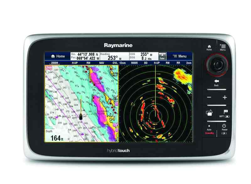
Most digital radars allow you to choose how your data is displayed: heading-up, north-up or course-up alignment. In heading-up mode, the radar stays aligned with the bow of the boat, regardless of your heading. In the north-up mode, the screen top remains aligned with true or magnetic north irrespective of where the bow is pointed. A course-up configuration aligns the top of the radar screen with a pre-entered route composed of waypoint entries. When learning to use radar, most sailors find the heading-up feature makes target recognition easier. It also causes objects displayed on the screen to directly correlate with the surrounding view.
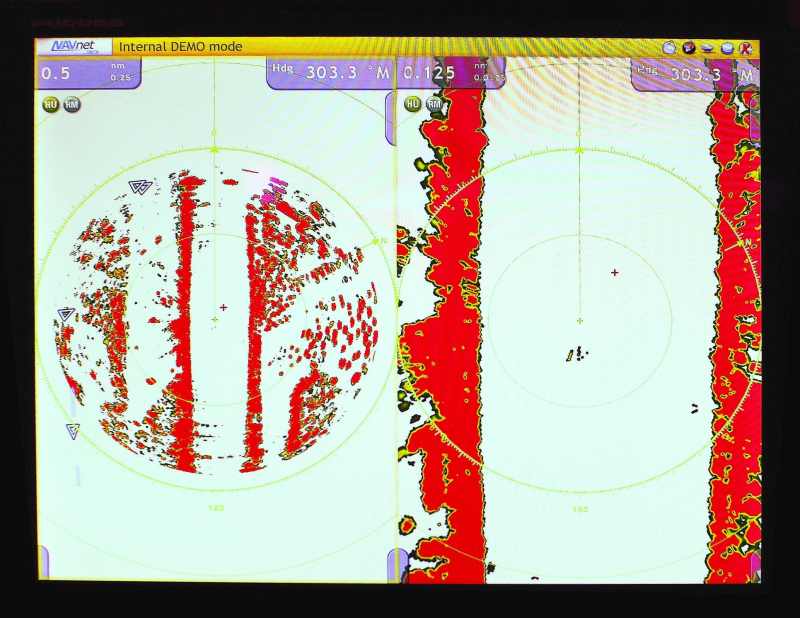
Radar range-ring settings represent the maximum radius of a specific scan. Typically these progress from close-in ranges, starting at an eighth of a mile, to greater distances of up to 24 miles and even larger settings on some systems. How radar detects targets at these differing ranges involves changes in microwave or FM signal propagation. Many sailors new to radar assume that if a unit has a 24- or 36-mile maximum range setting, it will allow them to pick up all the targets out to that distance. But that’s not quite the case. Intruding on radar’s capability are several electromagnetic wave-propagation issues and one major geographic fact of life: the curvature of the Earth. In practice, the height of your radar antenna and the height of the target determine whether your radar will depict the object. Radar mounted on small craft, it turns out, is not much better than the human eye when it comes to coping with a curving horizon.
Imagine that your radar antenna is 9 feet above the water and you’re trying to spot a big ship with a bridge height of 90 feet. A quick dipping-range calculation indicates that on a flat sea, the upper part of the ship’s bridge might be seen by your radar at about 20 miles. Wave crests and troughs, the heel of your sailboat, pitching and yawing, plus radar wave attenuation and refraction reduce the range to perhaps 10 miles — still a great early warning.
So what are those 24- to 36-mile range settings good for? At night or in fog, you could spot developing storm cells, or a distant tall island, bold coast or towering headland. They can even be used to detect the skyscrapers of a coastal city, confirming your distance offshore. Modern digital X-band radars do a good job of picking out tall, dense targets a long distance away.
This relationship between material density and the character of a radar return is important. Take for instance the radar’s response to a low-lying sand bar barely breaking the surface. At best, the target is displayed as a vague, often intermittent shape on the screen when the unit is set to short-range operation. At longer ranges, the partially awash sand bar remains invisible. Add a cluster of mangroves and a small marshy spit, and a more dominant image appears on the screen. Put a massive granite cliff in the background and it will eclipse whatever’s in the foreground. In fact, this is an important reason why care must be taken when using radar ranges to determine your distance from shore. In many instances the cliff or elevated rocky upland area is well inland, preceded by a long stretch of low-lying beach and surf-swept sandbars. The high-contrast representation of the cliff is by no means the water’s edge; rather it’s well inland from the hazards of the coastline, and the person using radar as a piloting tool should carefully take that into consideration. The best approach is to look at a chart (digital or paper) and compare it with the radar image or, if your radar is networked with the GPS/plotter and digital compass, you may be able to do a radar overlay. This is also a great way to confirm that the cartography and GPS signal are accurate, seldom an issue in the more trafficked waters of the western world, but a concern for those cruising well off the beaten path.
When choosing a radar, to my mind, the most important feature is the unit’s ability to discern a weak return signal. This means you’ll be able to locate those unlighted, often uncharted marks that pinpoint shifting sandbars; discover a fisherman who’s anchored his skiff in the channel; or detect the breaking surf on a ledge or reef adjacent to a partially submerged jetty.
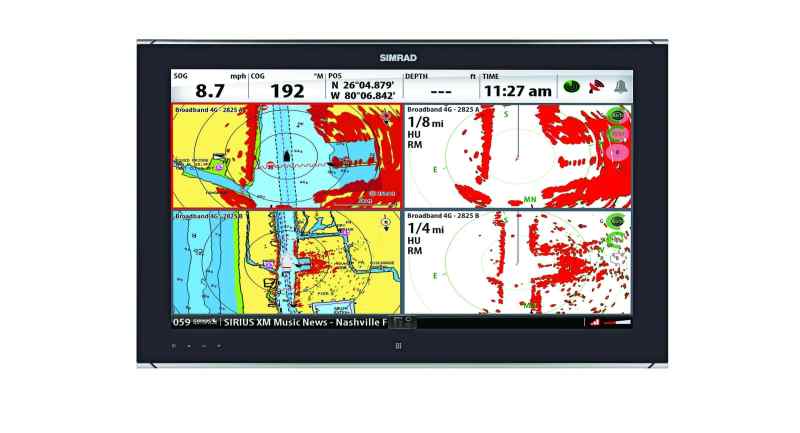
The extra features found on modern radar are more than window dressing. With the electronic bearing line (EBL) and variable range mark (VRM) you can pinpoint the location of a target in terms of its relative range and bearing and even digitally transfer that target as an icon onto your MFD’s cartography. The radar will continue to track the target and update its position on your chart. Guard zones can be set so that an alarm buzzes when a target enters the specified zone. Some units offer dual range display on one screen, and some are even linked to dual-processor CPUs, allowing the unit to work as if you had two independent radars running. These features provide an operator with the ability to display two ranges at once. At sea, this combo can be set to 3 miles and 12 miles, while the coastal cruiser might prefer .5 mile and 3 miles for inshore sailing.
Three of the big four electronics companies, Furuno, Garmin and Raymarine, offer a wide range of X-band radar antennas; these are available in dome and open-array configurations. Most sailboat owners will tend toward a dome because of the size of open-array units.
The small 2-kilowatt domes are lightweight and compact, but they have less power and the smallest-diameter antennas. Thus they lack the range, and to some extent, the ultra-crisp target acquisition of the larger 4-kilowatt domes and open-array options. However, it takes more current to deliver higher output power; for sailors, that often leads to keeping the unit in energy-saving standby mode rather than radiating energy to keep an image on the screen. The point here is sailors face a trade-off when deciding between the more powerful (and power-hungry) 4-kilowatt system versus a 2-kilowatt antenna.
Simrad and B&G, both brands under the Navico umbrella, have taken a different tack and switched from a magnetron microwave generator to a much more energy-efficient variable-frequency FM radar called “Broadband” that consumes less power than a 2- or 4-kilowatt conventional system. This Broadband design delivers top-quality results when it comes to discerning targets within 3 miles. From 3 to 6 miles, the 4-kilowatt units of other manufacturers begin to shine, and at 12 miles and beyond, the advantage goes to X-band units with their high energy output and large antenna.
The fact remains, though, that sailboats are relatively slow. There’s great value in having a clear picture of what’s going on nearby, say within a 3-mile radius. After all, seeing that low-lying rock jetty spring to life or detecting a stealthy kayaker crossing the bow in a dense fog is a big deal. Yes, Broadband radar might not pick up distant racon beacons, but there are no microwaves scanning your noggin when you’re standing just forward of a stern-mounted Broadband radar, and you’ll see that nun buoy looming just feet from the boat, an area that’s obscured in the “main bang” of conventional radar.
What all navigators agree on is that radar is a key component in a well-equipped suite of electronic navigation instruments. Whether you use it as a stand-alone device or as part of a networked MFD, radar can take the high anxiety out of sailing in low-visibility conditions.
Where to Mount a Radar Dome:
Antenna positioning is important, and while some prefer a stern pole, many cruisers find a mast mount near the spreaders delivers a reasonable blend of height, reduced motion and an unobstructed field of view.
Height is key: A dome mounted 15 to 20 feet above the deck delivers both close-in and longer-range target acquisition. Dome location, and hence performance, is also influenced by boat motion, most importantly heel, pitch and yaw. The heel angle at the mast may be the same as a stern-mounted pole, but the influence of yaw is much less at the mast due to the spar’s proximity to the center of lateral resistance. Keeping the antenna level with the horizon is critical. Sailing on the wind and heeling, a boat’s movement and its effect on a fixed-mount radar causes well-delineated targets to disappear. At minimum, when sailing to weather in overcast conditions, lessen the heel on a regular basis to see what’s around. Or you can solve the problem by adding a gravity gimbaling bracket or one that’s electrically or mechanically trimmed.
Ralph Naranjo writes frequently about electronics and other technical subjects for CW.
This article first appeared in Cruising World, May, 2014.