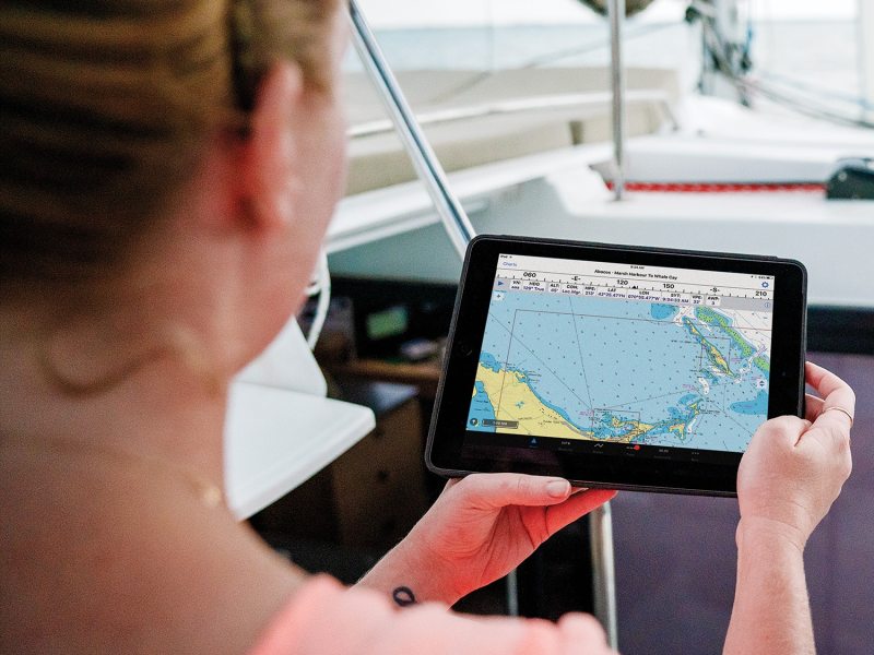
When Steve Jobs unveiled the Apple iPhone in January 2007, sailors may not have fully appreciated the coming jugger-naut. Thanks to the device’s graphically rich touchscreen interface, cellular and Wi-Fi connectivity, GPS receiver, solid-state sensors and onboard storage, smartphones quickly revolutionized navigation. A growing number of apps give navigators access to information that rivals a vessel’s hard-wired instrumentation. Better yet, if you climb aboard a buddy’s boat or head off on a sailing vacation, you can have your go-to e-tools ready in your pocket. Here’s a roundup of today’s best navigation and sailing apps, and a look at their most important features.
When it comes to working with onscreen charts, it’s important to be able to easily create routes and waypoints, and measure ranges and bearings. These tasks are simple with i-Boating: Marine Charts and GPS (for iOS devices) and i-Boating: Marine Navigation Maps & Nautical Charts (Android compatible), created by Bist. Users can choose between “lite” and “professional” versions, the latter of which allows you to download charts for numerous areas; the lite version allows only cartography downloads for a single map quadrant. Once cartography has been imported, users can touch and hold objects on the app’s vector cartography to launch an app-based “object query” to help identify, for example, buoys or lighthouses. I-Boating draws from a library of primarily vector charts that are created by official cartography sources (such as the National Oceanic and Atmospheric Administration or the Canadian Hydrographic Office), and backfills any uncovered areas with NOAA raster charts. (A raster chart is essentially a reproduction of a paper chart viewed on a display screen, while a vector chart pulls data from various sources and is compiled electronically.) Route planning is a matter of dragging and dropping the chart, and adding waypoints as needed. Once a route has been created, the app displays the distance and bearing between waypoints, and, critically, the app also supports offline navigation so it continues to allow you to navigate using previously downloaded charts in locations lacking cellular or Wi-Fi coverage.
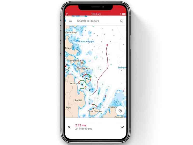
Long a trusted name in electronic cartography, C-Map created its Embark app to deliver user-friendly navigation with an uncluttered screen view. All displayed cartography is smart, meaning it automatically adjusts its coloring and contrast to enable full readability in daytime, nighttime and full-sun settings. Users can further customize their screen views by selecting between the app’s “classic” view and its more-detailed “contour” view, the latter of which is popular with anglers. Route planning is a matter of tapping the screen, naming routes, and letting the software generate distance information; users can input their anticipated velocity made good, or VMG, and the app automatically estimates how long it will take to sail the route. Finally, Android and iOS users can upgrade to the app’s premium version to receive automatic identification system and weather information, and to download and access charts for use offline, the latter of which is especially helpful when cruising outside cellular coverage.
Considered the gold standard for electronic cartography, Navionics recently compressed its suite of apps into a universal Boating Marine and Lakes app, which includes access to the ActiveCaptain Community (sailor-sourced information on a variety topics), and works on all Android and iOS devices. Sailors can enjoy a two-week trial before hitting the app’s subscription paywall, but once signed up, they can access features including Navionics’ Dock-to-Dock Autorouting, which creates bespoke routes based on user-specified conditions and vessel parameters; Community Edits, which provides localized information such as fuel prices; Plotter Sync, which allows B&G and Raymarine customers to update their plotters’ cartography libraries, and exchange waypoints and routes with their mobile devices. Anyone who cruises with a sounder can create high-definition bathymetric data using the app’s Sonarchart Live feature. Additionally, the app features a clever crosshair feature that helps users identify objects, soundings and navigational concerns on its vector cartography.
Historically, NavX Studios’ iNavX app worked only with iOS devices, but this changed with the company’s latest version, which now also runs on Android devices. In all cases, users download the app and high-resolution NOAA raster navigational charts for U.S. waters, and in-app purchases allow users to buy cartography from third-party vendors including Blue Latitude, Explorer and Navionics. In addition to port-A-to-port-B navigation and route planning, users can view GRIB weather overlays, subscribe to Theyr Premium mobile weather, and display real-time NMEA instrumentation data using their mobile device’s Wi-Fi and cellular connectivity. The app also works with third-party AIS receivers and transceivers and GPS receivers, and it allows users to create anchor and AIS alarms. Additionally, sailors can measure the bearing and distance between any two points on iNavX’s displayed cartography, and the app allows users to import and export data in KML or GPX formats, both of which are popular for exporting routes and waypoints to third-party viewers such as Google Earth.
When it comes to incorporating cutting-edge technologies, Pocket Mariner’s SeaNav US deserves attention for its use of augmented reality. SeaNav US works on iOS platforms, and provides access to proprietary charts online as well as offline, if they’ve been previously downloaded. The charts are derived from NOAA’s official Electronic Navigational Charts, available for all U.S. waters. Setting waypoints and planning routes is straightforward, but it’s the app’s ability to increase users’ situational awareness via augmented reality that’s most interesting. Using the device’s camera, the app delivers a real-time video feed that’s overlaid with informational tags denoting, for example, nearby AIS targets (courtesy of the Boat Beacon app) or aids to navigation. Additionally, users can tap objects, such as a buoy or bridge, in the app’s chart-plotter mode to access higher-level information, or, if the goal is to declutter the screen, they can deactivate graphical layers such as contour lines.
TZ iBoat from TimeZero is available only in the Apple App Store for iPads—not iPhones—but this powerful navigation tool comes from one of the leaders in computer-based navigation software, and gives sailors the ability to navigate on their choice of raster or C-Map vector cartography. Navigators can enhance their chart views by photo-fusing them with high-resolution coastline satellite imagery, and the app allows users to navigate in either 2D or 3D perspectives. In addition to drawing on the iPad’s internal sensors, TZ iBoat can be networked with a vessel’s external GPS and AIS receivers and transceivers to bolster accuracy and display nearby AIS targets atop the displayed cartography. Finally, for sailors who cruise with a Furuno DRS4W wireless radar, the app interfaces with this sensor’s wireless, real-time radar feed, and data can be displayed atop vector cartography.
Safe and Aware
To be clear, Marine Traffic ship positions for Android devices and Marine Traffic–Ship Tracking for Apple devices do not deliver the same level of real-time information as an AIS receiver or transceiver. Instead, these apps deliver updated information from the privately operated MarineTraffic AIS service to users’ smart devices. While this information should not be trusted for navigation, it’s useful for accessing information about nearby AIS-equipped traffic, including each vessel’s name and 16-digit maritime mobile service identity number, which enables direct helm-to-helm communications using digital select calling-enabled VHF radios. Both apps provide global real-time and forecasted wind information, and users can unlock next-level functionality, including an augmented-reality feature that helps identify AIS-equipped vessels.
When it comes to ensuring full compliance with the law while also keeping a protective eye on your surrounding wa-ters, the United States Coast Guard‘s self-titled app bills itself as both a mobile resource and a tool. Android and iOS users can read up on boating laws and regulations in different states, brush up on rules of the road, determine mandatory and recommended safety gear, and even request a vessel safety check from the USCG Auxiliary service. Additionally, sailors can access up-to-date weather information from NOAA weather buoys, file search-and-rescue-friendly float plans, and even report out-of-place aids to navigation, spills or suspicious behavior directly to the USCG. Finally, the app includes a bright-red emergency-assistance feature to request help. However, this isn’t a substitute for an EPIRB, or personal locator beacon.
How’s the Weather?
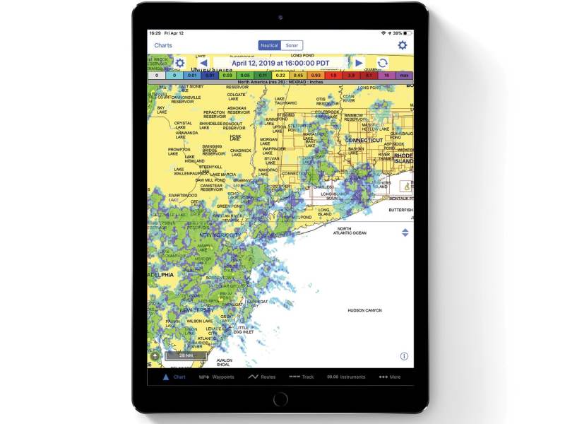
While sailors of yore likely spent significant parcels of time looking for mare’s tails and other cloud formations to forecast approaching storms, modern sailors are typically better served by consulting a real-time, high-definition Doppler radar feed, such as the one offered by MyRadar NOAA Weather Radar, developed by Aviation Data Systems. This app—which is available in both the Apple App Store and Google Play store—gets its raw data from NOAA and the National Weather Service, and then crunches this information using the company’s proprietary software. Users can explore macro- and micro-level forecasts, and they can opt to display cloud, wind and forecast levels. Sailors choose between free and professional versions of the app, with the latter providing an advertisement-free experience, detailed hurricane tracking, and access to unedited Nexrad Level LL radar information for more than 150 U.S.-based Doppler radar installations, including Alaska, Hawaii and, when it’s available, Puerto Rico.
New Zealand-based PredictWind‘s two products, PredictWind app and PredictWind Offshore app, deliver a huge amount of utility. Coastal cruisers using the PredictWind app get access to weather information from NOAA’s Global Forecast System (GFS) and from the European Union’s European Centre for Medium-Range Weather Forecasts (ECMWF); additionally, they can access PredictWind’s proprietary, high-resolution forecast models (PWG and PWE), which are based on GFS and ECMWF data (respectively), using either the device’s cellular or Wi-Fi connection. Alternatively, the PredictWind Offshore app works with satellite or single-sideband connections to deliver compressed data files that can be viewed in its built-in GRIB viewer, as well as satellite imagery. Additionally, these apps can access Predict Wind’s departure-planning and weather-routing tools, and they can also access Global Maritime Distress and Safety System weather forecasts.
David Schmidt is CW’s electronics editor.
A Portable Nav Station
Smartphone GPS receivers and solid-state sensors do an impressive job of dropping location pins onto charts, but sailors can increase their accuracy, situational awareness and safety margins by downloading Garmin’s Earthmate app (and the corresponding NOAA charts), and pairing it with a Garmin inReach Mini satellite communicator. The 3.5-ounce, water-resistant (IPX7-rated) inReach Mini operates on Iridium’s Short Burst Data network to give users global access to email and SMS communications, and—in the event of an emergency—the ability to contact the privately operated GEOS International Emergency Response Coordination Center, which operates around the clock. InReach Mini devices share GPS information with paired smartphones via a Bluetooth connection. Navigators can plan and track their trips using the Earthmate app, set waypoints, and get critical data including their real-time latitude and longitude, speed over ground and compass information. And, for cruisers who like to take the dink ashore and climb the tallest hill, inReach Mini devices generate distance, elevation and maximum-speed information.
Vendor Information
- Aviation Data Systems: myradar.com; free, in-app purchases available
- Bist: free, in-app purchases available
- C-Map: 800-424-2627; free, in-app purchases available
- Garmin: 800-800-1020; $380, plus airtime costs
- Pocket Mariner: $20
- PredictWind: 970-470-8694; free, in-app purchases available
- Navionics: free, in-app purchases available
- NavX Studios: $5, in-app purchases available
- TimeZero: subscriptions from $40-$120 per year
- United States Coast Guard: free


