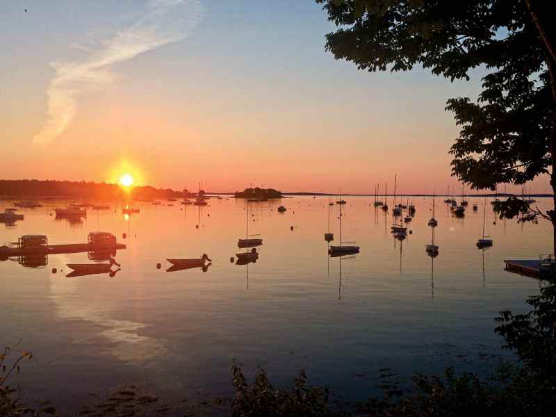
This summer, with the pandemic and social distancing still in mind, taking the family on a Down East cruise to Maine might be just the thing. After all, it’s not only one of the world’s great sailing destinations, but also there are isolated coves, vacant beaches and uninhabited islands where self-isolation is just fine. If you take your own boat, there are ample shore services, yards, marinas and harbor towns in which to haul or moor your vessel between visits. Or you can charter a bareboat or reserve a crewed yacht. Let me provide an overview of what’s entailed in cruising Maine in the second summer of COVID-19.
The coronavirus restrictions remain fluid, and of course you’ll need to investigate the current situation before shoving off. Now, on to the fun stuff.
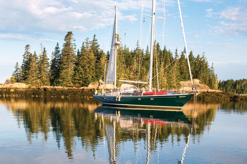
Sailing to Maine is the easy part.
It’s only 144 nautical miles on a rhumb-line course from the Cape Cod Canal to Monhegan Island. At 6 knots, that’s 24 hours. It’s another 24 miles up through Muscle Ridge Channel to Owls Head Lighthouse—the front door to what I feel is the greatest cruising ground anywhere: Penobscot Bay.
The distance from York Harbor, near the southern border with New Hampshire, all the way to the Canadian border is 200 nautical miles in a straight line…but the Maine coastline is anything but straight. If you add in the shoreline around each of the 4,500 islands—then include the coves, bays, harbors and tidal rivers—Maine has more coastline than the rest of the entire East Coast, more than 5,000 miles. Logic suggests there must be a few places along that stretch where you can find a secluded spot to anchor for a spell.
Maine’s largest bay, Penobscot, is split down the middle by a chain of islands: the Fox Islands to the south, Islesboro to the north, with a dozen small islands in between. There are half a dozen harbor towns, some small fishing villages, and lots of isolated coves in which to anchor. You’ll find uninhabited islands and beaches to explore, mountain trails to hike, waterfront restaurants and seafood shacks, and open-air farmers markets. There’ll be blueberries to pick, corn to shuck, lobsters to boil, and quiet evenings aboard in your own boat.
Nice, right? Now let’s get to the particulars.
The two-week cruise I’ve outlined below will keep you and your crew safe, in your own bubble, on your own boat. Each day includes a few hours of sailing to a new anchorage. Afternoons are for exploring uninhabited islands, secluded coves and a few villages. Evenings, you are alone, anchored in a secluded cove, as the sun drops behind the Camden Hills. There are enough wilderness islands there to fill up a few weeks—if not the entire summer, and many summers to come.
I’ve lived on and cruised along the coast of Maine for 50 years, and my ideal two-week getaway would be a circumnavigation of the Fox Islands. A couple of kayaks and a RIB with at least a 10 to 15 hp outboard are essential for this kind of serious gunkholing. The anchorages I’ve described are no more than a few hours apart, affording the crew some time to test their sailing skills, and the navigator to plot courses to keep everything off the rocks. You may also find your own anchorages. There are untold options galore, so go explore. I won’t mind at all.
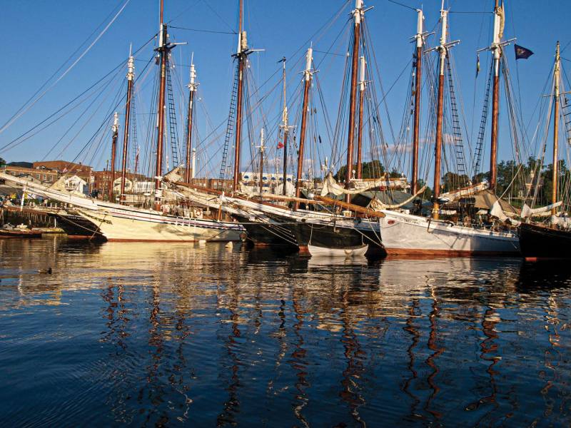
Day One: Rockland is a good place to start (and also a good spot to leave your boat between visits). This large commercial port is easy to enter, with ample space for anchoring. There are rental moorings, docks, fuel, four marinas (including a mega-yacht facility), a large chandlery (Hamilton Marine), supermarkets, canvas shop, mechanics and boatyards. Main Street is abuzz with shops, a theater, two art museums, lots of art galleries, and half a dozen restaurants; the four-star Primo eatery is also nearby. Cape Air provides regular service to Boston from the local airport; the Concord bus line stops at the ferry terminal twice each day. US1 passes through town, and rental and loaner cars are available. Box stores are a few miles out of town. It’s almost civilized there.
To kick things off, leave Rockland midmorning and steer northeast for Pulpit Harbor on the northwest corner of North Haven Island. It’s only 10 nautical miles, and with a southerly breeze, you’ll be there by lunch. Leave Pulpit Rock, with an osprey nest atop, to starboard and find a spot to anchor inside. The moorings are all locally owned, so find a spot in midharbor in 25 feet of water to anchor, or in the two coves on the south side.
There’s a public dock farther in for your dinghy. The island’s food store is a half-mile walk south, from the bridge. Take your dinghy farther up into the cove, past the traffic bridge. Farmland, fields of lupine, and cottages covered in roses line the banks and roads. In the summer, the sun sets over the Camden Hills across the bay well after 8 p.m.
Day Two: Two options: north around the top of North Haven, or south. The wind that day will dictate. The northerly route offers up a scattering of islands with four possible anchorages. Hank and Jan Taft have described these in their comprehensive A Cruising Guide to the Maine Coast (see “Resources and References,” page 51). The Barred Islands and Butter Island are accessible and a good place for lunch, beachcombing, a hike, or even an overnight stop in settled conditions.
Quick aside on dinghies: Finding a place along these islands to beach a dinghy is one thing; securing said dinghy is another. Pull it up on the beach, and when you get back from your hike, you might find that the tide has floated it off the beach and it’s drifting away, or it’s high and dry, 30 feet from the water’s edge.
There are numerous techniques to solve this problem. The captain can drop off the landing party and return to the yacht for a nap. Go ashore in kayaks; they are easily pulled above the high-tide line and carried back. Or rig a dinghy-retrieval mooring system: Secure a floating buoy to the dinghy anchor line with a shackle. Drop it in deep water. Nose into the beach, off-load, then with a long loop of line rove through a shackle on the anchor float, pull the dinghy back out to where you dropped the anchor. Tie the shore end of the loop to something above high tide. When you get back, just pull your dinghy in to the beach. Make your own, or try West Marine’s Anchor Buddy, a ready-made dinghy mooring system using a long bungee cord that snaps your dinghy back out into deep water.
Days Three and Four: With a fair breeze, steer southeast from Butter Island, down to Oak Hill on the tip of North Haven. Give the hodgepodge of small islands and ledges a wide berth on the way. Mind the current. There are two possible anchorages: Marsh Cove, below the hill on which sits the Watson Estate. No access ashore. Mullen Cove is better. The beach provides access to hiking trails through a town-owned park. Just south is Burnt Island, now a North Haven park, with a walking trail all the way around and a float to which you can tie a dinghy at any state of the tide. Or head for the beach off the northwest tip of Calderwood Island. You can’t go wrong with any of these.
Calderwood is tucked in between Simpson and Babbidge islands on the northeast side of the Fox Island Thoroughfare. Uninhabited and open to the public, it is now owned by Maine Coast Heritage Trust, which keeps the trails open now that the sheep have left. There’s a spruce forest at the southern end where the kids can build fairy houses. Anchor off the beach on the north side where hiking trails begin. Be aware of the rock in the middle of the anchorage. I spent a few hours there once waiting to be floated off. This is a popular anchorage, and if too crowded, there’s another spot to the east, between Calderwood and Babbidge. Two beaches provide access ashore and to the trails. The passage between the two islands is strewn with ledges and rock. When departing, go back around the north side of Babbidge or Calderwood. Calderwood might need two days to fully explore. I’ve spent weeks there photographing.
Nearby are two obvious anchorages for the night: Carver Cove, south of Widow Island, is calm, with views of saltwater farms, fields and forests. To the north, past the Goose Rocks spark plug lighthouse is Kent Cove. There’s no shore access, but if there’s a breeze, there’ll be no mosquitos.
Day Five: You have decisions to make: You could go east to Stonington, the Deer Isle Thoroughfare, and on to the islands farther down the Maine coast. (We say “down” up here in Maine when heading up the coast, as in Down East. The prevailing winds are southwest, meaning you’re mostly sailing “downwind.”)
But for the purposes of this itinerary, that cruise is for another time. So we’ll head west through the Fox Islands Thoroughfare, a narrow body of water separating North Haven from Vinalhaven. It’ll be busy with schooners, fishermen, gleaming classic yachts, and powerboats of all sizes passing through. The shore on the south side has a few summer cottages from the previous century. In the 1800s, Maine was a summer retreat for the wealthy from Boston, Manhattan and Philadelphia. With extended families and servants, they arrived by steamship to “camp out” in rambling cedar-shingled cottages. These “cottages” might look small from offshore, but up close, they are massive mansions with dozens of rooms, rambling porches, and servant’s quarters. They are still there. In recent years, the wealthy have returned to buy up fishermen’s shore frontage to erect even-more-lavish estates, with a jet-powered Hinckley picnic boat tied to the dock.
On the north side of the thoroughfare is the small village of North Haven, established by wealthy New York yachtsmen in the last century. North Haven is a world apart from its neighbor, Vinalhaven. The only grocery store is in the middle of the island, but the village might have places to order lunch, ice cream or dinner. This changes annually. Anchor outside the mooring field and out of the ferry’s approach to its terminal. Dinghy docks line both sides of the ferry terminal. The village has a library, art galleries and a community center with frequent performances, plays, lecturers and concerts. The roads wander inland past Victorian cottages, farms, fields and forests. Eric Hopkins, an island painter with a wide reputation, has a studio and gallery in the village, and there may be others. Seasons change, as do the residents.
Spend the night at anchor, or duck around to Perry Creek, a narrow cove on the south side of the thoroughfare. Ashore is a wilderness park with walking trails. Wander through spruce forests, over ledge outcroppings with views. It’s tight in there, but there are a few moorings that can be used by transients for a donation to the Vinalhaven Land Trust. Or drop the hook at the eastern entrance in 20 feet of water. If that’s too crowded, head farther south into Seal Cove. Watch the chart closely because rocks are about, but you should be able to find a spot with sufficient swing room. Take the dinghy back up to Perry Creek, where there’s access to the trails on the southeast side. Watch for a sign nailed high up on a tree. Set your dinghy moor and climb ashore.
Day Six: Heading west down the thoroughfare, pass Browns Light to port, the Sugar Loaves to starboard. You’re heading to Leadbetter Narrow. Pass north of Dogfish Island. To port is Crockette Cove, where there’s room for a boat or two, but mind the underwater cables. At high tide, you can take the dinghy or kayaks a mile and more up into the cove. There are more anchorages on the other side of Leadbetter Narrow.
Narrow is the operative word. It’s a tight squeeze between Leadbetter Island and the mainland of Vinalhaven. Steer north of the green can that marks a rock in the middle of the gap. The current is swift through there. Pass through, and you are at the head of Hurricane Sound, surrounded by a string of islands to the west and Vinalhaven to the east.
There is a lot to explore there, but first get the boat anchored. There’s a nifty spot to the east of Turnip Island, a small tree-topped isle at the entrance to Long Cove, a milelong fjord carved into the solid granite of Vinalhaven Island. There is an abandoned quarry on the hill that provided building blocks for the post offices in Boston and New York in the 1800s. At that time, more people lived and worked the granite quarries on Vinalheaven than live there now.
Read More: Maine
The entrance into Long Cove, to the east of Hall Island, narrows to 200 feet, but once through, the cove opens up into a quiet pond with room for a few boats to anchor. The shoreline is tall, covered in spruce. There are a few floating docks along both sides of the shore. Pathways lead up to large private estates. No access there.
A third of the way in, there’s a ledge barring the way, so take the dinghy and explore. Be back before the tides are low because the bar might be too shallow to navigate.
Day Seven: From your anchorage in or near Long Cove, there are small coves and islands—including Fiddlehead and a spot called the Basin—to explore. Use the kayaks, but someone should be in the RIB as a chase boat. The Basin is a large, almost landlocked body of water that’s worth a whole day fussing around in small boats. The narrow entrance to the Basin provides a reversing-falls effect, so enter at slack tide, or with the RIB. Be warned: The narrows can be a whitewater experience.
Day Eight: There are dozens of small islands to the west, a few with limited anchorages. One is south of the neck between Lawry’s Island and Cedar Island. There’s enough room for one, so leave early enough or give it a pass if someone is there. Farther south in Hurricane Sound are White and Garden islands, with two possible anchorages. Go ashore on the beach and take in beautiful vistas of the Camden Hills, and across to Owls Head.
Day Nine: Sail south to the anchorage and mooring field off the east side of Hurricane Island. In the 1800s, this island was a bustling community working the granite stone quarry, still visible today. In the 1970s and ’80s, it was home to the Outward Bound School. In 2009, the Hurricane Island Center for Science and Leadership took over the site, with science, technology, engineering and mathematics experiential education programs for youths between the ages of 11 and 18. Guest rental moorings might be available, and you are invited to go ashore. Anchoring is possible, but the bottom is rocky, with kelp. There are trails around the island and a center to visit.
You’ve been gone a week now, and you might need a few provisions. There’s a small grocery store nearby in Carvers Harbor. You can get there by going southeast around Herons Neck light or up and around Greens Island, then down the Reach, a narrow, twisty passageway between Vinalhaven and Greens Island leading to Carvers Harbor, the main settlement on the island. Keep an eye on the chart and markers as you go because they can be confusing. You might meet the ferry on its way to or from Rockland.
Just before the ferry terminal, drop the hook off Dodge Point or on the opposite side of the entrance, south of Potato Island. Send in the dinghy to see if there is a rental mooring available. Look for a buoy with a bottle wired atop a stick. It’s for the rental fee. Call the harbor master if necessary (207-756-0209).
Carvers Harbor is one of Maine’s busiest lobster-fishing harbors, landing some 5 million pounds of lobster annually. The harbor is narrow, full of lobster boats, and the shore is lined with floating docks piled high with the traps, wood crates and scales. It’s there where fishermen offload and weigh their haul, and cash out. There’s no room in the harbor to anchor, and the bottom is too hard anyway, so anchor outside.
There’s lots to do ashore, so take the crew to the dinghy dock at the head of the harbor, where you can tie up. Across the street is the Nightingale Restaurant, formerly the Harbor Gawker. There are shops, a grocery store, art galleries, pubs, offices and buildings that date back to when this town was a granite shipping port. The streets lead to lanes, past Victorian homes and farms, summer estates, forests, and abandoned, water-filled quarries. Stay overnight because tomorrow will be a long day.
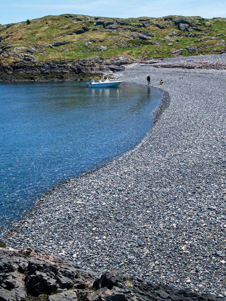
Day 10: It’s just 4 miles from Carvers Harbor to Brimstone Island, a tall, rugged, uninhabited island on the outer edge of Penobscot Bay. It might as well be on the edge of the world. Anchor off the pebble beach at the northwest corner. This is a day-only anchorage. The bottom is rocky with kelp. Holding ground is better on the south side between Brimstone and Little Brimstone but only in settled weather. Dinghy ashore, but keep an eye on the tide or set a dinghy mooring.
The island beach is famous for its small, round, black basaltic pebbles, polished smooth by 100,000 years of wave and tidal action. The stones arrived there eons ago from far, far to the north, carried by the ice sheet as it moved slowly south. I’ve carried three of these small black stones in my left pocket for years. Wherever I am in the world, I can grab a handful of Maine. Stay clear of the east side of the island because it is a bird nesting area.
By early afternoon it will be time to gather up the crew and return to the boat for lunch and a discussion of what to do with the remaining days of the trip.
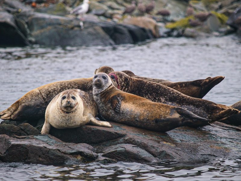
Day 11: Six miles north of Brimstone, halfway up the eastern shore of Vinalhaven, is Seal Bay, a nifty piece of water with anchorages, coves and islands. The entrance is between aptly named Bluff Head and Hen Island. The channel is narrow and the current swift, but inside there are five or six individual and secluded anchorages. You’ll be surrounded by a granite and spruce wilderness. The only trail access is through Huber Preserve, south of Burnt Island. With a kayak or the dinghy, you can explore the coves and islands, and watch wildlife, birds, dolphins, foxes, and perhaps see a deer. Next to Seal Bay is Winter Harbor, another narrow cove cut deep into the island. There are three or four spots to anchor, but mind the current and swing room.
Days 12 and 13: It’s time to get back into civilization, and cellphone service. Let’s head to Camden. This is a morning trip from Seal Bay. Head up through the Fox Island Thoroughfare, put the Sugar Loaves to port this time, and turn right at the Fiddler, a granite stone monument at the southern end of a ledge off Stand-In-Point. From there, it’s an 8-mile dash across West Bay to Camden. Watch out for the Graves, a ledge above high tide, marked by a light, a mile and a half southeast from Camden.
Put Curtis Island Lighthouse to port as you enter Camden’s outer harbor. There’s room to anchor inside to the right, east of the mooring field, west of the ledges. The Yacht Club, Wayfarer Marine and the town have rental moorings. Call ahead. The inner-harbor floats are filled with local craft, but Wayfarer and the town docks might have space to come alongside. Wayfarer has a fuel dock and pump-out station. The town has a pump-out boat that will come to you in the outer harbor. Call ahead.
Ashore, Camden is as charming a town as you could imagine. It was the film set for the 1950s movie Peyton Place. There are shops, a library, provisioning, laundry, and on Wednesdays and Saturdays, there’s an open-air farmers market. There are hardware stores, T-shirt shops, and art and home-furnishing galleries. Camden has also become Maine’s foodie town, with more a dozen restaurants, featuring Italian, Asian and French cuisine, and good-old New England seafood. There’s waterfront dining, and Harbor Dogs—a fish-taco truck—is right there on the public landing.
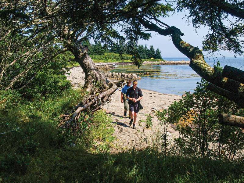
There’s a large, freshwater lake nearby and half a dozen hiking trails that wander through the Camden Hills. A half-hour climb to the top of Mount Battie, which oversees Camden, provides stunning vistas of Penobscot Bay. You can see the islands you just explored, with views all the way to Blue Hill, Cadillac Mountain and Isle au Haut. The trail begins just a 10-minute walk from the dinghy docks.
In non-COVID times, there are concerts and plays, as well as performances on the library lawn and at the Opera House. Wandering the streets or hiking over the hill to Rockport will get you back in shape from two weeks of cruising. It’s so nice there, you could move in. I did.
Day 14: Last day—it’s back to Rockland, 7 miles south of Camden. The crew can pack up, unload and head back to civilization. The boat can get parked on a mooring until the next adventure, or take you south. From there, it’s roughly 36 hours to Newport, Rhode Island. Or you can haul the boat for the winter, with plans to sail farther east next summer.
You can also think about future trips.
Northern Penobscot Bay needs a visit, including Warren Island, a state park next to Islesboro Island with hiking trails. Then into East Bay to visit Castine Harbor, Smith Cove and a dinghy trip up the Bagaduce. There are small coves and anchorages such as Bucks Harbor, along Eggemoggin Reach. Swans Island is next, then up into Blue Hill Bay, over to Mount Desert Island and Somes Sound. That’s another two-week jaunt before returning west, back through the Deer Isle Thoroughfare, with stops in Stonington and the islands of Merchants Row. Then a day’s sail back to Rockland.
The opportunities are endless. This could become a habit.

The Challenges of Cruising Maine
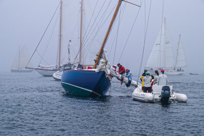
here are a few navigational challenges I should mention, such as fog, 10-foot tides, 4-knot currents, anchoring among rocks and ledges, and lobster buoys and trap lines. I didn’t say cruising the coast of Maine was going to easy, but it can be an exciting challenge for any cruising sailor. I can think if no better place to test your skills while exploring one of the world’s great archipelagos.
Fog: There are three degrees of fog, I’m told. With “normal” fog, you can see a quarter-mile ahead. “Thick” fog is when you can see only a few boat lengths ahead. With “dungeons” of fog, it’s so thick, you can’t see the bow of your own boat. In the old days, Mainers practiced potato navigation: a kid on the bow with a bag of spuds tossing them ahead. A splash? Keep going. A thud? Tacking!
Today, AIS, radar, GPS, chart plotters and VHF have reduced the anxiety, but many lobster boats fail to use AIS, radar doesn’t see trap buoys and lines, and the currents haven’t changed. Someone on deck needs to keep visual watch while you are below glued to the radar screen. The sounder doesn’t help much in fog. Your keel could be in 30 feet of water with the bowsprit tangled up in the spruce trees ashore. The most valuable piece of equipment to have on board in fog is the anchor. Fog will burn off by late morning—if it’s going to. In June and early July, fog is more common, less so later in the summer. September is the best month in Maine.
Tides and current: Tides in Maine run 8 to 10 feet. That’s a lot of water to push up into the bays and drain back out, twice each day, at six- and 12-hour intervals. The tidal current running in and out of bays and coves can reach 4 knots. An hour’s run across the bay can set you off a mile on arrival, unless you compensate. With all those ledges and rocks lurking about, even a few feet off course can put you aground.
Anchoring means deploying sufficient scope to cope with the tidal range. Then there’s the set of the current: When the tidal current switches direction, where will your boat sit? Best to have a few anchors and extra line aboard to deploy in a Bahamian moor, to anchor astern or to run a stern line ashore.
Lobster buoys and trap lines: Lobster buoys are as much a hazard as fog and currents. Maine is prime lobster-fishing territory, with buoys so thick in places, you could walk to shore on them. The colorful buoys are not the problem—it’s the line that floats just below the surface from the buoy to the toggle. The toggle is a small float that keeps the trap line off the bottom, but when the tide is low, the toggle might reach the surface, and the 20 feet of line to the colorful buoy floats just below the surface.
Steer around the top of a buoy, not the bottom end where the line exits the base of the buoy. Do not go between the buoy and the toggle; you’re liable to find that you’ve snagged the line and fouled the prop. This might require a dive overboard into frigid water to cut the line free. And in most places, the sea rarely gets above 60 degrees, even in the middle of the summer. Lobster boats have a wire cage around the prop to keep out their trap lines. You can have a line cutter bolted to your prop shaft to cut the line, but then the fisherman has lost his trap. Radar doesn’t see the buoys, and you can’t see them at night. Keep a constant watch when navigating in Maine, and steer clear of buoys and trap lines. Even sailboats with their prop locked can snag a line on the blades or the rudder. Divers can be hired in many harbors to free a fouled prop. Still, lobster buoys are helpful in seeing which way the current flows and at what speed.
Prevailing winds: A midsummer day in Maine is apt to be under a high-pressure system, resulting in sunny, fog-free days but little wind, especially in the mornings. As the land heats up, a southwest sea breeze is likely to fill in after lunch, and might get up to 20 knots by late afternoon, just before dying off before dark. Gales are infrequent in the summer, and when a low comes up the East Coast, it tends to pass by just offshore to the east, producing northeasterly winds. Most Maine bays and harbors are open to the southwest, providing a lee to those winds. Hurricanes are infrequent.
David H. Lyman is journalist, author, photographer and sailor. He sailed into Maine in the early 1970s and started a summer photography school, the Maine Photographic Workshops, which continues today as Maine Media Workshops (mainemedia.edu). He has been owned by four different sailboats, from an Alden 34-footer to a Bowman 57. He has sailed the entire East Coast, and made more than 24 offshore voyages between Maine and the Caribbean. His first memoir about his hitch as a Navy photojournalist with a Seabee outfit in Vietnam in 1967 was published in 2019. He lives and writes in Camden, Maine.


