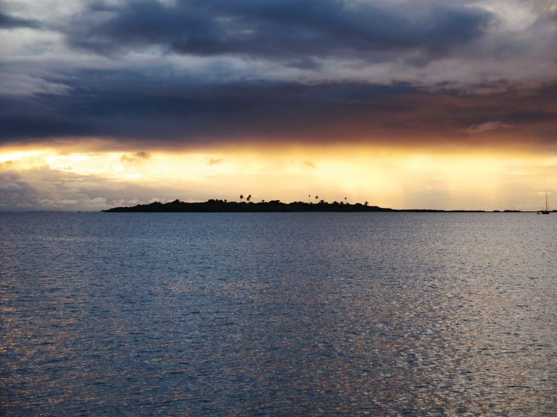
Occasionally we hear complaints like these from fellow cruisers about the unsteady weather here in the South Pacific: “The weather here is lousy. We should have stayed in the Caribbean!” Or, “The Pacific is so cold!” Admittedly, there is some truth in these simplified conclusions; the trade winds are frequently interrupted by disturbances and some areas really do cool down. So, some crews do seem truly surprised by the mixed weather after their arrival in Polynesia. However, by analyzing the patterns responsible for tropical weather in the South Pacific, it’s possible to plan favorable itineraries and perhaps avoid any unpleasant surprises.
Wandering Trades
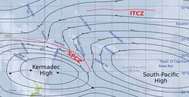
Trade winds, as we’ve learned from the weather textbooks, are caused by the air-pressure difference between a high-pressure area (or ridge) in the subtropics and the low-pressure area along the equator. This weather model applies nicely for the North Atlantic, where the Azores High (or Bermuda-Azores High) behaves rather predictably—it’s big and fairly permanent.
In the South Pacific, the model is less reliable; the Pacific Ocean is simply way too big. Instead of a single ridge in the subtropics, there are (at least) two highs. To the east lies the South Pacific High with its center typically close to Easter Island. The other one is farther west, closer to New Zealand. French meteorologists call the first one Anticyclone de Pâques after the French name for Easter Island, and the western one Anticyclone de Kermadec after the subtropical Kermadec island chain between Tonga and New Zealand.
Like the Azores High, the South Pacific High is quite permanent. As a consequence, steady trade winds prevail in the eastern South Pacific, which make a passage from Galapagos to French Polynesia relatively easy. The Kermadec High, on the other hand, is neither permanent nor stationary. It arises from the Tasman Sea, or north of New Zealand, and travels eastward via the Kermadec Islands and south of the Austral Islands of French Polynesia, and may fade away to be replaced by the next one. More persistent examples travel farther southeast and join the eastward procession of lows in the Roaring 40s. The transitory and wandering nature of the Kermadec High is the main cause of the frequently interrupted trade winds in the western and central tropical South Pacific. In other words, there is quite a bit of weather going on.
The Influential SPCZ
The two separate highs in the subtropics result in a different air-pressure gradient in the tropics than a single ridge. Between the highs, there is clearly an area with lower pressure, and isobars encircle both centers. Where those circles approach each other, air masses from different wind directions collide and cause a zone of convergence—the South Pacific Convergence Zone (SPCZ). This zone typically stretches from the Solomon Islands to Fiji and Tonga, or to Samoa, and often continues farther to the southern Cook Islands or the Austral Islands. As the Kermadec High moves eastward, so does the SPCZ (or a part of it), and often there are several disconnected branches of convergence zones.
To the south (or west) of the SPCZ, dry and cool southerly or southeasterly winds can be found, and to the north (or east) the wind is from the northeast, north or northwest and brings warm and humid air. The consequence is cloud formation, squalls and thunderstorms, as well as developing fronts. Due to a lingering upward movement of air, the air pressure drops and parts of the zone may evolve into a trough or low pressure.
Around every eight to 10 days, a new transitory high starts its journey eastward, bringing the SPCZ and the accompanying troughs along for the ride. An approaching trough is foreshadowed by the trade winds shifting first northeast, then north. When a trough passes, the wind turns farther to the west and then south. The southerly wind typically arrives with a front and strong squalls. Deepened troughs and lows may also develop a front on their northeastern side where the wind turns north.
When we compare weather charts from different government meteorological offices, we see that even experienced forecasters seem to be divided over how to classify the weather phenomena in the SPCZ. For example, French Meteo may see a convergence zone with an associated front or just a stationary front, while the National Oceanic and Atmospheric Association observes a (weak) trough. A pattern we observed over the last six years is that strong and weak events usually alternate. Another observation is that GRIB files based on the Global Forecast System (GFS) model do a poor job at depicting those fronts.
Squash Zones
When an east-traveling high is very strong and/or moves very close to the tropics, the isobars on top of it are squeezed together and the resulting trade winds are strong. Such squash zones of enhanced trade winds occur frequently during the southern winter and are called mara’amu in Tahitian. The southeasters generally arrive with a nasty cold front after the convergence zone or trough has passed. The strong winds may last for several days and carry numerous squalls as the agitated sea causes increased vaporization and the formation of cumulus clouds.
Seasonal Variations
During the cyclone season (the Southern Hemisphere summer), the subtropical highs are farther away from the tropics than during the colder season. As a consequence, the trade winds are weaker, squash zones are rare and calm periods are more likely. The SPCZ moves slower or tends to become stationary. For instance, a branch likes to linger over the southern Cooks and the Australs and brings rainy weather to those areas as well as the Society Islands. This branch also causes plenty of warm and humid northeasterly and northerly winds over French Polynesia, particularly in December and January.
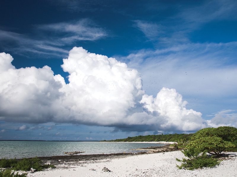
The SPCZ is the birthplace of most cyclones in the South Pacific. With the warm ocean surface in summer and high activity in the SPCZ, the risk of cyclone formation is great, particularly when an additional, extensive area of cloud formation and rainfall coincides with the SPCZ.
In southern winter—the so-called sailing season—the trade-wind belt paradoxically does not cover the entire tropics. As the highs are so close to the Tropic of Capricorn, the southern fringe lies in the belt of variable winds, particularly in the central and eastern Pacific. In Tonga, it is not unusual to get an extended period (five to six days) of westerly winds around August.
RELATED: Pacific Passage Planning
As to the cooler temperatures, most yachts cross the South Pacific outside the cyclone season, in the Southern Hemisphere winter. When an itinerary then includes places at the fringe of the tropics like Pitcairn and the Gambiers, the Austral Islands, the southern Cooks, Niue, and/or the southern parts of Tonga, cold weather is unavoidable, particularly when the fresh southeasters blow hard. In July and August, the water temperature in those areas is not far above 68 degrees F (20 degrees C). Bring a thick wetsuit in case you gather enough willpower to go diving or snorkeling.
Summing Up
The eastern South Pacific has relatively undisturbed trade winds, the result of the big and stable high around Easter Island. Also, there’s a wide equatorial area that has steady trade winds and fine (but hot) weather. When moving closer to the equator and farther away from the subtropical highs, the isobars become more or less straight lines and resemble those caused by a single high-pressure ridge, and so the area does not see a convergence zone. In addition, the Intertropical Convergence Zone (ITCZ) is typically located well north of the equator (around 5-10° N). Apart from occasional warm fronts and squalls, when the trade winds blow strongly, the Marquesas, the Line Islands and Penrhyn in the Northern Cooks are blessed with stable weather all year round. Farther west or south, the SPCZ already starts to influence the weather. On the other hand, New Caledonia lies far enough west to also experience less convergence-zone typical weather.
In summation, it pays to take some time and conduct proper research, including pilot and climate charts—after all, the Pacific is a huge and diverse area. Simplified textbook principles do not always apply everywhere; for instance, it is not true that all archipelagos have their rainy season during the summer months. Avoid extra-tight itineraries as they leave no time to await favorable passage weather when bold plans include picking up and dropping off a constantly changing crew or visitors, especially from ambitiously distant places. With some clever planning, as well as a lot of flexibility, cruising the South Pacific is undeniably an extraordinary experience.
Finally, it is not advisable to solely rely on GRIB files to find good passage weather. An additional look at surface-analysis weather charts shows where the convergence zone and nasty fronts exist, particularly when sailing between French Polynesia and Fiji, or farther west. The SPCZ that causes so much variable weather in the Pacific also has a good side: the numerous disturbances with shifting winds provide good-weather windows to sail eastward.
Birgit Hackl and Christian Feldbauer set out from the Med in 2011 aboard their 41-foot S&S-designed Pitufa. Two years later, after an Atlantic crossing, time in the Caribbean and a transit of the Panama Canal, they reached French Polynesia, which has become their home base. For more on the couple, visit Pitufa.at.


